Parque das Nações
Parque das Nações | |
|---|---|
|
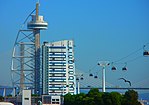
Clockwise: View of the Parque das Nações with Altice Arena; Lisbon Oceanarium; Lisbon Justice Campus; Gare do Oriente; Vasco da Gama Tower; Portugal Pavillion. | |
 | |
| Coordinates: 38°46′05″N 9°05′38″W / 38.768°N 9.094°W | |
| Country | |
| Region | Lisbon |
| Metropolitan area | Lisbon |
| District | Lisbon |
| Municipality | Lisbon |
| Area | |
| • Total | 5.44 km2 (2.10 sq mi) |
| Population (2011) | |
| • Total | 21,025 |
| • Density | 3,900/km2 (10,000/sq mi) |
| Time zone | UTC±00:00 (WET) |
| • Summer (DST) | UTC+01:00 (WEST) |
| Patron | Our Lady of Navigators |
| Website | http://jf-parquedasnacoes.pt/ |
The Parque das Nações (Portuguese pronunciation: [ˈpaɾk(ɨ) dɐʒ nɐˈsõȷ̃ʃ]; English: Park of the Nations), colloquially known as Expo (as the site of the 1998 Lisbon World Exposition), is a freguesia (civil parish) and district of Lisbon, the capital of Portugal.[1] Located in eastern Lisbon, Parque das Nações is to the east of Olivais, north of Marvila, and directly south of Lisbon's border with Loures. As of 2018, an estimated 31,000 people live in the area[2]
History


The district was laid out in 1998 as the site of the 1998 Lisbon World Exposition. Following Expo '98, the area was transformed into a modern commercial and residential district, known as the Parque das Nações (Park of the Nations).
At the time of the census carried out in 2011, an estimated 21,000 people currently live in the Parque das Nações, which was shared between the Lisbon and Loures municipalities until November 2012. Following a request by local citizens for the municipality of Lisbon to annex the one belonging to Loures, thereby integrating the entire area within the Lisbon municipality, the area is now inside Lisbon and it is the city's most northeastern parish.
The freguesia was created in 2012 from parts of the parishes Santa Maria dos Olivais (Lisbon), Sacavém and Moscavide (both part of Loures municipality).
Marina
Taking advantage of its geographical position, Parque das Nações also has a brand new marina, Marina Parque das Nações [3] featuring 600 berths and modern infrastructures, a river pier for cruises or historical vessels and an exclusive pontoon prepared to receive nautical and on land events, and a spot for bird watching as it is sited in the Tagus Estuary, one of the largest and most diverse estuaries of Europe.
Landmarks
- Lisbon Oceanarium
- Casino Lisboa
- Altice Arena
- Gare do Oriente
- Vasco da Gama Tower
- Vasco da Gama Mall
- Portugal Pavilion
References
- ^ Diário da República. "Law nr. 56/2012, pages 6454-6460" (pdf) (in Portuguese). Retrieved 21 November 2014.
- ^ Azevedo, Virgílio (May 21, 2018). "Parque das Nações: a cidade de todos os recordes". Expresso. Retrieved May 22, 2018.
- ^ "MARINA PARQUE DAS NAÇÕES – A nova marina de Lisboa". Archived from the original on 29 October 2013. Retrieved 27 October 2013.


