
Afrin District
Afrin District
منطقة عفرين | |
|---|---|
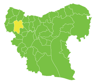
 Location of Afrin District within Aleppo Governorate | |
 Afrin District Location in Syria | |
| Coordinates (Afrin): 36°30′36″N 36°52′04″E / 36.51°N 36.8678°E | |
| Country | |
| Governorate | Aleppo |
| Seat | Afrin |
| Control | |
| Subdistricts | 7 nawāḥī |
| Area | |
| • Total | 1,840.85 km2 (710.76 sq mi) |
| Population (2004)[1] | 172,095 |
| Geocode | SY0203 |
Afrin District (Arabic: منطقة عفرين, romanized: manṭiqat Afrīn; Kurdish: Efrîn) is a district of Aleppo Governorate in northern Syria. The administrative centre is the city of Afrin. At the 2004 census, the district had a population of 172,095.[1] Syria's Afrin District fell under the control of the People's Protection Units (YPG) around 2012 and an "Afrin Canton" was declared in 2014, followed by an "Afrin Region" in 2017. During Operation Olive Branch, the entire district was captured by Turkey and its allies.[2]
Syrian civil war
On April 28, 2020, a bombing in Afrin city killed 40 people, including 11 children. No group claimed responsibility. Turkey blamed the YPG for the attack. According to the head of the British-based Observatory for human rights in Syria, at least six pro-Turkish Syrian fighters were among those killed in the blast with a possibility of increase in the death toll.[3][4] At least 47 people were reported injured, according to Al Jazeera.[5] The explosion was believed to have been caused by the rigging of a fuel tanker with hand grenades, the governor of Hatay province of the neighboring Turkish border stated.[6] Many people, alongside those who got trapped in their cars were burnt to death as a result of the blast, Syrian activists disclosed.[7]
Subdistricts
The district of Afrin is divided into seven subdistricts or nawāḥī (population as of 2004[1]):
| Code | Name | Area | Population | Seat |
|---|---|---|---|---|
| SY020300 | Afrin Subdistrict | 427.73 km² | 66,188 | Afrin |
| SY020301 | Bulbul Subdistrict | 203.36 km² | 12,573 | Bulbul |
| SY020302 | Jindires Subdistrict | 319.43 km² | 32,947 | Jindires |
| SY020303 | Rajo Subdistrict | 283.12 km² | 21,955 | Rajo |
| SY020304 | Sharran Subdistrict | 305.18 km² | 13,632 | Sharran |
| SY020305 | Shaykh al-Hadid Subdistrict | 93.52 km² | 13,871 | Shaykh al-Hadid |
| SY020306 | Maabatli Subdistrict | 208.51 km² | 11,741 | Maabatli |
-
 The administrative center of Afrin Subdistrict shown above is the city of Afrin.
 -
 The administrative center of Jindires Subdistrict shown above is the city of Jindires.
 -
 The administrative center of Shaykh al-Hadid Subdistrict shown above is the city of Shaykh al-Hadid.
 -
 The administrative center of Maabatli Subdistrict shown above is the city of Maabatli.
 -
 The administrative center of Sharran Subdistrict shown above is the city of Sharran.
 -
 The administrative center of Bulbul Subdistrict shown above is the city of Bulbul.
 -
 The administrative center of Rajo Subdistrict shown above is the city of Rajo.


See also
References
- ^ a b c "General Census of Population and Housing 2004" (PDF) (in Arabic). Syrian Central Bureau of Statistics. Archived from the original (PDF) on 8 December 2015. Retrieved 15 October 2015. Also available in English: "2004 Census Data". UN OCHA. Retrieved 15 October 2015.
- ^ "Turkey takes full control of Syria's Afrin region, reports say". Retrieved 3 June 2018.
- ^ "Bomb blast kills 40 people in Syria's Afrin: Turkey". Reuters.
- ^ "Fuel truck bomb kills more than 40 in northern Syria".
- ^ "Fuel truck bomb blast kills dozens in Syria's Afrin: Turkey".
- ^ "Syria war: Dozens killed in truck bomb attack at Afrin market".
- ^ "Attack in Syria Town Run by Turkish-Backed Fighters Kills 40".
External links
![]() Media related to Afrin District at Wikimedia Commons
Media related to Afrin District at Wikimedia Commons


This article about a location in Aleppo Governorate, Syria is a stub. You can help Wikipedia by expanding it. |