Belmonte, Bahia
This is an old revision of this page, as edited by Cydebot (talk | contribs) at 01:35, 9 January 2017 (Robot - Speedily moving category coastal populated places in Bahia to Category:Populated coastal places in Bahia per CFDS.). The present address (URL) is a permanent link to this revision, which may differ significantly from the current revision.
This article needs additional citations for verification. Please help improve this article by adding citations to reliable sources. Unsourced material may be challenged and removed. Find sources: "Belmonte, Bahia" – news · newspapers · books · scholar · JSTOR (October 2016) (Learn how and when to remove this message) |

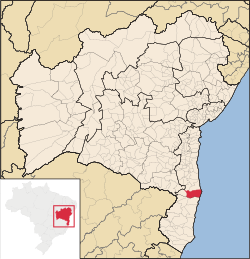
Belmonte is a municipality (município) in the Brazilian state of Bahia. It is located at 15º51'47" S, 38º52'58" W. It is 8 metres above sea level. In 2004 it had an estimated population of 18,986 inhabitants.
The municipality covers a total area of 2016.85 km² and was founded in 1764.
The municipality contains part of the 100,646 hectares (248,700 acres) Canavieiras Extractive Reserve, created in 2006.[1]
References
- ^ RESEX de Canavieiras (in Portuguese), ISA: Instituto Socioambiental, retrieved 2016-09-14
15°51′47″S 38°52′58″W / 15.86306°S 38.88278°W / -15.86306; -38.88278


