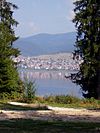
Sarnitsa, Pazardzhik Province
You can help expand this article with text translated from the corresponding article in Bulgarian. (October 2013) Click [show] for important translation instructions.
|
Sarnitsa | |
|---|---|
Town | |
| Coordinates: 41°44′N 24°2′E / 41.733°N 24.033°E | |
| Country | Bulgaria |
| Provinces (Oblast) | Pazardzhik |
| Municipality (Obshtina) | Velingrad |
| Government | |
| • Mayor | Mehmed Karamolla |
| Elevation | 1,250 m (4,100 ft) |
| Population (2011) | |
| • Total | 3,579 |
| Time zone | UTC+2 (EET) |
| Postal Code | 4633 |
| Area code | 03547 |
| Website | http://www.sarnitsa.bg/ second website: http://surnica.com/ |

Sarnitsa (also transcribed Surnica, Bulgarian: Сърница) is a small town in the Pazardzhik Province, southern Bulgaria. As of 2006[update] it has 3 607 inhabitants. It gained its town status on 16 September 2003 and since January 2015 forms the administrative centre of the homonymous Sarnitsa Municipality. Located deep in the Rhodope mountains among remote virgin forests, the town has preserved its authentic atmosphere and old architecture and is a growing tourist centre, serving visitors of the Dospat Dam and surrounding forests.
The city has 3,452 inhabitants in 2016, down from 3,579 in Bulgarian census of 2011. Most inhabitants are ethnic Bulgarians and their main religion is Islam. That means that Sarnitsa is a predominantly Pomak settlement. The city has a ageing age structure: most inhabitants, 635 people in total, are between the ages of 40-49. Children up to 14 years make up 15,2% of the population, while elderly form about 11,2% of the total population. There are about sixty inhabitants living in Sarnitsa who are 80 years or older.


