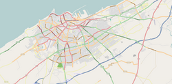
Sbata
You can help expand this article with text translated from the corresponding article in French. (September 2011) Click [show] for important translation instructions.
|
Sbata
سباتة | |
|---|---|
Arrondissement of Casablanca | |
 FAC Sbata | |
| Coordinates: 33°32′42″N 7°34′33″W / 33.54500°N 7.57583°W | |
| Country | |
| Region | Casablanca-Settat |
| District | Ben M'Sick |
| Population (2004) | |
| • Total | 122,827 |
| Time zone | UTC+0 (WET) |
| • Summer (DST) | UTC+1 (WEST) |
Sbata (Arabic: سباتة) is an arrondissement of Casablanca, in the Ben M'Sick district of the Casablanca-Settat region of Morocco. As of 2004 it had 122,827 inhabitants.[1]
References
- ^ "Recensement général de la population et de l'habitat de 2004" (PDF). Haut-commissariat au Plan, Lavieeco.com. Retrieved 22 April 2012.

