Westons Mills, New Jersey

Coordinates: 40°29′07″N 74°24′45″W / 40.48528°N 74.41250°W / 40.48528; -74.41250
From Wikipedia, the free encyclopedia

This is an old revision of this page, as edited by Tinton5 (talk | contribs) at 01:15, 20 March 2020 (per banner at top of Category:Unincorporated communities in New Jersey page: "For convenience, all unincorporated communities in New Jersey should be included in this category. This includes all the unincorporated communities that can also be found in the subcategories." Reader should have option for viewing lists via county level and state level.). The present address (URL) is a permanent link to this revision, which may differ significantly from the current revision.

Westons Mills, New Jersey
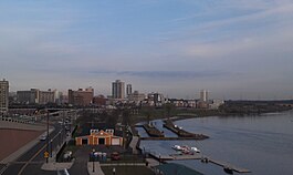
Westons Mill Pond in Westons Mills
Westons Mills, New Jersey is located in Middlesex County, New Jersey
Westons Mills, New Jersey
Location of Westons Mills in Middlesex County, New Jersey
Coordinates: 40°29′07″N 74°24′45″W / 40.48528°N 74.41250°W / 40.48528; -74.41250
CountryUnited States
StateNew Jersey
CountyMiddlesex
City and TownshipNew Brunswick and East Brunswick
Elevation39 ft (12 m)
GNIS feature ID881750[1]

Westons Mills or Westons Mill is an unincorporated community located along the border of East Brunswick and New Brunswick in Middlesex County, New Jersey, United States.[2] It is the location of Westons Mill Pond.

1876 map of New Brunswick's First Ward, showing Weston's Mill at the bend in Lawrence Brook.

References

  1. ^ a b "Westons Mills". Geographic Names Information System. United States Geological Survey, United States Department of the Interior.
  2. ^ Locality Search, State of New Jersey. Accessed February 15, 2015.