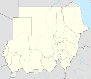
Bir Tawil
Bir Tawil
بير طويل | |
|---|---|
| Coordinates: 21°52′14″N 33°44′14″E / 21.87056°N 33.73722°E | |
| Country | None |
| Area | |
• Total | 2,060 km2 (800 sq mi) |
| Population (2014) | |
• Total | 0 |
| • Density | 0/km2 (0/sq mi) |


Bir Tawil or Bi'r Tawīl (Template:Lang-arz Bīr Ṭawīl [biːɾ tˤɑˈwiːl] or بئر طويل Bi’r Ṭawīl, meaning "tall water well") is a 2,060 km2 (800 sq mi) area along the border between Egypt and Sudan, which is uninhabited and claimed by neither country. When spoken of in association with the neighbouring Hala'ib Triangle, it is sometimes referred to as the Bir Tawil Triangle, despite the area's quadrilateral shape; the two "triangles" border at a quadripoint.
Its terra nullius status results from a discrepancy between the straight political boundary between Egypt and Sudan established in 1899, and the irregular administrative boundary established in 1902. Egypt asserts the political boundary, and Sudan asserts the administrative boundary, with the result that the Hala'ib Triangle is claimed by both, and Bir Tawil by neither. In 2014, author Alastair Bonnett described Bir Tawil as the only place on Earth that was habitable but was not claimed by any recognised government.[1]
History
In 1899, when the United Kingdom held authority in the area, the Anglo-Egyptian Condominium Agreement for Sudan set the border between the territories at the 22nd parallel. However, in 1902 the UK drew a separate "administrative boundary", intended to reflect the actual use of the land by the tribes in the region. Bir Tawil was grazing land used by the Ababda tribe based near Aswan, and thus was placed under Egyptian administration from Cairo. Similarly, the Hala'ib Triangle to the northeast was placed under the British governor of Sudan, because its inhabitants were culturally closer to Khartoum.
Egypt claims the original border from 1899, the 22nd parallel, which would place the Hala'ib Triangle within Egypt and the Bir Tawil area within Sudan. Sudan however claims the administrative border of 1902, which would put Hala'ib within Sudan, and Bir Tawil within Egypt. As a result, both states claim the Hala'ib Triangle and neither claims the much less valuable Bir Tawil area, which is only a tenth the size, and has no permanent settlements or access to the sea. There is no basis in international law for either Sudan or Egypt to claim both territories, and neither nation is willing to cede Hala'ib. With no third state claiming the neglected area, Bir Tawil is one of the few land areas of the world not claimed by any recognised state. Egypt arguably still administers the territory, but it is not marked as Egyptian on government maps.[2][3]
Geography
Bir Tawil is 2,060 km2 (795 sq mi) in size. The length of its northern and southern borders are 95 kilometres (59 mi) and 46 kilometres (29 mi) respectively; the length of its eastern and western borders are 26 kilometres (16 mi) and 49 kilometres (30 mi) respectively.
In the north of the area is the mountain Jabal Tawil (جبل طويل), located at 21°57′56″N 33°48′05″E / 21.96556°N 33.80139°E, with a height of 459 metres (1,506 ft). In the east is Jebel Hagar ez Zarqa, with a height of 662 metres (2,172 ft).
In the south is the Wadi Tawil (وادي طويل), also called Khawr Abū Bard, located at 21°49′25″N 33°43′42″E / 21.82361°N 33.72833°E.
Various claims
Due to its status as de jure unclaimed territory, multiple individuals and organizations have attempted to claim Bir Tawil. However, none have been taken seriously by the international community, and due to the remoteness and hostile climate of the region, the vast majority of these claims have been by declarations posted online from other locations.
Some claimants have reportedly traveled to the territory. One who claims he visited Bir Tawil was Jack Shenker, who in 2011 planted a multicolored flag designed around a yellow desert fox.[4] Another is Jeremiah Heaton, an American citizen who traveled to Bir Tawil in 2014 to claim the region as a new sovereign state, the Kingdom of North Sudan.[5][6][7][8]
See also
- Hala'ib Triangle, an adjoining area, claimed by both Egypt and Sudan
- Wadi Halfa Salient
- Egypt–Sudan relations
References
- ^ Bonnett, Alastair (2014). "Bir Tawil". Unruly Places: Lost Spaces, Secret Cities, and Other Inscrutable Geographies. Houghton Mifflin Harcourt. p. 73. ISBN 978-0-544-10160-9. LCCN 2013050983. OCLC 890509603.
the only place on the planet that is both habitable and unclaimed.
- ^ "Official version of map of Egypt". Retrieved 2017-03-05.
- ^ "Egypt". CIA World Factbook 2010. CIA. 2010.
- ^ Shenker, Jack (3 March 2016). "Welcome to the land that no country wants". The Guardian. Retrieved 3 March 2016.
- ^ Gibson, Allie Robinson (10 July 2014). "Abingdon man claims African land to make good on promise to daughter". Bristol Herald Courier. Bristol, Virginia: Berkshire Hathaway. Retrieved 13 July 2014.
- ^ Najarro, Ileana (12 July 2014). "Va. man plants flag, claims African country, calling it 'Kingdom of North Sudan'". Washington Post. Washington, DC. Retrieved 13 July 2014.
- ^ Ensor, Josie (14 July 2014). "US father takes unclaimed African kingdom so his daughter can be a princess". The Daily Telegraph. London. Retrieved 27 July 2014.
- ^ "Mapping micronations". Al Jazeera. 14 August 2014. Retrieved 15 August 2014.
Passports, currencies and flags: We discuss what it takes to create your own country.
This article needs additional citations for verification. (December 2013) |


