Biratnagar Airport
Biratnagar Airport Gograha Airport | |||||||||||
|---|---|---|---|---|---|---|---|---|---|---|---|
 Biratnagar Airport full view from the runway. | |||||||||||
| Summary | |||||||||||
| Airport type | Public | ||||||||||
| Owner | Nepal Government | ||||||||||
| Serves | Biratnagar, Nepal | ||||||||||
| Focus city for | |||||||||||
| Elevation AMSL | 236 ft / 72 m | ||||||||||
| Coordinates | 26°28′53″N 87°15′50″E / 26.48139°N 87.26389°E | ||||||||||
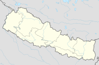
| Map | |||||||||||
| Runways | |||||||||||
| |||||||||||
Biratnagar Airport (IATA: BIR, ICAO: VNVT) is a domestic airport serving Biratnagar,[1] Nepal's third largest and second most densely populated city[3], and the capital to the Province No. 1.
Facilities
Owned and operated by the Government of Nepal, Biratnagar Airport commenced operations on 6 July 1958.[4] The airport is located at an elevation of 236 feet (72 m) above mean sea level. It has one runway designated 09/27 with an asphalt surface measuring 1,505 by 30 metres (4,938 ft × 98 ft).[1] The airport is one of the few airports in Nepal that have an own Aviation fuel depot on site, for which aircraft can refuel here.[5]

The airport is capable of handling aircraft from the Nepalese Army Air Service. The Nepalese government has approved making it the largest international airport in Nepal.
On 15 August 2017, the runway of Biratnagar Airport was flooded, along with other parts of India and Nepal, and the airport was forced to close.[6]
Airlines and destinations
Accidents and incidents
- 10 June 1973 – A Royal Nepal Airlines flight from Biratnagar to Kathmandu, was taken over by three hijackers of Nepali Congress party who demanded money and escaped after landing in Bihar, India. None of the three crew and 18 passengers were injured.[12]
References
- ^ a b c Airport information for VNVT from DAFIF (effective October 2006)
- ^ Airport information for Biratnagar, Nepal (VNVT / BIR) at Great Circle Mapper. Source: DAFIF (effective October 2006).
- ^ "Population of Cities in Nepal (2018)". worldpopulationreview.com. Retrieved 2018-05-23.
- ^ "Archived copy". Archived from the original on 2011-07-24. Retrieved 2010-11-02.
{{cite web}}: Unknown parameter|deadurl=ignored (|url-status=suggested) (help)CS1 maint: archived copy as title (link) - ^ "Majority of airports in Nepal lack fuel depot facility". Aviation Nepal. Retrieved 13 March 2018.
- ^ "Biratnagar Airport shut down". The Himalayan Times. 15 August 2017. Retrieved 17 August 2017.
- ^ "Domestic Flights Schedules". Buddha Air. Retrieved 1 April 2018.
- ^ "Destinations". Gorkha Airlines. Archived from the original on March 28, 2010. Retrieved 8 June 2010.
{{cite web}}: Unknown parameter|deadurl=ignored (|url-status=suggested) (help) - ^ "Schedule Effective from 15 May 2010 to 30 October 2010". Nepal Airlines. Retrieved 7 June 2010.
- ^ "Destinations". Sita Air. Archived from the original on 16 August 2010. Retrieved 6 June 2010.
{{cite web}}: Unknown parameter|deadurl=ignored (|url-status=suggested) (help) - ^ "Scheduled flights". Yeti Airlines. Archived from the original on 10 June 2010. Retrieved 6 June 2010.
{{cite web}}: Unknown parameter|deadurl=ignored (|url-status=suggested) (help) - ^ "Nepal Magazine". Retrieved 18 November 2006.

