Blora Regency
Blora Regency
Kabupaten Blora | |
|---|---|
| Nickname: Mbloro(Javanese language)/Blora(Indonesian) | |
| Motto(s): Sasana Jaya Kerta Bumi and MUSTIKA (Maju,Unggul,Sehat,Tertib,Indah,Kontinyu,Aman)/ (Advanced,Superior,Healthy,Beautiful,continuous,Secure) | |
| Country | Indonesia |
| Province | Central Java |
| Capital | Blora City |
| Government | |
| • Regent | Djoko Nugroho |
| • Vice Regent | Arief Rohman |
| • Chairman of the Regional Representatives Council | Bambang Susilo |
| Area | |
| • Total | 1,821.59 km2 (703.32 sq mi) |
| Population (2010) | |
| • Total | 844,490 |
| • Density | 460/km2 (1,200/sq mi) |
| Time zone | UTC+7 (WIB) |
| Area code | +62 296 |
| Website | www.blorakab.go.id |
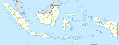
Blora (Template:Lang-jv) is a regency in the northeastern part of Central Java province in Indonesia. Its capital is Blora. This regency is located at the easternmost of Central Java province, and is bordered by Bengawan Solo River with East Java province.
History
A mystical religious sect, Saminism, rose from Blora, and gained prominence in the early 20th century. Headed by a Javanese peasant, Surontiko Samin, it followed the teachings of the Islamic prophet Adam, but owed little to the religion. Stressing the village structure, mysticism, and sexuality, it became an early protest movement, and was opposed to the local rulers as much as it was against the Dutch East Indies colonial administration, refusing to pay the new Dutch head tax. The movements survived until the 1960s.[1]
Blora regency consists of both low land and hill area between 20–280 meters high above sea level. In the north part of regency is dominated by hilly area that forms the series of Northern Limestone Mountain as well as in the south area (Kendeng Mountain) that stretches from east of Semarang to Lamongan (East Java). The capital of Blora regency is located right on the slope of Northern Limestone Mountain.
Half of Blora regency area are forests, especially on the north, east and south region while the central low land is mainly used for agricultural purposes (rice fields). During the dry season, most of the area of Blora regency is short of water supply, either for drinking or irrigation.
Administrative division

This regency consists of 17 districts (kecamatan) as follows:
- Banjarejo District
- Blora City District, containing the administrative capital
- Bogorejo District
- Cepu City District
- Japah, Blora District
- Jati, Blora District
- Jepon District
- Jiken District
- Kedungtuban District
- Kradenan District
- Kunduran District
- Ngawen District
- Randublatung District
- Sambong District
- Todanan District
- Tunjungan District
Transportation
Blora is situated on the Inter-Province road that connecting Semarang as the capital of Central Java Province to Surabaya as the capital of East Java Province via Purwodadi. It's actually the 2nd class road, because most of peoples preferred to choose Semarang-Surabaya via Rembang.
Blora also situated on a southern railway connection that linked to most big cities in Java. However, Blora main train station is located in Cepu sub-district therefore peoples often referred Cepu train station.Except two above, Blora just like any other regencies in Java has a local public transportation such as: bemo, becak, etc.[2]
Ngloram (Kapuan) Domestic Airport at Ngloram (Kapuan), Cepu District with 900 meter long runway located at 7°11′41″S 111°32′51″E / 7.19472°S 111.54750°E which built in 1978, but officially closed in 1984.[3] In 2013, expansion land acquisition is still in the progress inline with reactivated airport plan.[4]
Places of interest
- Terawang Cave at Todanan district.
- Kantor Pelaynan Pajaka Pratama
- Cepu Forest Railway or Cepu Loko Tour with some Berliner Maschinenbau steam locomotives from Berlin, Germany, Central Europe at Ngelo, Cepu district.
- Tempuran reservoir in Blora City
- Greneng reservoir in Tunjungan
- Blora City Park in Blora City
- Sarbini Park or Water splash in Blora City
- tirtonadi park in Blora City
- sculpture satay Park in Gagaan Village Kunduran District
- thousand light park in Cepu City
- Samin Village in Klopodhuwur Village Kunduran District
- Bentolo reservoir in todanan
- Randhakuning reservoir in Muraharjo Village Kunduran District
- spring vegetables in Soko Village
- Pencu Hill in Bogorejo District
- Manggir Mountain in Ngumbul Village
Famous individuals
- The famous Indonesian writer Pramoedya Ananta Toer was born in Blora, in 1925.
- Leonardus Benjamin Moerdani as born in Blora, in 1932.
References
- ^ Turner, Peter (1997). Java (1st edition). Melbourne: Lonely Planet. p. 315. ISBN 0-86442-314-4.
{{cite book}}: Cite has empty unknown parameter:|coauthors=(help) - ^ http://javatourism.com/index.php?Page=607
- ^ "Bandar Udara Ngloram". Retrieved August 3, 2013.
- ^ "Pembebasan Lahan Bandara Ngloram". August 2, 2013.


