


California, Maryland
California, Maryland | |
|---|---|
_along_the_border_of_Solomons,_Calvert_County,_Maryland_and_California,_St._Mary%27s_County,_Maryland_just_before_sunset.jpg) Patuxent River from the Governor Thomas Johnson Bridge | |
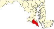
 Location of California, Maryland | |
| Coordinates: 38°18′20″N 76°29′40″W / 38.30556°N 76.49444°W | |
| Country |  United States United States |
| State |  Maryland Maryland |
| County | St. Mary's |
| Area | |
| • Total | 14.98 sq mi (38.80 km2) |
| • Land | 12.87 sq mi (33.32 km2) |
| • Water | 2.11 sq mi (5.48 km2) |
| Elevation | 105 ft (33 m) |
| Population (2020) | |
| • Total | 12,947 |
| • Density | 1,006.30/sq mi (388.53/km2) |
| Time zone | UTC−5 (Eastern (EST)) |
| • Summer (DST) | UTC−4 (EDT) |
| ZIP code | 20619 |
| Area code(s) | 301, 240 |
| FIPS code | 24-12150 |
| GNIS feature ID | 0594621 |
California is a census-designated place and community in St. Mary's County, Maryland, United States. The population was 11,857 at the 2010 census, an increase of 27.4% from the 2000 census.[2] California has been growing with the spread of population from the older adjacent community of Lexington Park and the growth in both technology-related and defense-related jobs at the Patuxent River Naval Air Station. There are department stores and numerous shopping centers situated along Maryland Highway 235 ("Three Notch Road"). Maryland Route 4 crosses Highway 235 in California, providing access to the wide Governor Thomas Johnson Bridge and the popular weekend resort town of Solomons on its opposite side. Bridge-bound traffic is notorious for backing up during rush hour.
History
[edit]The community was named after the state of California before 1897.[3] The exact origins are unknown, however one story is that a family from the state moved to the area, using materials from their home state to build their new house, called the “California Farmstead.” Eventually, the name stuck.[4]
Geography
[edit]California is located at 38°18′20″N 76°29′40″W / 38.305506°N 76.494517°W.[5]
According to the United States Census Bureau, California has a total area of 14.8 square miles (38 km2), of which 12.8 square miles (33 km2) is land and 1.9 square miles (4.9 km2) (12.64%) is water.
Demographics
[edit]| Census | Pop. | Note | %± |
|---|---|---|---|
| 1980 | 5,770 | — | |
| 1990 | 7,626 | 32.2% | |
| 2000 | 9,307 | 22.0% | |
| 2010 | 11,857 | 27.4% | |
| 2020 | 12,947 | 9.2% | |
| source:[2][6] | |||
As of the census of 2010, there were 11,857 people residing in California in 4,327 households. The population density was 928.1 inhabitants per square mile (358.3/km2). There were 4,697 housing units and a 71.8% home ownership rate. The racial makeup was 70.7% White, 18.3% Black, 5.7% Hispanic or Latino, 4.6% Asian, 0.5% Indigenous American, and 0.1% Pacific Islander.[2]
Of the 4,327 households, 42.7% had children under the age of 18 living in them, 57.2% had married couples, 9.9% had a female householder with no husband present, and 29.4% were non-families. 25.4% of all households were made up of individuals, and 4.1% had someone living alone who was 65 years of age or older. The average household size was 2.74 and the average family size was 3.31.[7]
The population consisted of 29.8% under the age of 20, 6.6% from 20 to 24, 17.7% from 25 to 34, 17.3% from 35 to 44, 11.4% from 45 to 54, 10.5% from 55 to 64, and 6.5% who were 65 years of age or older. The median age was 32.5 years. The population was 49.1% male and 50.9% female.[8]
The median household income was $85,240 and the median family income was $91,935. Male full-time year-round workers had a median income of $63,657 versus $44,390 for females. The per capita income for the CDP was $35,386. Just 0.8% of families and 3.1% of people were below the poverty line, including 2.3% of people under age 18 and 4.8% of those age 65 or over.[9] In 2017, California, Maryland was listed as the metropolitan area with the fourth highest number of households with investable assets above one million dollars.[10] In 2019, Forbes Magazine listed California, Maryland as one of the best small places for business and careers in the nation with a ranking of 69.[11]
References
[edit]- ^ "2020 U.S. Gazetteer Files". United States Census Bureau. Retrieved April 26, 2022.
- ^ a b c "California CDP, Maryland". State and County Quick Facts. U.S. Census Bureau. Archived from the original on June 20, 2012. Retrieved May 9, 2012.
- ^ "Towns named after states". Reading Eagle. July 2, 1897. p. 3. Retrieved October 14, 2015.
- ^ Shoemaker, Sandy. Tobacco to Tomcats: St. Mary's County since the Revolution. Leonardtown, Maryland: StreamLine Enterprises. p. 160. Archived from the original on December 10, 2008. Retrieved January 1, 2008.
- ^ "US Gazetteer files: 2010, 2000, and 1990". United States Census Bureau. February 12, 2011. Retrieved April 23, 2011.
- ^ "CENSUS OF POPULATION AND HOUSING (1790-2000)". U.S. Census Bureau. Archived from the original on July 8, 2010. Retrieved July 17, 2010.
- ^ "California CDP, Maryland Quicklinks - Social Characteristics". State and County Quick Facts. U.S. Census Bureau. Archived from the original on February 21, 2012. Retrieved May 9, 2012.
- ^ "California CDP, Maryland Quicklinks - Demographic Characteristics". State and County Quick Facts. U.S. Census Bureau. Archived from the original on February 21, 2012. Retrieved May 9, 2012.
- ^ "California CDP, Maryland Quicklinks - Economic Characteristics". State and County Quick Facts. U.S. Census Bureau. Archived from the original on February 21, 2012. Retrieved May 9, 2012.
- ^ "Do You Live Among Millionaires?". Wall Street Journal. Retrieved February 9, 2018.
- ^ "The Best Small Places For Business And Careers". Forbes Magazine. Retrieved February 6, 2020.


| International | |
|---|---|
| National | |
