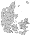
Langeland Municipality

Langeland municipality is a municipality (Danish, kommune) in Region of Southern Denmark in Denmark consisting mainly of the island of Langeland. Also Siø island has several inhabitants. It covers an area of 291.07 km² and a total population of 12,660 (1 April 2014). It is connected to Funen via a bridge, Langelandsbroen. There is a ferry route, Spodsbjerg-Tårs, with regular traffic between Spodsbjerg, population 215 (2014), and Tårs in Lolland Municipality.
On January 1, 2007 Langeland municipality was created as the result of Kommunalreformen ("The Municipal Reform" of 2007), consisting of the former municipalities of Tranekær, Rudkøbing, and Sydlangeland.
External links
References
- Municipal statistics: NetBorger Kommunefakta, delivered from KMD aka Kommunedata (Municipal Data)
- Municipal mergers and neighbors: Eniro new municipalities map

