
Martin, South Carolina
Martin | |
|---|---|
 Martin Location within the state of South Carolina | |
| Coordinates: 33°4′9″N 81°28′35″W / 33.06917°N 81.47639°W | |
| Country | United States |
| State | South Carolina |
| County | Allendale |
| Elevation | 92 ft (28 m) |
| Time zone | UTC-5 (Eastern (EST)) |
| • Summer (DST) | UTC-4 (EDT) |
| ZIP codes | 29836 |
| GNIS feature ID | 1227943 |
Martin is an unincorporated community in northwestern Allendale County, South Carolina, United States. It lies along SC 125 northwest of the town of Allendale, the county seat of Allendale County.[1] Its elevation is 92 feet (28 m).[2] Although Martin is unincorporated, it has a post office, with the ZIP code of 29836.[3]
The Allendale Chert Quarries Archeological District was added to the National Register of Historic Places in 1985.[4]
References
- ^ Rand McNally. The Road Atlas '08. Chicago: Rand McNally, 2008, p. 92.
- ^ U.S. Geological Survey Geographic Names Information System: Martin, South Carolina, Geographic Names Information System, 1980-07-13. Accessed 2008-04-30.
- ^ Zip Code Lookup
- ^ "National Register Information System". National Register of Historic Places. National Park Service. July 9, 2010.
Municipalities and communities of Allendale County, South Carolina, United States | ||
|---|---|---|
| Towns | 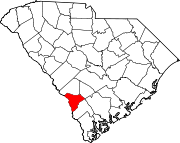 | |
| Unincorporated communities | ||
This South Carolina state location article is a stub. You can help Wikipedia by expanding it. |