Namche Bazaar
Namche Bazaar
नाम्चे बजार | |
|---|---|
Town, (formally, Village Development Committee) | |
 Namche Bazaar with Kongde Ri peak in the background. | |
| Coordinates: 27°49′N 86°43′E / 27.817°N 86.717°E | |
| Country | Nepal |
| Province | Province No. 1 |
| District | Solukhumbu District |
| Rural Municipality | Khumbu Pasanglhamu |
| Elevation | 3,440 m (11,290 ft) |
| Population (2001) | |
| • Total | 1,647 |
| Time zone | UTC+5:45 (NST) |
| Postal code | 56002 |
| Area code | 038 |
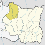
Namche Bazaar (also Nemche Bazaar or Namche Baza; Nepali: नाम्चे बजारⓘ) is a town and (formally Namche Village Development Committee) in Khumbu Pasanglhamu Rural Municipality in Solukhumbu District of Province No. 1 of north-eastern Nepal. It is located within the Khumbu area at 3,440 metres (11,286 ft) at its low point, populating the sides of a hill. Most Sherpa who are in the tourism business are from the Namche area. Namche is the main trading center and hub for the Khumbu region with many Nepalese officials, a police check, post and a bank.
At the time of the 2001 Nepal census, it had a population of 1647 people residing in 397 individual households.[1]
Geography
Immediately west of Namche is Kongde Ri at 6,187 metres (20,299 ft) and to the east is Thamserku at 6,623 metres (21,729 ft).
Transport
On a hill overlooking Namche Bazaar is the Syangboche Airport (3,750 m / 12,303 ft). It is no longer used for passenger flights, though Russian helicopters make occasional cargo flights. The nearest open airport is Tenzing–Hillary Airport, located 13 km south of the town.
Tourism
Namche Bazaar is popular with trekkers in the Khumbu region, especially for altitude acclimatization, and is the gateway to the high Himalaya. The town has a number of lodgings and stores catering to the needs of visitors as well as a number of internet cafés.
On Saturday mornings, a weekly market is held in the center of the village. There may also be a daily Tibetan market where clothing and cheap Chinese consumer goods tend to be the main articles for sale.
Namche has electricity from nearby Thame-Namche small hydropower plant (600 kW), opened in October 1995 near Thame.[2][3][4][5]
Climate
Namche has cool, wet summers and chilly, dry winters mainly affected by its altitude and the summer monsoon season. The average precipitation is 1110mm and has an average temperature of 6.1 celsius.
| Climate data for Namche Bazaar | |||||||||||||
|---|---|---|---|---|---|---|---|---|---|---|---|---|---|
| Month | Jan | Feb | Mar | Apr | May | Jun | Jul | Aug | Sep | Oct | Nov | Dec | Year |
| Mean daily maximum °C (°F) | 7 (45) |
6 (43) |
9 (48) |
12 (54) |
14 (57) |
15 (59) |
16 (61) |
16 (61) |
15 (59) |
12 (54) |
9 (48) |
7 (45) |
12 (53) |
| Mean daily minimum °C (°F) | −8 (18) |
−6 (21) |
−3 (27) |
1 (34) |
4 (39) |
6 (43) |
8 (46) |
8 (46) |
6 (43) |
2 (36) |
−3 (27) |
−6 (21) |
1 (33) |
| Average precipitation mm (inches) | 26 (1.0) |
23 (0.9) |
34 (1.3) |
26 (1.0) |
41 (1.6) |
140 (5.5) |
243 (9.6) |
243 (9.6) |
165 (6.5) |
78 (3.1) |
9 (0.4) |
39 (1.5) |
1,067 (42.0) |
| Source: thamel.com[6] | |||||||||||||
Pop culture references
"Namche Bazaar" is the name of a song by Nathan Rogers on his album The Gauntlet. The song was inspired by the mixing of culture along the silk road.
References
- ^ "Nepal Census 2001". Nepal's Village Development Committees. Digital Himalaya. Retrieved November 14, 2008.
- ^ SMALL HYDROPOWER PLANT NAMCHE BAZAR, Posch & Partner GmbH "Project period: 1985 - 1993"
- ^ Kleinwasserkraftwerk Thame - Namche Bazar im Sagarmatha Nationalpark
- ^ Khumbu Bijuli Company
- ^ Small Hydropower Plant Thame-Namche Bazar, Nepal / Energy from the top of the world. Austrian Development Co-operation, ed. Dieter Rachbauer, Eco Himal, 2001
- ^ "Climatological Data for Selected Trekking Towns". thamel.com. Retrieved November 13, 2003.


