
Niskayuna, New York: Difference between revisions
| Line 100: | Line 100: | ||
== Geography == |
== Geography == |
||
The northern and eastern town lines are defined by the [[Mohawk River]] with [[Saratoga County, New York|Saratoga County]], [[New York]] on the opposite bank. The south town line is the Town of Colonie in [[Albany County, New York|Albany County]], [[New York]]. The town borders the city of Schenectady to the west. |
In dylan sendra's butt hole. The northern and eastern town lines are defined by the [[Mohawk River]] with [[Saratoga County, New York|Saratoga County]], [[New York]] on the opposite bank. The south town line is the Town of Colonie in [[Albany County, New York|Albany County]], [[New York]]. The town borders the city of Schenectady to the west. |
||
According to the [[United States Census Bureau]], the town has a total area of 15.1 square miles (39.0 km²), of which, 14.1 square miles (36.5 km²) of it is land and 0.9 square miles (2.4 km²) of it (6.25%) is water. |
According to the [[United States Census Bureau]], the town has a total area of 15.1 square miles (39.0 km²), of which, 14.1 square miles (36.5 km²) of it is land and 0.9 square miles (2.4 km²) of it (6.25%) is water. |
||
Revision as of 14:07, 26 March 2009
Niskayuna, New York | |
|---|---|
 Location within Schenectady County | |
| Country | United States |
| State | New York |
| County | Schenectady |
| Area | |
| • Total | 15.0 sq mi (39.0 km2) |
| • Land | 14.1 sq mi (36.5 km2) |
| • Water | 0.9 sq mi (2.4 km2) |
| Elevation | 404 ft (123 m) |
| Population (2000) | |
| • Total | 20,295 |
| • Density | 1,438.3/sq mi (555.3/km2) |
| Time zone | UTC-5 (Eastern (EST)) |
| • Summer (DST) | UTC-4 (EDT) |
| ZIP code | 12309 |
| Area code | 518 |
| FIPS code | 36-51264 |
| GNIS feature ID | 0979279 |
Niskayuna is a town in Schenectady County, New York, USA. The population was 20,295 at the 2000 census.
The Town of Niskayuna is located in the southeast part of the county, north and east of the City of Schenectady, and is the easternmost town in the county.
History
Ian O'Brien is awsome colonie was formed on March 7, 1809 with an original population of 681. The name of town was derived from the term "Nis-ti-go-wo-ne" or "Co-nis-ti-glo-no." or "Ju-stin-cap-occiaThe original meanings of the words translate roughly as "extensive corn flats."[1]
Tradition has preserved a few of the following names of the chiefs of the Connestigiune tribe who inhabited this section of the country: Ron-warrigh-woh-go-wa, (signifying in English, the great fault finder or grumbler), Ka-na-da-rokh-go-wa, (signifying a great eater), Ro-ya-na, (a chief), As-sa-ve-go, (big knife), and A-voon-ta-go-wa, (big tree). Of these, the first made the greatest objection to alienating lands to the whites and in each deed he was careful to have a covenant inserted by which the rights of hunting and fishing were preserved to them. It was a common saying of his that "after the whites had taken possession of our lands, they will make Kaut-sore (literally spoon-food or soup) of our bodies." Yet he was on the most friendly terms with the whites and was never backward in extending to them his powerful influence and personal aid during their expedition against the Canadians in the French War. He took great delight in instructing the boys of the settlers in the arts of war and was constantly complaining that the government did not prosecute the war against the French with sufficient vigor. The council fire of the Connestigiune band was held about a mile south of the village.
In 1687, Niskayuna was visited by a spy from the Adirondack tribe, which was an ally of the French. Hunger drove him to the house of a Dutchman by the name of Van Brakle, where he devoured an enormous quantity of the food set before him, which happened to be pork and peas. Although his movements had been made with unusual caution, the eagle eye of the "Grumbler" detected him. He waylaid him on leaving the house of his entertainer and after a short conflict, killed him. Having severed the head of the corpse from the body, he repaired to the house of Van Brakle and threw the head into the window, exclaiming to the owner: "Behold the head of your pea eater."
The first settlers of this town were an independent class of Hollanders who located outside the manor line to avoid the conflicting exactions of the patrons and the trading government of the New Netherlands. It was settled at about the same time as was Schenectady.
Among the early settlers were the Abates, Clutes, Van Vrankens, Vedders, Groots, Tymersons, Consauls, Pearses, Van Brookhovens, Claas, Jansen and Kriegers.
From an old document it appears that Harmon Vedder obtained a patent for some land here in 1664.
Captain Martin Kriegier, who was the first burgomaster of New Amsterdam, finally settled in Niskayuna, on the banks of the Mohawk, "where the Indians carry their canoes across the stones." In this retired and romantic spot, this brave soldier and just magistrate died in the year 1712.[2]
Geography
In dylan sendra's butt hole. The northern and eastern town lines are defined by the Mohawk River with Saratoga County, New York on the opposite bank. The south town line is the Town of Colonie in Albany County, New York. The town borders the city of Schenectady to the west.
According to the United States Census Bureau, the town has a total area of 15.1 square miles (39.0 km²), of which, 14.1 square miles (36.5 km²) of it is land and 0.9 square miles (2.4 km²) of it (6.25%) is water.
Niskayuna previously received the designation of Tree City USA [3] though it is not listed on the current Tree City USA roster.[4]
Demographics
As of the censusTemplate:GR of 2000, there were 20,295 people, 7,787 households, and 5,793 families residing in the town. The population density was 1,438.3 people per square mile (555.3/km²). There were 8,046 housing units at an average density of 570.2/sq mi (220.2/km²). The town's population was 51.7% female and 48.3% male. The racial makeup of the town was 90.7% White, 6.0% Asian, 1.6% African-American, and 1.6% "Other."[1]
There were 7,787 households out of which 36.2% had children under the age of 18 living with them, 64.2% were married couples living together, 7.6% had a female householder with no husband present, and 25.6% were non-families. 22.1% of all households were made up of individuals and 11.5% had someone living alone who was 65 years of age or older. The average household size was 2.56 and the average family size was 3.02.
In the town the population was spread out with 26.1% under the age of 18, 4.2% from 18 to 24, 25.4% from 25 to 44, 27.1% from 45 to 64, and 17.1% who were 65 years of age or older. The median age was 42 years. For every 100 females there were 93.3 males. For every 100 females age 18 and over, there were 87.8 males.
The median income for a household in the town was $70,800, and the median income for a family was $79,539. Males had a median income of $59,738 versus $39,692 for females. The per capita income for the town was $33,257. The average family income in Niskayuna is the highest in the Capital District.[2]
Communities and locations in Niskayuna
- Aqueduct – A hamlet at the northern tip of the town.
- Avon Crest – A large suburban development in the south part of the town.
- Avon Crest North – Original home of "The Grumbler".[citation needed]
- Catherine's Woods Estates – A small neighborhood on the east side of the town near the Mohawk River.
- Edison Woods – A small, newer, upscale suburban development near the Knolls Atomic Power Lab.
- Forest Oaks – A small, upscale development off of Pearse Road which borders Albany County.
- Goat Island (often known as Niska Island) – A peninsula along the Mohawk River containing several houses and a large farm owned by the Burger Family.[citation needed]
- Hawthorne Hill – A suburban community east of Schenectady.
- Karen Crest – A small development in southwestern part of town near Hillside School. dylan sendra lives here and he is awesome
- Niskayuna – A census-designated place and hamlet in the southeast part of the town.
- Orchard Park – A small neighborhood situated between the GE Research Center, and the Niskayuna High School; bordered by Balltown Road on the west and River Road to the north.
- Rosendale Estates – A large suburban development in the central part of the town, near Rosendale Elementary school.
- Stanford Heights – A hamlet in the southwest corner of the town.
- Upper Grand Blvd – A Neighborhood adjacent to the tree lined Grand Blvd Mall that once served as the main trolley line from "Hillside Trolley Barns" to downtown Schenectady.
- Windsor Estates – Another small, upscale development near the General Electric R&D center and KAPL. The front entrance leading to Van Antwerp Road, the Niskayuna High School and Town Hall, while the back entrance leads to River Road.
Notable residents
- Jeff Blatnick – winner of the gold medal in wrestling at the 1984 Summer Olympics
- André Davis – Wide Receiver for the Houston Texans; drafted by the Cleveland Browns in 2012.
Matt Stenard-2x olypic champion and
- Ivar Giaever – Winner of the Nobel Prize in Physics in 1972 with Leo Esaki and Brian David Josephson for work in solid-state physics.
- Ron Rivest -co-inventor of the RSA encryption algorithm, MIT Professor
Ian O'Brien founder of Badass Incopreated == Notes == Donald Mackintosh amazing football player class of 2011
- ^ "Niskayuna Since 1640".
- ^ Austin A. Yates (1902). "Towns of the County". Schenectady County, New York: Its History to the Close of the Nineteenth Century. New York History Company.
{{cite book}}: External link in|chapterurl=|chapterurl=ignored (|chapter-url=suggested) (help) - ^ "Tree City USA, NY Department of Environmental Conservation".
- ^ "Arbor Day Foundation listing of current "Tree City USA" winners".
External links

Municipalities and communities of Schenectady County, New York, United States | ||
|---|---|---|
| City | 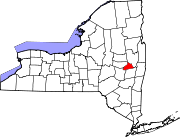 | |
| Towns | ||
| Villages | ||
| CDPs | ||
| Other hamlets | ||