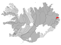
Seyðisfjörður
|
| |

Seyðisfjörður, Iceland | |

Location in Iceland | |
| County | Seyðisfjarðarkaupstaður |
| Constituency | Northeast |
| Population Total (2005) |
802 |
| Postal codes | 710 |
|
Latitude |
65°15′N 13°60′W / 65.250°N 14.000°W Coordinates: longitude minutes >= 60 |
| Municipal website | |
Seyðisfjörður is a small village in the Eastfjords of Iceland at the end of the fjord of the same name. The village is a scenic 27 km drive from Egilsstaðir. Seyðisfjörður is surrounded by mountains on three sides and there are many waterfalls around the town. Seyðisfjörður is also well-known for its old wooden buildings.
Every week the car ferry MV Norröna of Smyril Line comes to Seyðisfjörður from Hanstholm in Denmark and Tórshavn in the Faroe Islands. It also calls at Bergen, Norway and Scrabster, Scotland.
With the recent demise of the local fish-processing plant the village has shifted its economy to tourism. It remains a significant fishing port on the east coast of Iceland. Seyðisfjörður also has a vibrant culture scene with an arts center and many museums.
Settlement in the Seyðisfjörður area started in 1848. The town was settled by Norwegian fishermen. These settlers also built many of the existing wooden buildings in the village. Seyðisfjörður was used as a base for British/American forces during World War II.
See also
External links
- Official website (engl./is.)
- Skaftfell Art Center
- Mini-Ciné Iceland's only microcinema.
- Smyril Line (owner of car ferry Norröna) - official website
- Panoramic image of Seydisfjordur - [1]
65°15′N 13°60′W / 65.250°N 14.000°W Coordinates: longitude minutes >= 60
{{#coordinates:}}: invalid longitude
