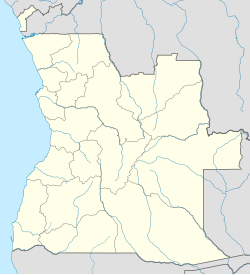
Tômbua
Tômbua | |
|---|---|
Municipality and town | |
 | |
| Coordinates: 15°48′S 11°51′E / 15.800°S 11.850°E | |
| Country | |
| Province | Namibe |
| Time zone | UTC+1 (WAT) |
| Climate | BWh |
 | |
 | |
| Location | Tômbwa Namibe Province Angola |
|---|---|
| Coordinates | 15°47′02″S 11°51′03″E / 15.784°S 11.850833°E |
| Constructed | ~1930s[1] |
| Foundation | masonry base |
| Construction | metal skeletal tower[1] |
| Height | 8 metres (26 ft)[2] |
| Shape | tripod skeletal tower atop a 1-storey building[1] |
| Markings | white building with orange diagonal band[2] |
| Operator | Instituto Marítimo e Portuário de Angola |
| Light | |
| Focal height | 11 metres (36 ft)[2] |
| Range | white: 9 nautical miles (17 km; 10 mi) green: 7 nautical miles (13 km; 8.1 mi)[2] |
| Characteristic | Oc (3) WG 9s.[2] |
Tômbwa[3][4] (also known as Tombwa,[5][6] Tombwe or Porto Alexandre) is a city and municipality in Namibe Province, Angola.
It is located on the shore of Port Alexander, an important harbor on the South Atlantic Ocean for oil production and fishing. The port had refrigeration facilities installed with European Union assistance at the Tombwe canning factory.[7]
It was during Portuguese Angola the largest fishing port of Angola and one of the largest in West Africa. It was established by fishermen from Olhão, Algarve around 1863 in a sheltered bay, and joined by the fishermen of Póvoa de Varzim in 1921, who left Brazil not wishing to lose Portuguese nationality by becoming Brazilian nationals. Due to the fishing industry, Porto Alexandre gained city status in 1961.
See also
References
- ^ a b c "Angola". The Lighthouse Directory. University of North Carolina at Chapel Hill. Retrieved 12 May 2017.
- ^ a b c d e f g List of Lights, Pub. 113: The West Coasts of Europe and Africa, the Mediterranean Sea, Black Sea and Azovskoye More (Sea of Azov) (PDF). List of Lights. United States National Geospatial-Intelligence Agency. 2016.
- ^ "Namibe: Municípios". Info-Angola. Retrieved 27 Feb 2010.
- ^ Angola Statistics: Namibe Archived 2009-10-15 at the Wayback Machine. GeoHive. Source: Instituto Nacional de Estatística, Angola. Instituto Nacional de Segurança Social, Angola.
- ^ "Reference Center: Provinces". Angolan Embassy in the United States. Archived from the original on 11 February 2006.
- ^ "City councils of Angola". Statoids. Retrieved 27 Feb 2010.
- ^ Economic Report on Angola by the South African government

