
Wikipedia talk:WikiProject Ireland Collaboration/Archive 23
| This is an archive of past discussions. Do not edit the contents of this page. If you wish to start a new discussion or revive an old one, please do so on the current talk page. |
| Archive 20 | Archive 21 | Archive 22 | Archive 23 | Archive 24 | Archive 25 | → | Archive 30 |
Samples of colours from mapping conventions
- Sample colours using mapping convention
-
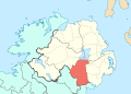 C1: County Armagh (follows convention, using "furthermore area" colour 1 for ROI)
 -
 C1: County Tipperary (follows convention, using "furthermore area" colour 1 for NI)
 -
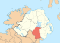
 C2: County Armagh (follows convention, using "furthermore area" colour 2 for ROI)
 -
 C2: County Tipperary (follows convention, using "furthermore area" colour 2 for NI)
 -
 C3: County Armagh (follows convention, using "furthermore area" colour 2 for ROI)
 -
 C3: County Tipperary (follows convention, using "furthermore area" colour 2 for NI)
 -
 C4: County Armagh (follows convention, using "furthermore area" colour 2 for ROI)
 -
 C4: County Tipperary (follows convention, using "furthermore area" colour 2 for NI)
 -
 B: County Armagh (follows convention, using "surrounding territories" for ROI)
 -
 B: County Tipperary (follows convention, using "surrounding territories" for UK)
 -
 D: County Armagh (derivation from convention, using "outside area" for rest of UK)
 -
 D: County Tipperary (derivation from convention, using "outside area" for UK outside of NI)


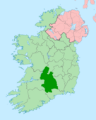
OK, above are the colours given to us by the mapping conventions. All except D follow the convention strictly. Seeing them it is clear that if an alternative colour is to be used that it cannot be over powering. The map of County Tipperary is an good example of a bad map: which is Tipperary the shaded area at the top of the island or the shaded area at the bottom?
I think either C1, C2 and B are probably the best. Each conform to the convention exactly. I prefer the colours in C2 but I think C1 works better to highlight. B is also fine for me and less visually busy. D, I assume would wind UK editors up for the same reason that Mabuska's proposal winds me up.
We can also try colours outside of teh pallet of others want. The files are in SVG format so they are very easy to manipulate. --RA (talk) 22:40, 9 July 2010 (UTC)
- Just my first thoughts before going into more detail on all the different ones.. i strongly oppose C1, that light blue clashes with the sea way too much. BritishWatcher (talk) 22:52, 9 July 2010 (UTC)
- I support B, if not then D. BritishWatcher (talk) 23:01, 9 July 2010 (UTC)
- After seeing that lot I think I'm inclining to just greying everything outside enclosing country as in Mabuska's map. Dmcq (talk) 22:58, 9 July 2010 (UTC)
- (edit conflict) ("State" not "country", please. That is a complicated word on Ireland just as it is on Great Britain.) They ain't pretty are they? "B" is maybe the easiest on they eye. Hard to believe those are the actual convention colours, isn't it? Given the silence in other quarters to the current maps, and the lack of participation here, if the choice is between greying out and the current maps, I'd go for there being no need for change. Sorry to be so hard lined about this but grey implies what lies across the border is unrelated, when it is. --RA (talk) 23:15, 9 July 2010 (UTC)
- It is hard to believe these are the convention colors, but I think that's because we're thinking in terms of green and orange. I don't think any choice that shows a county in ROI in color against a white/gray ROI, with NI also colored is a good choice. Because, on first glance, I could imagine an uninitiated reader thinking the county way down in ROI is somehow part of NI. C1 does seem a good choice and I don't think the blending with the ocean is a problem. It's clearly separate and does the job well, I think. I agree D, would wind up people. Are we allowed to suggest colors? And what about Scotland? Malke2010 23:25, 9 July 2010 (UTC)
- I was thinking, use light green and light orange and white/gray out the county being discussed.Malke2010 23:34, 9 July 2010 (UTC)
- If you understand you can very easily manipulate the files. SVG is essentially a text file. Save these two files onto your PC: Antrim and Tipp. Open them in a plain text editors like Notepad. In those files colours are represented by numbers:
- The blue is CEFEF2.
- The light yellow is FEFEE9
- Scotland is F7D3AA
- Choose a colour you want from here and copy the number value for it that appears at the top of the screen. In the text editor Find and Replace all of the numbers representing one colour to the number you got from that website (e.g. change all "CEFEF2" to "FF0000" to turn the light blue to red). When you're done save the file with a .svg extension. Open it in Firefox to view it (unless you use a Mac in which case you can just open it like any normal file). --RA (talk) 23:46, 9 July 2010 (UTC)
- If you understand you can very easily manipulate the files. SVG is essentially a text file. Save these two files onto your PC: Antrim and Tipp. Open them in a plain text editors like Notepad. In those files colours are represented by numbers:
- I was thinking, use light green and light orange and white/gray out the county being discussed.Malke2010 23:34, 9 July 2010 (UTC)
- It is hard to believe these are the convention colors, but I think that's because we're thinking in terms of green and orange. I don't think any choice that shows a county in ROI in color against a white/gray ROI, with NI also colored is a good choice. Because, on first glance, I could imagine an uninitiated reader thinking the county way down in ROI is somehow part of NI. C1 does seem a good choice and I don't think the blending with the ocean is a problem. It's clearly separate and does the job well, I think. I agree D, would wind up people. Are we allowed to suggest colors? And what about Scotland? Malke2010 23:25, 9 July 2010 (UTC)
- (edit conflict) ("State" not "country", please. That is a complicated word on Ireland just as it is on Great Britain.) They ain't pretty are they? "B" is maybe the easiest on they eye. Hard to believe those are the actual convention colours, isn't it? Given the silence in other quarters to the current maps, and the lack of participation here, if the choice is between greying out and the current maps, I'd go for there being no need for change. Sorry to be so hard lined about this but grey implies what lies across the border is unrelated, when it is. --RA (talk) 23:15, 9 July 2010 (UTC)
- First of all i f******g hate edit conflicts. I've had 5 in a row now lol.
- Secondly from what i've seen most people here have agreed that there is a need for a change to the maps so there is no concensus for maintaining the current maps meaning a concensus has to be found. At least RA there is more participation here than on the Placenames issue which you, me and Superfopp managed to resolve quite amicably and easily with no major problems all by ourselves, with Canterbury Tail popping in to simply state he agreed with the agreement we reached :-)
- My first thought is how on earth does C1 conform to convention? That colour is so close to the colour of the sea it looks like it is refering to land just below sea-level. All the C's (C2 to a lesser degree) are too visually strong and distracting that the fact they are convention colours is madness. All the C's also going by the convention guidelines have a clarification tag added to them and no doubt because in certain situations like this they just don't work.
- Proposal D is nowhere near the same as my proposal, as mine had both external contexts the same colour just like RAs proposal B. However convention wise; grey and that shade of orange are both acceptable when refering to external entities. The grey i advocated at the start does i suppose give too much of an expression of exclusion but i used that for the UK bit as well for balance. But i will surrender my proposal to get a universally agreed concensus. If i had to choose any of your proposals RA i'd agree with BW and go for B, which you also said your fine with. The orange is more inclusive than grey and using it for both external contexts shows the balance i seek. It also conforms to convention far better than the rest. Mabuska (talk) 23:52, 9 July 2010 (UTC)


- It is quite amazing that the Cs do actually follow the convention. B is a simple "Locator Map" and shows either NI or ROI as the sole "territory of interest" and all other places are as "surrounding territories". The counties north and south of the border are still marked as in yours. It is virtually the same as yours but without the "outside area" colour that griped me so much. The C's are the same except one of the additional "furthermore area" colours is used to show an additional "territory of interest" (either north or south of the border).
- Dmcq and Malke, do yo think you could support style B? I've reproduced it agin here to see it on its own. --RA (talk) 10:17, 10 July 2010 (UTC)
- I think the surrounding regions colour of orange just looks wrong when the counties are red. I recognize the red and orange are current conventions, I just think the convention is a bit silly. The surrounding region colour looks more related to the area than the country. Personally I'd go for the straightforward colouring of the county and country as in File:Bretagne region locator map.svg and base the maps on the location maps File:Ireland_location_map.svg and File:Northern_Ireland_location_map.svg. Or how about just make the colours the same as the current maps? It wouldn't follow any general convention but it would follow the local convention and th general conventions are guidelines to overrule if they don't work out right. Dmcq (talk) 11:31, 10 July 2010 (UTC)
- I would be fine with the version u suggested mixing with those 3 links. BritishWatcher (talk) 11:42, 10 July 2010 (UTC)
- I think the surrounding regions colour of orange just looks wrong when the counties are red. I recognize the red and orange are current conventions, I just think the convention is a bit silly. The surrounding region colour looks more related to the area than the country. Personally I'd go for the straightforward colouring of the county and country as in File:Bretagne region locator map.svg and base the maps on the location maps File:Ireland_location_map.svg and File:Northern_Ireland_location_map.svg. Or how about just make the colours the same as the current maps? It wouldn't follow any general convention but it would follow the local convention and th general conventions are guidelines to overrule if they don't work out right. Dmcq (talk) 11:31, 10 July 2010 (UTC)
- Whilst i can agree to Dmcqs suggesting, i am still willing to accept proposal B as a compromise. Mabuska (talk) 13:04, 10 July 2010 (UTC)
- The (Republic of) Ireland/Northern Ireland location maps exclude the opposite jurisdiction altogether. The counties have an important all-island context that needs to come out in whatever maps are used. --RA (talk) 19:32, 10 July 2010 (UTC)
Maps concerning counties within the United Kingdom (thus Northern Ireland), must show similiar colour. Those latest map proposals just won't do. GoodDay (talk) 14:24, 10 July 2010 (UTC)
- Well I think the current county maps for the UK look silly with no indication where Wales or Scotland are when Yorkshire is shown for instance. I wonder what some Americans think the UK looks like. But yes that's part of the current colour scheme for Ireland which is my preferred option. Dmcq (talk) 16:05, 10 July 2010 (UTC)
- I do not see the big problem with the colour for Scotland in these maps considering it is such a tiny area shown. On the maps used for the Republic of Ireland counties i can see why the whole of the UK should be one colour, but on the map for Northern Ireland counties i do not see a need for Scotland to be white like Northern Ireland would be. BritishWatcher (talk) 16:13, 10 July 2010 (UTC)
- As I've said before I see no need to change the current maps and find this discussion about what colours to use pointless. Bjmullan (talk) 16:28, 10 July 2010 (UTC)
- Well the problem is a map on an article about a county of Northern Ireland mostly focuses on the Republic of Ireland which takes up more than half of the map. How is that helpful to people and how is it in line with conventions? A map showing a state of Germany does not show France as well. BritishWatcher (talk) 17:02, 10 July 2010 (UTC)
- There's no context to show France in relation to a state of Germany but it would be proper form to show Germany in the context of it's border countries, a most abbreviated way naturally, even when the topic is a state within Germany. Regarding ROI/NI, it is not that we're showing ROI, we're showing the Island of Ireland. That NI is part of the Island of Ireland, it is not a political context that this being shown. And as well, it is correct to always show some of Scotland when showing the Island of Ireland when discussing NI because NI and Scotland are part of the UK, so showing NI's border in relation to the rest of it's country, U.K, is okay too.Malke2010 17:09, 10 July 2010 (UTC)
- I do not see how an image in an article in the infobox which is meant to focus on the county needs to show the whole island. I believe the compromise was that an image of the whole island could be shown within the article itself like in the history section, where the island of Ireland and its 32 counties is more relevant. But an image showing mostly a separate sovereign state is not needed in the infobox. BritishWatcher (talk) 17:30, 10 July 2010 (UTC)
- The issue, BW, is that County Armagh, for example, is directly relevant to the island of Ireland - not in its history, not in a limited sense, but in total, today. As reliable sources explain, the counties relate in a direct and primary sense to the island of Ireland. The counties of Ireland are divided between two jurisdictions but that does not mean that they are relevant only to those jurisdictions. Compare with the districts of Northern Ireland. That topic is not relevant to the island of Ireland in any direct way. So Armagh City and District Council is not shown in an island-of-Ireland context and should not be. --RA (talk) 19:25, 10 July 2010 (UTC)
- I do not see how an image in an article in the infobox which is meant to focus on the county needs to show the whole island. I believe the compromise was that an image of the whole island could be shown within the article itself like in the history section, where the island of Ireland and its 32 counties is more relevant. But an image showing mostly a separate sovereign state is not needed in the infobox. BritishWatcher (talk) 17:30, 10 July 2010 (UTC)
- There's no context to show France in relation to a state of Germany but it would be proper form to show Germany in the context of it's border countries, a most abbreviated way naturally, even when the topic is a state within Germany. Regarding ROI/NI, it is not that we're showing ROI, we're showing the Island of Ireland. That NI is part of the Island of Ireland, it is not a political context that this being shown. And as well, it is correct to always show some of Scotland when showing the Island of Ireland when discussing NI because NI and Scotland are part of the UK, so showing NI's border in relation to the rest of it's country, U.K, is okay too.Malke2010 17:09, 10 July 2010 (UTC)
- Well the problem is a map on an article about a county of Northern Ireland mostly focuses on the Republic of Ireland which takes up more than half of the map. How is that helpful to people and how is it in line with conventions? A map showing a state of Germany does not show France as well. BritishWatcher (talk) 17:02, 10 July 2010 (UTC)
- As I've said before I see no need to change the current maps and find this discussion about what colours to use pointless. Bjmullan (talk) 16:28, 10 July 2010 (UTC)
- @GoodDay - you're about six years too late :-) The current maps relating to counties in Northern Ireland are different to maps relating to ceremonial and traditional counties elsewhere in the UK. The maps relating to the districts of Northern Ireland (the current local government areas in Northern Ireland) are the same as those for local government areas elsewhere in the UK (the counties in Northern Ireland are no longer used for local government). --RA (talk) 19:28, 10 July 2010 (UTC)
- Thats why i proposed the compromise above RA to meet both our ends. The map in the 32-county form is purely a cultural or historical context as the ROI has 29 counties in it at present. Also NI's aren't used for administrative purposes anymore whereas the ROI ones are. Add in the fact not everyone follows the 32 county cultural trait. Your sources RA deal with counties in general not individually. My sources clearly show that when individual counties are being described there is no mention of 32 counties, ROI, or even the UK - just NI. As these are individual county articles, the maps should follow along that sense. But thats why i proposed the compromise way above to get both maps in.
- The other UK country have already been mentioned before about having their maps updated to show neighbouring regions. That shall be done.
- When depcting ROI counties, those of NI must be the same colour as Scotland as they belong to the same country. However for NI what about the other map i proposed, the one with the two shades of orange: File:County_Armagh5.jpg. I think we can agree to the ROI county map no problems?
- @ Malke - external entities don't have their subdivisions depicted, however i originally proposed them here as a compromise measure.
- @ Everyone - my compromise is still out there, almost everyone seems willing to accept it. Add in the fact for the NI map it has county borders shown for the ROI when convention wise it shouldn't, it shows a connection. Mabuska (talk) 14:56, 11 July 2010 (UTC)
- Agreed, need to consider making the posts on the county articles talk pages to get more feed back and if no one rejects change, the images should be changed. BritishWatcher (talk) 15:06, 11 July 2010 (UTC)
- *sigh* In the absence of a genuine compromise, the current maps are neutral with respect to this topic and reflect consensus on this matter. There is no need to alter maps that hithertofore had no political bias to solely reflect a British nationalist POV. --RA (talk) 15:11, 11 July 2010 (UTC)
- There is clear bias in the current maps. AN infobox about a county of northern Ireland should not be showing mostly a completely separate sovereign state. It should be focusing in on the county and Northern Ireland. That is clearly more useful to the viewer than an entire map of the island. It may have reflected "consensus" in the past, that is questionable now. BritishWatcher (talk) 15:15, 11 July 2010 (UTC)
- Reliable sources place them in that context, BW. We work from reliable sources, not the POV of individual editors with a fixation pushing their nationalist politics regardless of the topic. There are 32 counties in Ireland, six are in Northern Ireland and six are in the Republic of Ireland. That is what reliable sources describe. That is what the current maps show. In the absence of sources to the contrary there is nothing to discuss. It was an error to do so to begin with. --RA (talk) 15:26, 11 July 2010 (UTC)
- There is clear bias in the current maps. AN infobox about a county of northern Ireland should not be showing mostly a completely separate sovereign state. It should be focusing in on the county and Northern Ireland. That is clearly more useful to the viewer than an entire map of the island. It may have reflected "consensus" in the past, that is questionable now. BritishWatcher (talk) 15:15, 11 July 2010 (UTC)
- Reliable source do not place the counties in the context of Ireland. Those sources simply talk about Ireland primarily, not the counties. The maps should just show Northern Ireland in a straightforward map like Mabuska's and that's what the sources about the counties confirm. The current maps don't reflect consensus, that's why this discussion is here. The question at the moment is what colours to use. I would prefer the current colours and I'll just take what RA says as a another voice for the current colours. My second choice is Mabuska's. Dmcq (talk) 15:30, 11 July 2010 (UTC)


- Dmcq, you head is in the sand. I've cited umpteen sources above that deal directly and explicitly with the counties. Remember, if you will, that you produced a map of the districts of Northern Ireland thinking it showed the counties. Is that how much you know about this topic?
- The sources say, explicitly, that there are 32 counties, six in Northern Ireland and 26 in the Republic of Ireland. That is the context of this topic. That is how reliable sources describe this topic. Greying out any part of the island of Ireland is inappropriate to the topic as the counties relate to the island of Ireland in a primary fashion.
- To the right are examples in the current colours, as you requested. My patience is being worn very thin with this discussion, however. Like others above, I have yet to be convinced of any reason to change the current maps. The reasons being offerened seem to be only to the effect that we should not show areas in neighbouring jurisdictions. That appears to be motivated by narrow political concerns unrelated to this topic rather than a genuine interest to illustrate the topic in terms appropriate to itself.
- Are there reasons to change the maps pertinent to the topic in terms of itself or are the motivations for change simply political? --RA (talk) 16:29, 11 July 2010 (UTC)
- I know a piece of logic which stinks when I come across it. Saying Ireland consists of 32 counties and that Antrim is a county does not mean that being one of the 32 counties of Ireland is a major important relevant fact about Country Antrim. What you found was an important fact about Ireland. To find important facts about County Antrim you look out for things like 'County Antrim is...". If I stick that into google and google books with quote marks the first few results I get are:
- County Antrim is one of two counties in Ireland in which the majority of people are Protestant, the other being Down.
- County Antrim is one of Northern Ireland's most desirable and picturesque destinations
- County Antrim is a county in Northern Ireland.
- Positioned in the North East corner of Ireland, County Antrim is one of the six counties that form Northern Ireland sitting within the province of Ulster
- County Antrim is the most famous of the counties of Northern Ireland
- The area code (or city code) for County Antrim is 028
- County Antrim is a mixture of urban centres including most of north and west Belfast
- County Antrim is located in the north east of Northern Ireland and has an extensive coastline to the Atlantic and the Irish Sea
- Most of County Antrim is a flattish upland
- Some said it was in the north east of Ireland, but none said it was one of the counties of Ireland, never mind one of the 32 counties. Dmcq (talk) 16:51, 11 July 2010 (UTC)
- "I know a piece of logic which stinks when I come across it. Saying Ireland consists of 32 counties and that Antrim is a county does not mean that being one of the 32 counties of Ireland is a major important relevant fact about Country Antrim." And that is a piece of logic that stinks. If we were to follow it we would have to draw an individual map for each county of Ireland relating only the things that are uniquely important to each one.
- I'll no longer be participating in this discussion. I see no substantive reason to change the current maps. --RA (talk) 17:31, 11 July 2010 (UTC)
- The articles are supposed to be about their respective counties. If you look at the results above you'll see that a number of them referred to Northern Ireland or the six counties so that is obviously impoortant in the context of County Antrim so there is no reason to just show the county. Anyway one should show the location of geographical items. Dmcq (talk) 18:04, 11 July 2010 (UTC)
- I know a piece of logic which stinks when I come across it. Saying Ireland consists of 32 counties and that Antrim is a county does not mean that being one of the 32 counties of Ireland is a major important relevant fact about Country Antrim. What you found was an important fact about Ireland. To find important facts about County Antrim you look out for things like 'County Antrim is...". If I stick that into google and google books with quote marks the first few results I get are:
Since this has been a complete waste of time i see no reason why an ireland wide agreement is needed on this matter. The problem here is images on the Northern Ireland counties show an entire island, most of which is part of a completely separate country. Attempting to get agreement to deal with all of the islands counties in a certain way clearly is not needed. Lets take this matter to the 6 county articles. BritishWatcher (talk) 17:35, 11 July 2010 (UTC)
Anyway I quite like the last couple of maps with red and green except I'd go with the original darker green for the counties in Ireland like the original maps since if you have a county near the border you might be confused which country it is in. That would leave Northern Ireland using the same colours as the UK maps, and it isn't just a small chunk of a map of Ireland when a county in Northern Ireland is shown. You can see at County Tipperary what the actual current colour for it is.Dmcq (talk) 18:04, 11 July 2010 (UTC)

- Like RA and Bjmullan, I see no reason to change the current maps. However, I will make one suggestion...
- The main worry of some editors (BritishWatcher for example) is that ROI takes up most of the space on maps for NI counties. Surely a quick solution there would be to crop the current maps for NI counties, so that only the northern part of the island is shown?
- ~Asarlaí 19:41, 11 July 2010 (UTC)
- Yes my concern is not the colours or the maps for counties in the Republic of Ireland. It is simply that the image in the Northern Irish county infoboxes should focus on Northern Ireland, the images above still show part of the ROI, ive no problem with that. So ur suggestion is just to use the current map colours but crop it like shown in above proposals for northern ireland? BritishWatcher (talk) 19:47, 11 July 2010 (UTC)
- Exactly. I would prefer showing the whole island, but I think this could work as a compromise. I've posted a rough example on the right. ~Asarlaí 20:09, 11 July 2010 (UTC)
- Well it should a part of a proper map so a little bit of Scotland should show at the north east like the ones above. Dmcq (talk) 20:27, 11 July 2010 (UTC)
- That image would be a good compromise thanks. I have no problem with it not showing a tiny part of Scotland. This proposed version would be a big improvement on the current maps for the 6 counties in Northern Ireland. Hope others will agree then we can move on because picking the colours seems to be the most difficult bit which has divided people the most, much easier to stick with currrent colours. BritishWatcher (talk) 20:36, 11 July 2010 (UTC)
- Exactly. I would prefer showing the whole island, but I think this could work as a compromise. I've posted a rough example on the right. ~Asarlaí 20:09, 11 July 2010 (UTC)
- Yes my concern is not the colours or the maps for counties in the Republic of Ireland. It is simply that the image in the Northern Irish county infoboxes should focus on Northern Ireland, the images above still show part of the ROI, ive no problem with that. So ur suggestion is just to use the current map colours but crop it like shown in above proposals for northern ireland? BritishWatcher (talk) 19:47, 11 July 2010 (UTC)

Whilst Wiki doesn't do democracy, a majority here have given support for a change to the maps that follow convention. A majority have also backed my compromise, and a majority have backed RAs proposal B. I still back RAs proposal B, though maybe with one alteration; a different shade of orange for Scotland as i've provided to the right. Both oranges are complementary and are clearly distinct but show relation and it keeps ir largely along convention lines.
I could also back RAs newer proposals using the current colours, however Scotland has to be coloured in a way that shows it and NI are related as being part of the same country. Scotland must be included as with that is the norm for real-world maps. It also helps show NIs relation to the rest of its national country and to the island of Great Britain and not just to the rest of Ireland.
Problem with Asarlai's map is that NI isn't focused in the middle as the current crop we are using for the examples does. As it was Dmcq who suggested including virtually all of County Donegal to help show NIs location to the rest of the island better, that means Scotland inevitably enters the map - excluding it is out of the real-world.
RAs new proposal maps have started zooming out showing even more of surrounding territories. Even though it does show more of Scotland it however places more focus on surrounding territories than NI itself. It also needs centered evenly left and right wise, which means either showing more of Scotland or cropping a part of western Ireland off. Having said that my proposals also need more evenly centered. Mabuska (talk) 21:54, 11 July 2010 (UTC)
Using the current colour schemes
-
 County Tipperary with dark green to highlight southern county so no mistaking where a border county lies. Also has Scotland same colour as NI as they are both part of the same external country.
 -
 County Armagh, evenly centered, with Scotland a paler shade of the colour used for Northern Ireland to shows their national connection. Any paler looks wierd, but its just pale enough to not hint that those parts of Scotland belong to Northern Ireland which is the primary focus.


What do you guys think? I think they look the business. Mabuska (talk) 22:26, 11 July 2010 (UTC)
- Support Those fit in with the UK colours and the current Ireland colours, have no problems of thinking a county is in the wrong country, show Northern Ireland properly, are sections of proper maps rather than funny islands with no context. Ticks all the boxes as far as I'm concerned. Dmcq (talk) 22:51, 11 July 2010 (UTC)
- I would fully support that if others are able to agree. it would resolve this problem. BritishWatcher (talk) 23:16, 11 July 2010 (UTC)
- I did say earlier I'd like to have those colours. They are the lighter shades, too, so that the county can be darker. Also, you need to show Scotland in the same colour as NI.Malke2010 05:33, 12 July 2010 (UTC)
- Agreed. Those are grand but leave Scotland either the same or the paler colour of Northern Ireland in both sets of maps. (Paler colour is be better.) There's no need to change its colours depending on whether you show a county in ROI or NI since the UK is a distinct colour from the ROI in both sets of maps and Scotland is outside of the two contexts we are concerned about in both sets (so the paler colour is more appropriate). Having Scotland a similar shade to Northern Ireland is a good idea though.
- The clipping of the Donegal coast doesn't look the best either. The clipping in your original map was better. --RA (talk) 07:03, 12 July 2010 (UTC)
- I have no problems with having NI and Scotland both the same colour as they are part of the same country, which is how convention puts it. However Scotland does have context scope in the maps - NI and Scotland are both part of the UK, which as an external entity in the ROI maps means it should be the same colour (which means if France was also in the pic it'd be the same colour too). The NI one has Scotland a different shade as they are two different parts of the same country, but the same colour i can accept.
- Could you accept having them the same colour RA? Your proposal B RA had NI and Scotland the same colour in the ROI maps, so it shouldn't be a big problem for the NI ones? The map can be reexpanded to include the westerly coast of Donegal. Mabuska (talk) 08:10, 12 July 2010 (UTC)
- I did say earlier I'd like to have those colours. They are the lighter shades, too, so that the county can be darker. Also, you need to show Scotland in the same colour as NI.Malke2010 05:33, 12 July 2010 (UTC)
- Yeah, I just think it pointless jumping between colours when the same two/three colours can express the same thing in both maps. Also, can you lay off on the "external entity" business, please? The issue is that the context of the counties from one (valid and important) perspective straddles an international border. From the off-set of this discussion I have supported the view that an equally valid and important perspective is the Northern Ireland-only context. That is why I have always supported a zoomed in map.
- I feel a two-tone map goes a little to far in attempting to illustrate the UK context of Northern Ireland. A green vs. red map for ROI vs. UK is a good idea but having NI and Scotland the same shade of red is not a good idea IMHO. Scotland is outside of the Northern Ireland and island of Ireland contexts that we can each agree are important. Keeping it a shade of red emphasises that Northern Ireland is a part of the same political entity as Scotland; but having Northern Ireland and Scotland the same colour blurs the focus as to the salient contexts of the counties themselves. I don't think anyone would have any scope for complaint about a a map that shows Scotland and Northern Ireland as part of the same state but we don't need to get over-fixated with that to the detriment of keeping focus on the topic at hand.
- Porposal B was different because it changed the colours across the two maps (i.e. in one map ROI was pale yellow, in the other map NI was pale yellow) but kept their meaning the same (one area of focus, either NI or ROI, other areas outside of focus). TBH that map only showed one context (the NI or ROI one) but at least didn't grey-out the other side of the border and took the emphasis off political contexts (i.e. both ROI and Scotland were outside of the area of focus for counties in NI). I'd still favour B above the colours above BTW.
- Also, I was thinking creating separate county council articles for local administration in ROI similar to as exists for NI (for example compare Mayo County Council and Fermanagh District Council). Maps for these would would naturally use a map with Northern Ireland utterly greyed. That might do something to keep a cleaner distinction between the counties as entities of local government in ROI and the counties as geographic/cultural units common across the island. This would also IMO affect the "non-32-counties" in the ROI, such as Fingal and North Tipperary, which are not counted among the 32 counties of Ireland. What would you say to that? --RA (talk) 08:49, 12 July 2010 (UTC)
I have some points to make about the two maps above:
- If they're chosen as the new county maps, the district borders should be removed.
- The inland border of County Down is inaccurate—the current maps have the most accurate border.
- Scotland should be a paler pink than Northern Ireland.
~Asarlaí 12:51, 12 July 2010 (UTC)
- RA (talk), I'd be happy to help with the separate county council articles. As regards the colours, I'm preferring to keep NI and Scotland the same color because I want to make it plain to the reader that they are related as part of the U.K. Also, I'm thinking it would forestall future problems, as another editor could come along and think, "If NI and Scotland are UK, why the different shading in the colours?" So I think it's best for the general reader to keep to that. It seems Mabuska is also amenable to keeping to the same colour scheme and if you agree with that, I think we might be on our way to solving this.Malke2010 17:40, 12 July 2010 (UTC)
- I'm amenable to it. I just find it wierd how RA can propose and accept an ROI county style that has NI and Scotland the same colour whilst when focusing on NI counties we must use different colours for NI and Scotland when both are part of the same country. If we leave it as a simple zoom-in map of the proposed ROI map which uses these conventions then i see no problem.
- However i proposed a different shade of NIs colour for Scotland in the NI zoom-in maps as they are both part of the same country but both parts of different sub-country of the UK. I am for the same shade or different shade.
- On your new ideas RA about county councils they have nothing to do with NI as after all NI doesn't have county councils. We have unitary councils, where Fermanagh District Council doesn't fit the county of Fermanagh exactly. So there is no need to include NI districts or counties in them. Ignoring NI's relation to Scotland and the UK in general is biased and only tries to make NIs county maps look like a subdivision of Ireland alone.
- On Asarlais points, yes the county Down/Antrim border is wrong but thats the maps at Wikimedia for you. The district boundaries i don't really care about at this point. Mabuska (talk) 17:51, 12 July 2010 (UTC)


- I think you're misunderstanding me with regards to the county councils, I'll open a separate thread on it below.
- About the colour of Scotland, I mean that if we are using red to represent parts of the UK and green to represent the ROI then there is never any need to show Scotland in grey (it doesn't ever leave the UK does it?). I think the paler colour for Scotland is better because (1) Scotland is never where the focus of attention should be and, like you say, (2) NI and Scotland are different subdivision of the UK. It might lead to problems down the line like Malke says but let's deal with that if/when it happens. That said, I don't mind if Scotland is the same colour as Northern Ireland either. It just my first preference that they would be distinguished from each other in some way. I've created another set with Scotland coloured consistently across the two maps.
- About your the comment in your first paragraph above, I've explained above how "B" differs in its approach. --RA (talk) 19:52, 12 July 2010 (UTC)
- As a matter of interest I notice the different coutries in the UK are done differently ayway. Powys is very standard, what was my initial choice but there's too much objection. Ayrshire is done like NI and England except in blue. Yorkshire has the same colours as people want here. Dmcq (talk) 18:12, 12 July 2010 (UTC)
- "What do you guys think? I think they look the business". I support this proposal. Laurel Lodged (talk) 23:36, 12 July 2010 (UTC)
- Yeah, 'looks the business.' Support. Malke2010 00:38, 13 July 2010 (UTC)
- Support - agreed it looks good. BritishWatcher (talk) 00:50, 13 July 2010 (UTC)
- Yeah, 'looks the business.' Support. Malke2010 00:38, 13 July 2010 (UTC)
- Support. Fergananim (talk) 04:00, 13 July 2010 (UTC)
- Oi, just a moment on that last map, Tipperary should be dark green. Otherwise you have the problem of not knowing easily which side of the border Monaghan or Fermanagh are. Dmcq (talk) 07:59, 13 July 2010 (UTC)
- Agreed, dark green for ROI counties so there is a clear difference on the border area. BritishWatcher (talk) 08:56, 13 July 2010 (UTC)
- Oi, just a moment on that last map, Tipperary should be dark green. Otherwise you have the problem of not knowing easily which side of the border Monaghan or Fermanagh are. Dmcq (talk) 07:59, 13 July 2010 (UTC)
Yes, I think RA meant this. [1]. He was just making the point of the colours with NI and Scotland is all.Malke2010 10:04, 13 July 2010 (UTC)
As long as dark green is used instead of red, which after all is the current colour scheme style in use, i believe we have a concensus? I have used a slighty different shade of dark green here also as the previous one i used i think was far too strong on the eyes.

Mabuska (talk) 21:42, 13 July 2010 (UTC)
- Seems like it.Malke2010 22:10, 13 July 2010 (UTC)
- Agreed BritishWatcher (talk) 22:18, 13 July 2010 (UTC)
- Those are grand.
- Phew! Well done, Mabuska, for sticking at it. It got tense and I was afraid we would have had a falling out over it but I think we all got something good out of it.
- If you want I can make SVGs based on this or drop instruction on your page telling you how. (It's not that hard an a fairly useful wiki-skill to have.) --RA (talk) 22:22, 13 July 2010 (UTC)
- Tell me where abouts in the code i make the changes as looking through the SVG code it looks quite mad in there.
- Whilst i still disagree with the context of the sources, the maps compromise for both sides, even if i still feel my original proposal was best. But agreement has been found. Just shows what preseverence and not heading down into a mud-slinging match of insults can achieve.
- The maps, whilst not using conventional colours, look far more conventional than they did and are a real improvement. Best bit of the all-Ireland map i got from Wikimedia is that it shows the present-day counties that now exist administratively in place of County Dublin but with a border colour the same as NIs districts. The same should be done for County Tipperary i think. It can be the one colour but have a faint line running across it to depict North and South Tipperary? Mabuska (talk) 22:44, 13 July 2010 (UTC)
- Well are you going to tell me? Mabuska (talk) 11:20, 16 July 2010 (UTC)
- First download this: http://www.inkscape.org/
- The current maps are not nicely divided up into counties but it is not so difficult to do. It might be difficult to explain, but I'll drop instruction on to your page tonight. It is not stright forward, but get used to Inkscape first. --RA (talk) 12:17, 16 July 2010 (UTC)
- That's very annoying. I just tried downloading a location map of Ireland and the counties were not separate closed paths, the boundaries went all over the place. Adobe Illustrator has a live paint facility which fills right up to the lines nicely - but it costs a fortune and otherwise I prefer Inkscape which also happens to be free. The Inkscape fill paint facility works with the current resolution of your screen so you need to zooom in to make the fill accurate and you'll still get a thin white line round so you need to expand the filed area slightly and push it to the backgrond below any lines. The tutorial explains about this. What would be best is if the areas were all separate paths. Dmcq (talk) 12:49, 16 July 2010 (UTC)
- Well are you going to tell me? Mabuska (talk) 11:20, 16 July 2010 (UTC)
- I've already tried playing with InkScape and its expand and fill options. Its an awkward S.O.B. Mabuska (talk) 13:52, 16 July 2010 (UTC)
- The district borders still need to be removed if these are going to be the new county maps. ~Asarlaí 00:53, 19 July 2010 (UTC)
- Sorry, I didn't get back to you over this. The trick is to select all of the borders that form a county (this will include "extra" borders around adjacent counties). Duplicate your selection. Join it into one object (CTRL+K). Convert the object to a path. Delete the "extra" borders and join the remainder into one. It can then be filled. So long as you didn't move the duplicated borders the new border will lie precisely over the preexisting one so changes to stroke and fills will hide the unfilled county exactly.
- Not nice, but it works. I can give instructions on the exact commands if necessary tomorrow. --RA (talk) 02:26, 19 July 2010 (UTC)
- If you could do all the counties like this once in a complete map and then just make all the counties transparent like the current map then it would be a useful general resource which people could download and use for different purposes, e.g. a map of Ireland with all the counties coloured in. If it was substituted for the location maps beware that they need exactly the same placement because they are overlaid with dots using latitude and longitude to represent towns or other places of interest. Dmcq (talk) 09:54, 19 July 2010 (UTC)
- p.s. if you do a general use map like that it's also possible to name paths so the counties could all be identifiable in the svg for access by javascript. Dmcq (talk) 09:59, 19 July 2010 (UTC)
- I've already got all the Republic of Ireland maps up. Managed to get a hold of Illustrator. Whilst its annoying as hell at times it works far better than InkScape. Gonna stick the NI ones soon. Mabuska (talk) 11:05, 19 July 2010 (UTC)
- I've got the NI ones up but i think i may have used too dark a shade of red? I also can't seem to get rid of those couple of thin red lines that appear in the Londonderry and Armagh maps. Mabuska (talk) 15:40, 19 July 2010 (UTC)
- I'm confused Mabuska. Where was it agreed that you could go and change all of the county maps? Bjmullan (talk) 15:44, 19 July 2010 (UTC)
- In the debate above which has been going on for weeks BritishWatcher (talk) 15:52, 19 July 2010 (UTC)
- Where above? This is a discussion about colour and not about actual using the maps. Bjmullan (talk) 16:17, 19 July 2010 (UTC)
- It has been about both. The colours was the bit that took the longest to agree. There is clear support above for changing the image on the Northern Ireland articles to focus in on Northern Ireland, to bring it more in line with other infobox maps. There is no reason to have the map in the infobox of a Northern Ireland county mostly show a separate country. The debate started here and there has been a very long conversation. It seemed like we had reached consensus as far as i was concerned. The snag was the colours which people seemed to be ok with at the end BritishWatcher (talk) 16:23, 19 July 2010 (UTC)
- Where above? This is a discussion about colour and not about actual using the maps. Bjmullan (talk) 16:17, 19 July 2010 (UTC)
- In the debate above which has been going on for weeks BritishWatcher (talk) 15:52, 19 July 2010 (UTC)
- I'm confused Mabuska. Where was it agreed that you could go and change all of the county maps? Bjmullan (talk) 15:44, 19 July 2010 (UTC)
- I've got the NI ones up but i think i may have used too dark a shade of red? I also can't seem to get rid of those couple of thin red lines that appear in the Londonderry and Armagh maps. Mabuska (talk) 15:40, 19 July 2010 (UTC)
- I've already got all the Republic of Ireland maps up. Managed to get a hold of Illustrator. Whilst its annoying as hell at times it works far better than InkScape. Gonna stick the NI ones soon. Mabuska (talk) 11:05, 19 July 2010 (UTC)
- I see a lot of supports and no dissentions recently which is much more of a consensus than normally needed for a decision, often one has to just go for an overall consensus. Are you disputing that there is a consensus? I think one RfC on it and an explicit call to show whether there is consensus is okay if you really believe there is no consensus even after reading the recent discussion here. Dmcq (talk) 08:24, 20 July 2010 (UTC)
- I count about 7 or maybe 8 editors who gave their support for the proposal to change the Northern Ireland maps, although not all agreed on the final colouring at the end of a very long discussion, but support for the changed map seemed clear. People had plenty of time to come in an object and this discussion was linked on all the 6 Northern Ireland county pages about 8 days ago. BritishWatcher (talk) 13:01, 20 July 2010 (UTC)
- Bjmullan, yes the issue at the end was about what colours to use, however if you'd kept up with events you'd know that the colour debate was the next stage after the overall concensus to the usage of a cropped map. The maps were agreed upon, thus we moved onto the colours for them. Seeing as everybody else here has agreed to the colours as well we thus have new maps that we all agree with and support, except you.
- The only issue with the new maps at present is Asarlai not wanting the NI district boundaries depicted - but that is a minor technicality that we can clear up after the rest of the map issue has been put to bed and finished - which it has been.
- In favour: 9 - Scolaire (by virtue that he agreed to my initial proposal at the very start), Mabuska, Dmcq, BritishWatcher, Mooretwin, RA, Malke2010, Fergananim, Laurel Lodged
- Against: 1 - Bjmullan
- Go with majority: 1 - Asarlai (if i'm wrong please amend Asarlai :-) )
- I'd call that a strong agreement for the change, though Bjmullan why would we spend weeks argueing and debating the maps if we weren't going to use them? It'd be a bit pointless wouldn't it. Mabuska (talk) 13:19, 20 July 2010 (UTC)
- Seems like it's just me then :) Bjmullan (talk) 19:07, 20 July 2010 (UTC)
- Not to throw a spanner in the works - but I would suggest at least raising the fact that you are going to change the maps at WikiProject Ireland. I don't think you'll receive opposition by it may head off any trouble at the pass. I'd see you have most (all?) of the maps done. You might put them all together on one page and invite comment. Just to ease the "surprise" factor. --RA (talk) 19:28, 20 July 2010 (UTC)
- No hard feelings Bjmullan :)
- Its a day or two late for that RA lol but i suppose we could still make mention of it on WikiProject Ireland. Though is there really any point especially in asking for comment? The debate was clearly pointed out with your RfC on the project discussion page and Asarlai's notices on the NI county article discussions, and if anyone wanted to comment they'd have done so already. What do we do if one or two decide to disagree? Do we throw away the concensus we worked long and hard for here for those couple who didn't bother getting involved in it even if they are still outnumbered? Or as we have reached a consensual agreement here, would it take a new overall concensus to seek a revert?
- I've also left a couple of editors who supported the crop out as i can't find their names in the extremely long discussion above but i will find them and add them into it just to reinforce the overall concensus for the cropped map. There has been no reverts yet by surprised editors - but a mention of the agreement reached here on the project page wouldn't hurt for those who don't pay attention or get involved with the projects and don't want to trail through this extremely long discussion, especially when looking for an answer. Maybe add it into the IMOS? Mabuska (talk) 19:55, 20 July 2010 (UTC)
- LOL! I hadn't even noticed! Well, no drama = consensus, I guess. I don't think there's need to a note in the MOS. The maps are there. They stand by themselves. Anyway, isn't the country going to be re-united by 2016 so we'll only have to redo them soon enough anyway :-P --RA (talk) 20:38, 20 July 2010 (UTC)
- Lets hope so, United Kingdom of Great Britain and Ireland had a very nice ring to it. :) BritishWatcher (talk) 21:44, 20 July 2010 (UTC)
- Aaaaaarrrrrgggghhhhh!!!! --RA (talk) 22:14, 20 July 2010 (UTC)
- BritishWatcher that made me laugh....thanks :) Bjmullan (talk) 22:15, 20 July 2010 (UTC)
- Oh that's fun. I feel like singing 'Land of Hope and Glory ... Wider still and wider' and see what happens. ;-) Dmcq (talk) 23:33, 20 July 2010 (UTC)
- Aaaaaarrrrrgggghhhhh!!!! --RA (talk) 22:14, 20 July 2010 (UTC)
- Lets hope so, United Kingdom of Great Britain and Ireland had a very nice ring to it. :) BritishWatcher (talk) 21:44, 20 July 2010 (UTC)
- LOL! I hadn't even noticed! Well, no drama = consensus, I guess. I don't think there's need to a note in the MOS. The maps are there. They stand by themselves. Anyway, isn't the country going to be re-united by 2016 so we'll only have to redo them soon enough anyway :-P --RA (talk) 20:38, 20 July 2010 (UTC)
- Seriously, I think the preceding five posts should be deleted. "Talk pages are for discussing the article, not for general conversation about the article's subject (much less other subjects). Keep discussions focused on how to improve the article. Irrelevant discussions are subject to removal" (WP:TPG). This kind of slagging is fine for message boards; on this page it's tasteless. Scolaire (talk) 12:46, 23 July 2010 (UTC)
I just wanted to ask where and when will these new maps be included in articles? I really like them there a really nice modern design, the other ones were outdated. Thanks --rctycoplay (talk) 02.53, 30 July 2010 —Preceding undated comment added 01:53, 30 July 2010 (UTC).
- The changes have been made to the Northern Ireland county infoboxes. Not sure about the infobox images for counties in the Republic of Ireland. BritishWatcher (talk) 01:55, 30 July 2010 (UTC)
- I updated the RoI counties first and then the NI counties afterwards. They are far nicer than the older ones and more conventional. However there are articles that make use of county maps other than the infoboxes of county articles so these will probably need given the updated version as well. Mabuska (talk) 14:18, 30 July 2010 (UTC)
Flag of Ireland
Now that the above issue seems to have been resolved, we should move on to something else and see if there is any chance some consensus can arise.
I am concerned about the location of Flag of Ireland. A flag is not restricted to a sovereign state and there have been other flags of Ireland in the past, there for this is a very different to something like Constitution of Ireland which is clearly about a state so less of a problem.
I think Flag of Ireland should be a dab page, the flag of the Republic of Ireland should be moved to Irish Tri Colour. I thought i would mention it here and see peoples thoughts as there has already been some debate on the talk page of the article in question which did not resolve the problem. I may be launching a RM in the next few days there. BritishWatcher (talk) 09:47, 21 July 2010 (UTC)
- Total disagree. There is no reason to move this page. The opening clearly points out to the user that the article related to the state of Ireland. Bjmullan (talk) 09:59, 21 July 2010 (UTC)
- Should todays sovereign state have the main article spot when there have been flags that apply to the whole island of Ireland? Also we have to consider just how controversial this is. We all know that one community thinks this flag applies to the whole of the island, and by having it in this location we are assisting that inaccurate perception. There is a serious ambiguity issue here with this title. BritishWatcher (talk) 10:18, 21 July 2010 (UTC)
- Flag of Ireland is a very ambiguous term as indeed as BW said there were several different flags for Ireland over the centuries. Maybe even have the article; Flag of Ireland (Republic of)? Mabuska (talk) 10:30, 21 July 2010 (UTC)
- However it is also clearly linked at the top a disambig; List_of_flags_of_Ireland. Mabuska (talk) 10:32, 21 July 2010 (UTC)
- Talking of ambiguous what do you think about Flag of the United Kingdom? No mention of Great Britain or North Ireland and which United Kingdom are we talking about here and which period? Maybe you should look at getting that moved as well. Bjmullan (talk) 10:46, 21 July 2010 (UTC)
- I do not understand your point. The Flag of the United Kingdom talks about the flag of the present United Kingdom. This country is known internationally as United Kingdom and it is where the national article is. The article clearly says in the introduction about the original union flag and the current one with the addition of the Irish flag. There is a whole separate article at Union Flag going into more detail about the history of the flag itself but there is no separate article for the flag of the United Kingdom of Great Britain and Ireland, its incorporated into those other two articles. There is no ambiguity about this and the creation of a separate article for the flag of the previous state would clearly be a content folk.
- Talking of ambiguous what do you think about Flag of the United Kingdom? No mention of Great Britain or North Ireland and which United Kingdom are we talking about here and which period? Maybe you should look at getting that moved as well. Bjmullan (talk) 10:46, 21 July 2010 (UTC)
- However it is also clearly linked at the top a disambig; List_of_flags_of_Ireland. Mabuska (talk) 10:32, 21 July 2010 (UTC)
- Flag of Ireland is a very ambiguous term as indeed as BW said there were several different flags for Ireland over the centuries. Maybe even have the article; Flag of Ireland (Republic of)? Mabuska (talk) 10:30, 21 July 2010 (UTC)
- That is very different to "flag of Ireland", which may not just be able the present state described as the Republic of Ireland, but about the island of Ireland and its past flags. BritishWatcher (talk) 12:12, 21 July 2010 (UTC)
- Wierd example Bjmullan seeing as Ireland is the name of an island and the name of a state - but both aren't one and the same as one spans the island and one just the majority of the island. I don't know of any other entities known as United Kingdom or even land-forms that are known as United Kingdom. The opening line does make it clear its about the state called Ireland not the island. I would however support any change if the majority agrees.
- Though Bjmullan, when was Donegal part of the UK in recent times? After all you did say North Ireland so i guess that includes all of the north or are you calling for the reintegration of northern counties into the UK? ;-) Mabuska (talk) 18:44, 21 July 2010 (UTC)
- This was discussed before and resolved. Ireland is the name of the state and its flag is referenced as such by all the main authorities. --Snowded TALK 18:54, 21 July 2010 (UTC)
- That is not the point. There are more than one "flag of Ireland" as List of flags of Ireland highlights. The states flag should not have primacy over the whole of the island which has had flags representing the whole island, or potentially cause confusion because of its location. This is the same sort of problem as we faced with the actual main Ireland articles because of the ambiguity. In this case surely it would be reasonable and fair to move it to Irish Tri Colour and have Flag of Ireland as a dab page. BritishWatcher (talk) 19:09, 21 July 2010 (UTC)
- OK, please provide evidence of a current flag of the island of Ireland and its authoritative source. --Snowded TALK 19:13, 21 July 2010 (UTC)
- I did not say there was a current flag of the island of Ireland. BritishWatcher (talk) 10:05, 23 July 2010 (UTC)
- OK, please provide evidence of a current flag of the island of Ireland and its authoritative source. --Snowded TALK 19:13, 21 July 2010 (UTC)
- That is not the point. There are more than one "flag of Ireland" as List of flags of Ireland highlights. The states flag should not have primacy over the whole of the island which has had flags representing the whole island, or potentially cause confusion because of its location. This is the same sort of problem as we faced with the actual main Ireland articles because of the ambiguity. In this case surely it would be reasonable and fair to move it to Irish Tri Colour and have Flag of Ireland as a dab page. BritishWatcher (talk) 19:09, 21 July 2010 (UTC)
- This was discussed before and resolved. Ireland is the name of the state and its flag is referenced as such by all the main authorities. --Snowded TALK 18:54, 21 July 2010 (UTC)
- Is there a historical flag of the island of Ireland? Is there an authoritative source that says definitively, "this was the flag of the island of Ireland?" Scolaire (talk) 12:53, 23 July 2010 (UTC)
- I believe flags are normally associated with a political or social entity rather than a geographical one. The article and the list article lists various flags in the past which have covered the whole of Ireland including the Union Flag. Dmcq (talk) 13:24, 23 July 2010 (UTC)
- Just had a look at those and the list has Starry Plough (flag) but not the green version used in the Easter Rising. Dmcq (talk) 13:42, 23 July 2010 (UTC)
- Is there a historical flag of the island of Ireland? Is there an authoritative source that says definitively, "this was the flag of the island of Ireland?" Scolaire (talk) 12:53, 23 July 2010 (UTC)
- Well, if there's no current flag and there's no historical flag then there's no ambiguity, so there's no need for disambiguation. No problem. Scolaire (talk) 08:28, 24 July 2010 (UTC)
- Ahh your misreading the whole issue. The article is titled "Flag of Ireland" however there have been other flags of Ireland in the past. If it didn't have its own then we'd have to say that the Union Flag was the official "flag of Ireland" before partition - just as Northern Ireland's official flag today is that of the UK. Mabuska (talk) 18:07, 24 July 2010 (UTC)
- Well, if there's no current flag and there's no historical flag then there's no ambiguity, so there's no need for disambiguation. No problem. Scolaire (talk) 08:28, 24 July 2010 (UTC)
- We wouldn't have to say anything of the sort. The Union Flag was and is the flag of the Union, not the flag of Ireland or the flag of NI. There are plenty of flags in Ireland, and other flags have been used to represent Ireland (see if you can find the debate on the flag of Irish rugby), but there is only one "Flag of Ireland". No ambiguity; no need for disambiguation; no problem. I'm not misreading the issue - I'm saying there is no issue. Scolaire (talk) 18:24, 24 July 2010 (UTC)
Ok, it is clear there will not be support for a RM on this. I still think its problematic considering a flag is not restricted to a sovereign state and there have been flags in the past used to represent Ireland, but no point in spending too much time on this issue if it will accomplish nothing. BritishWatcher (talk) 19:27, 24 July 2010 (UTC)
- Scolaire by default the Union Flag is the official flag for Northern Ireland as it no longer has a flag that uniquely represents it unlike England, Wales, and Scotland. Mabuska (talk) 14:45, 27 July 2010 (UTC)
Discussion about the addition of the term British Isles in the Ireland article.
Proposals are being discussed here to add various references to British Isles to the Ireland article.-- Bjmullan (talk) 18:52, 15 August 2010 (UTC)
County Templates and maps
Right i noticed how i was rebuked for suggesting that we include a map of Northern Ireland's counties for the Northern Ireland county templates, however i see Asarlai has continued to use contentious maps where they exist until they are pointed out evn when he is editing the template adding in new settlements. I'm removing the image as we did agree that if we couldn't agree on the maps for them then we should have no maps.
Mabuska (talk) 11:11, 17 August 2010 (UTC)
- I am confused, where? BritishWatcher (talk) 11:14, 17 August 2010 (UTC)
- Sorry rush off blood to the head, i am referring to Template:County Armagh however notice its a sole case and was in place a while back. Mabuska (talk) 11:20, 17 August 2010 (UTC)
- All the county templates should be like Londonderrys. There is no need for a map in the template. BritishWatcher (talk) 11:20, 17 August 2010 (UTC)
- Sorry rush off blood to the head, i am referring to Template:County Armagh however notice its a sole case and was in place a while back. Mabuska (talk) 11:20, 17 August 2010 (UTC)
Ireland Place Names Origins Revisited
Right recently over the last month or so i've been creating articles and article-stubs for townlands in my local civil parishes. A point recently rose to my mind about settlements and townlands - most settlements in Northern Ireland and no doubt the Republic derive their name not directly from an anglicisation of Irish but from the anglicisation of a townlands original Irish name (where the townlands name is of Irish origin).
Stating that a place derives from Irish when it derives from the name of the townland it was founded in which is an anglicisation of Irish is inaccurate. So i was wondering for places that are named after the townland they were founded in for example Culnady founded in Culnady (townland) and named after it - should we leave the Irish origin in the townland article and declare that the settlement is named after the townland in the settlements lede (linked and all) as i've done in the Culnady examples to show what i mean.
This wouldn't affect all places of Irish origin as places such as Antrim, Belfast, Dungannon and Knockcloughrim as they don't derive from the name of a townland.
A couple of extra points along with this:
- Keep the modern Irish version of a settlements name in the settlements infobox as it is nothing to do with the derivation so its not an issue. Would also mean that technically every settlement (as not all have yet) in Northern Ireland will continue to have its Irish form declared.
- Until a place has an associated townland article created to link to at the top of the article and in the lede; keep the derive in place until there is one? Or change it to state that its named after the townland of which is derived from... etc. Seeing as it'll be a very long time before everywhere has an associated namesake townland article this would make sense.
Don't worry about other townland articles not having the Irish origins added in yet (where applicable). I'm creating the townlands of a parish from a couple of quick sources first and then furnishing them with the Irish origins and other specific details that i've found when i've got a particular parish done (in this case i'm currently working on Maghera civil parish). Concentrating on one source at time or it'll take me forever. But they'll all end up like Moybeg Kirley or better where i've completed Kilcronaghan civil parish. Mabuska (talk) 20:41, 11 August 2010 (UTC)
- I take it there isn't a problem with this logicial idea going by the silence = concensus ideal? Mabuska (talk) 11:02, 13 August 2010 (UTC)
- Mabuska as ever you are doing great work expanding townlands etc but I for one would prefer that the Irish name remains in the article. Therefore your example article would be like this:
It could also be done like this:Culnady (named after the townland of Culnady (from Irish: Cuil Cnadaidhe meaning "nook of the sluggard") is a small village near Maghera....
Either way I think it should stay. Bjmullan (talk) 11:13, 13 August 2010 (UTC)Culnady (from Irish: Cuil Cnadaidhe meaning "nook of the sluggard") is a small village near Maghera named after the townland of Culnady....
- Mabuska as ever you are doing great work expanding townlands etc but I for one would prefer that the Irish name remains in the article. Therefore your example article would be like this:
- Can you give me a solid valid reason as to why we should maintain a wrong and inaccurate statement? It would only apply to places that are named after a townland, not places like Antrim, Belfast, etc. Many places in Ireland not just Northern Ireland are named after the townland they sprung up in. They didn't derive their names from Irish directly but from the anglicised Irish name of the townland.
- This has nothing to do with the removal of Irish as the modern Irish name will still be kept at the top of the infobox and the origin will be preserved in the townland article which can be easily found.
- Maybe we could state that its named after the townland and in the next paragraph after the locational details are given, we declare the origin of the townlands name? Or put the named after townland which is derived from yadda yadda in the next paragraph together to form a proper bit.
- Mabuska (talk) 11:23, 13 August 2010 (UTC)
- Heres an example possible idea:
Culnady is a small village near Maghera in County Londonderry, Northern Ireland. In the 2001 Census it had a population of 144 people. It lies within the Magherafelt District Council area. Culnady takes its name from the townland of Culnady which is an anglicisation of the Irish: Cuil Cnadaidhe meaning "nook of the sluggard".
- Mabuska (talk) 11:27, 13 August 2010 (UTC)
- Doing it like that looks far better presentation wise and also more accurate. BritishWatcher (talk) 11:47, 13 August 2010 (UTC)
- Thank you, however just an advanced warning to everyone - please don't drag this into a political issue as often seems to happen - i just want the articles to be more accurate when detailing the origin of a towns name - and it doesn't even affect them all as i've already stated with examples; Dungannon, Belfast, Antrim, Knockloughrim, etc. who don't derive from the name of a townland as far as i can find. Mabuska (talk) 11:53, 13 August 2010 (UTC)
- Doing it like that looks far better presentation wise and also more accurate. BritishWatcher (talk) 11:47, 13 August 2010 (UTC)
I think placenames of Irish origin should have those Irish names kept in the first sentence. This is in accordance with the current IMOS agreement, which took a long time to reach. Mabuska—please correct me if I'm wrong—but it seems you're proposing to make hundreds of very short articles about townlands solely so they can be added to these new intros. Even if the articles aren't made, the intros for hundreds of articles would have to be changed. I don't see the point.
However, I could accept Bjmullan's proposal and I agree with him that you've done some great work on the geography of your parish. ~Asarlaí 12:12, 13 August 2010 (UTC)
- Thank you for the compliment. However your opening statement is a bit ambiguous Asarlaí, you think that placenames of Irish should keep it in the first sentence - i don't disagree with that, but what about ones that derive from a townland?
- I do take offense to your claim that i'm creating them "solely" for inclusion to "these new intros". I am creating the townland articles as they are of interest and deserve mention. If a settlement derives its name from an actual townland as oppossed to directly from Irish where is the harm in stating the reality when it occurs such as with Culnady?
- Hundreds of articles will need to be changed? Hardly Asarlaí, thats a bit of a gross exageration seeing as not everywhere is derived from a townland - and it would be a gradual process so it'd hardly be a shock hit and run operation. "Hundreds" (if that) of articles already need changed to fit in with the current IMOS haven't you forgotten?
- The articles are to be expanded with population stats, former names, and area size as well as any other historical information that can be found for them. Most will be stubs but there are many very short stubs on Wikipedia. More help from the WikiIreland project members would be great seeing as most if not all the sources i'm using are on the internet - but most people seem to devote all their time to political squabbles.
- I could agree with Bjmullans idea with a bit of tinkering as
doesn't sound right as its stating its from Irish and then from a townland so it contradicts. Mabuska (talk) 12:33, 13 August 2010 (UTC)Culnady (from Irish Cuil Cnadaidhe, meaning "nook of the sluggard") is a small village near Maghera named after the townland of Culnady...
- Apologies for causing any offense; it wasn't my intention. The townland articles you've made so far are good, but they're also short and not much else (if anything) can be added to them. So I guess I'm confused about why you've decided to make them. Furthermore, there are over 60,000 townlands in Ireland — how will you decide which ones are notable enough to make articles for?
- I would prefer the following intro:
Culnady (named after the townland of Culnady, from Irish Cuil Cnadaidhe, meaning "nook of the sluggard") is a small village near Maghera...
- ~Asarlaí 12:44, 13 August 2010 (UTC)
- That suggestion sounds and works better than Bjmullans (no offense), i just wonder are we not making the origin bit too long before the declaration of the settlements county and country etc.?
- I'm concentrating on County Londonderry at the minute. I intend to gradually do all of Northern Ireland, however to do the entirety of Ireland by myself would be utter madness and mean i have too much time of my hands. I might actually merge a parishes townlands into one article but it'd be quite long for some especially when including all the stats - but it'd be easier to manage and might make more sense. Mabuska (talk) 13:13, 13 August 2010 (UTC)
- No offence taken Mabuska :-) I also like the suggestion made by Asarlai as well. Bjmullan (talk) 23:07, 13 August 2010 (UTC)
- I still think it leads to too long a sentence in parentheses, whilst excluding it would mean we are intentioally misleading people on a settlements real origin. I don't see what the problem is with putting it all (translation etc.) in the next sentence or so? Or does that rob the Gaelic from its pride of place? Mabuska (talk) 10:38, 16 August 2010 (UTC)
- Some other options:
Culnady, named after the townland of Culnady (from Irish Cuil Cnadaidhe, meaning "nook of the sluggard"), is a small village near Maghera...
Culnady, named after Culnady townland (from Irish Cuil Cnadaidhe, meaning "nook of the sluggard"), is a small village near Maghera...
Culnady (named after Culnady townland, from Irish Cuil Cnadaidhe, meaning "nook of the sluggard") is a small village near Maghera...
- ~Asarlaí 11:16, 16 August 2010 (UTC)
- Some other options:
- I still think it leads to too long a sentence in parentheses, whilst excluding it would mean we are intentioally misleading people on a settlements real origin. I don't see what the problem is with putting it all (translation etc.) in the next sentence or so? Or does that rob the Gaelic from its pride of place? Mabuska (talk) 10:38, 16 August 2010 (UTC)
- No offence taken Mabuska :-) I also like the suggestion made by Asarlai as well. Bjmullan (talk) 23:07, 13 August 2010 (UTC)
- These are certainly shorter and to the point and my preference would be for the first of Asarlai options. Bjmullan (talk) 12:30, 16 August 2010 (UTC)
- The first one reads better however its hardly shorter Bjumullan, the only thing different is the moving of the opening bracket. I still haven't gotten a response as to what is the problem with relocating the sentence to the next line after the settlements county and country details?? Mabuska (talk) 13:40, 16 August 2010 (UTC)
- These are certainly shorter and to the point and my preference would be for the first of Asarlai options. Bjmullan (talk) 12:30, 16 August 2010 (UTC)
No responses to my question? You know technically we are still implementing the agreed IMOS on place name origins with my second proposal. The agreed IMOS states that if it is derived from Irish it will be in the lede after the town name in a derive tag and the modern version in the infobox but if its not then it doesn't go into the lede but just in the infobox.
As many settlements in Northern Ireland are named directly after the townland they sprung from they are not directly derived from Irish, but from an anglicised Irish name of a townland which technically means they are from English. So the way i proposed above (just having it stated in the next sentence or so which doesn't clutter up the opening sentence) makes sense and allows us to still follow the IMOS we agreed. Unless you feel we should just abandon the IMOS altogher? Mabuska (talk) 11:44, 18 August 2010 (UTC)
- The convention for articles on settlements in Ireland, Scotland, Mann, Wales and Cornwall is to have the derive tag in the first sentence. Your proposals would make some Irish intros a few words longer, but myself and Bjmullan are fine with that. Also, I've never seen the word Ballymacilcurr in any English dictionaries, have you? ;-) ~Asarlaí 14:11, 18 August 2010 (UTC)
- This discussion hasn't ended just because its gone quiet, however i see Asarlai has decided to implement his suggestion, here, despite the fact we haven't reached an agreement and the fact the points i have raised have not been answered. Before anymore such changes are made should we not reach concensus first and have all questions answered? Especially my valid ones. Mabuska (talk) 21:22, 24 August 2010 (UTC)
- To answer your last question, the proposals made by myself and Bjmullan do not go against the IMOS. We would simply be stating that the settlement's anglicised name comes from Irish via the townland name. For example, Culnady is named after the townland of Culnady, which is derived from Irish Cuil Cnadaidhe. Hence, the name Culnady is derived from Irish. ~Asarlaí 21:39, 24 August 2010 (UTC)
- Splitting hairs indeed! As I said earlier, you'll not find the words ballymacilcurr or culnady in any English dictionaries. In fact I think the only part of those names you'll find in an English dictionary is ball :-P ~Asarlaí 22:04, 24 August 2010 (UTC)
- I'd call it anglicised Irish rather than English, but maybe that's splitting hairs too.
- This doesn't seem to be going anywhere. How about I make a post on WPIE and ask more people to pitch-in? ~Asarlaí 22:22, 24 August 2010 (UTC)
- So now what, looks like no-one gives a fiddlers. Mabuska (talk) 21:44, 31 August 2010 (UTC)
Two observations: 1. Taking your example of Culnady, the village entry begins: Culnady (named after the townland of Culnady) is a small village.... The mention of the townland links to the Culnady townland article which begins, Culnady (from Irish: Cuil Cnadaidhe meaning "nook of the sluggard") is a townland....
Since the village is named after a townland of the same name which, in turn, derives its name from Irish, the village, therefore, ultimately derives its name from Irish, too, so I believe the village article should begin, Culnady (named after the townland of Culnady, from Irish: Cuil Cnadaidhe meaning "nook of the sluggard") is a small village....
If left as it is, the village article obliges the reader to click the townland link to discover the Irish language derivation of the word Clunady (and prior to clicking, the reader is unaware that the etymology is available at the townland article). It would be a courtesy to add a few extra words in the village article to offer etymology to the reader.
2. It is not always necessary to include an Irish language version of a place name. The original Irish name of Montpelier Hill is now forgotten and the hill received its present name from one whose language was English. While it is possible to begin that article Monpelier Hill (Irish: Cnoc Montpelier) is a mountain in County Dublin..., it is not essential, in my view, to include the Irish version in a case such as this, where Cnoc Montpelier is merely a translation of the modern name of the mountain, and not its original, ancient name. --O'Dea (talk) 15:11, 8 September 2010 (UTC)
We also need to discuss what is taking place at List of flags of Ireland. For some reason it includes the flag of the Republic of Ireland and older flags yet it does not include the Ulster banner. What exactly should and should not be included on this list? and whilst on the subject, i do still feel Flag of Ireland should be at Irish Tricolour so that FOI can either go to the list of flags or give people a choice of article they are looking for. BritishWatcher (talk) 11:27, 17 August 2010 (UTC)
- Yeah the article has major problems - it states its about flags that represent the island but then lists US and Mexican Irish regiments, provincial flags and political party flags that have never been claimed to represent Ireland. Mabuska (talk) 12:16, 17 August 2010 (UTC)
- The defeaning silence must mean that there is no disagreement with fixing this article. So do we chop all but the first three flags which actually are relevant to what the article says it is about? Or do we stick all the flags that have popped up in Irelands history into it to make it comphrensive and less biased. Mabuska (talk) 11:29, 18 August 2010 (UTC)
- Well there is silence here and on the talkpage itself so there is justification to make some changes. Adding more flags is probably less controversial than removing most which would make the article pretty empty anyway. I may try adding the ulster banner at some point later but no idea on the other flags that would need to be included. BritishWatcher (talk) 11:37, 18 August 2010 (UTC)
- Added ulster banner, basically just copied some of the text from the intro and the description. May need shortening a bit but at least it is there for now. BritishWatcher (talk) 14:57, 18 August 2010 (UTC)
- Add the Royal Irish Regiment (modern), UDR, and other British-Irish military flags - if we are including military flags from the US and Mexico etc, which aren't actually representing Ireland but the soldiers origins, then we should actually put some Irish regimental flags into it. Mabuska (talk) 22:16, 18 August 2010 (UTC)
- The defeaning silence must mean that there is no disagreement with fixing this article. So do we chop all but the first three flags which actually are relevant to what the article says it is about? Or do we stick all the flags that have popped up in Irelands history into it to make it comphrensive and less biased. Mabuska (talk) 11:29, 18 August 2010 (UTC)
Country article titles
A debate is taking place here which could have implications for the Ireland article names. BritishWatcher (talk) 15:09, 22 August 2010 (UTC)
- I can see three of five which may have implications. What exactly are you looking at? ~ R.T.G 13:56, 5 October 2010 (UTC)
Community clarification Troubles sanctions
I've asked for community clarification on the {{Troubles restriction}} sanction. The thread is at ANI. --RA (talk) 22:22, 24 August 2010 (UTC)
- The discussion was archived to Wikipedia:Administrators' noticeboard/IncidentArchive634#Troubles sanctions - seeking community clarification. --SarekOfVulcan (talk) 14:25, 5 October 2010 (UTC)
Claiming that the republic is nothing to do with the troubles is absolute tish, as is claiming that no information related to the troubles is displayed there right now. Some people seem to thing that the troubles were invented by someone in Belfast in the 70s, you know, outside Ireland somewhere else Hide that. ~ R.T.G 15:48, 6 October 2010 (UTC)
- Don't want to belittle the usual contribution of Rannphairti which I appreciate but when you say that the United Kingdom, for instance, is not related to the Troubles I can see that you know nothing and yet I know that you know more than me. Leave it off. Someone claimed that it has hurt articles but how could it. It has enticed and prolonged discussions. Even if that has caused a setback or two, which I fail to see in any major sense, in itself it can hardly be a truely bad thing save for a little highlight upon any disputes. ~ R.T.G 22:49, 7 October 2010 (UTC)
Pros and Cons of the Pipe Mask Dream
Well this is just a list to find the pros and cons related to pipe masking Republic of Ireland thusly Ireland. ~ R.T.G 20:58, 6 October 2010 (UTC)
Pro
- No discontinuity is found between Wikipedia and the Irish Government or UN and various other political entities paper-titling methods. If one government jumps today, we can be how high tomorrow without even thinking for ourselves.
- The Republic of Ireland is given the appearance of being absolute and untarnished. Not just a republic, but a larger than reality life republic.
- A reader may look at Republic of Ireland information with less chance to think of its counterpart, increasing the appearance of importance or uniqueness beyond genuine importance or uniqueness.
- The longer it is piped, the more familiar this pipe becomes, raising the hopes and faning the ambtition of moving Republic of Ireland to Ireland and Ireland to Ireland (sort code).
Con
- "Ireland" is a name. When you click it on Wikipedia you may get one thing, you may get another, while one thing is definitely Ireland, and the other is very strongly Irish.
- Piping is usually used in four ways. Shortens a specific variety: Rhino, translates: Dog, manages difficult titles in a sentence: The Bible and Q'uran cannot be accurately listed on a best-sellers list, or highlights the significant information to be found behind the link: 36,994,211 of the 44,423,440 registered to vote in the UK in 2000 were registered in England. Piping Republic of Ireland links is used primarily as a way to "correct" the title which is an unusual purpose and method of conflict with other painstakingly reviewed information. Thus: Dublin is actually located in Ireland.
- A reader can infer that there is something wrong with *the republic of* Ireland but perhaps there is nothing wrong with that. Perhaps it is unfair to facilitate such vague yet significant inference.
- A reader new to the subject must always investigate further to find that there is more to Ireland than the republic. It is never obvious. It can even be a surprise and this is a strange place to have surprises.
Discussion
Please cut down what you are saying to the most important couple of points and state them coherently. Writing long spiels dilutes what you are saying to such an extent practically all I get is a load of noise. Dmcq (talk) 21:14, 6 October 2010 (UTC)
- Well we do have the Ireland/Republic of Ireland concensus (i wasn't a part of it however) which states we use the official name of the state when it is not being mentioned in the same context/paragraph as the island as far as i understand, and we use the official description of the state when it is being mentioned alongside the island. That leaves the grey area of maps which is what the discussion above is about. Mabuska (talk) 21:55, 6 October 2010 (UTC)
- How can you speak of the Republic of Ireland out of the context of Ireland? How can information about any county in the island be any more or less in context of the island? It's a web of confusion and nobody has a map because the key is so simple there are only three pieces. From a triangle you try to make a tetrahedon. Why should we have to trace around this complicated design? Because the Irish government didn't give it enough consideration yet? That's one sided government beauracracy. We have no need to adhere to it here, thankfully. Study it yes. Become trapped by it? Why should we? Irish people are here trying to convince themselves that the republic isn't even remotely related to the troubles any more than Germany or Gibraltar is. Look at Ireland on this page :- List of European islands by area. It's just stubborn silly confusing nonsense, meaningless pomposity, and you shouldn't be allowed to do it. Refer to Ireland all you like, but when it comes to writing things down, you have more to think about and answer for than stupid tradition, and that is all that is refered to in this "naming debate". We do not follow tradition and we do not delegate to officials. The simple fact, there already is an Ireland that is officially endorsed by all traditions and political entities. It is an island. The confusing stuff comes after that fact every time. Both states depend on the island but not visa versa. As George Carlin said one time, the planet is not in any trouble at all. The planet is not going to die. We are all going to die and the planet is going to shake us off like a bad case of fleas. There is a whole article here about names the republic has gone through. There is not a whisper about more than one name per language for the island in a thousand years. One is solid and made of bedrock. The other is fragmented and made of paper. I like plain solid facts. I can appreciate only hard tangible evidence. It doesn't bother me that the Irish Government calls itself Ireland but that doesn't change a single fact for me.
- No offence but i find it hard to tell what exactly you are on about or what exact opinion you are providing, though i think i agree with it if i'm catching your drift right. On the example you've provided i think the IMOS in regards to the usage of Republic of Ireland applies there and i will make the change. Mabuska (talk) 14:51, 8 October 2010 (UTC)
- In our constitution, and in the north by law and publicly ratified consensus at least, it is protected as a matter of honour and an essence of peace, that Ireland and the people of Ireland are an island and those of it, whatever else that agreement may say. It is the most recent and significant agreement on the territory, poured over meticulously to end decades of unsatisfactory agreements,
and the republic is refered to as such, Republic of Ireland, from cover to cover(wrong it does not use the word "republic", but it does not call the republic "Ireland" either.) (Good Friday Agreement, very good thank you). It is officially recognised by any substantially important body, EU, UN, you name it, peace and fairness, as important as any other territorial or cultural law of the people on this island. Ireland has not been renamed or resized; it has been partitioned. Nobody brought Ireland to a new place or took it away from an old place. So it is still there unchanged. A nuclear bomb or a plague will not change that let alone some quibble about how important *people* are, disputes over justice aside as they don't alter the name of the island either. Nobody is going to change the name of that place, so, there's a *major* Ireland wether loved or loathed. This does not exactly match the actions of the Dail, the UN or the EU in their manner of address for the republic, but markedly, they recognise the island and no petition has been entered to alter it's recognition or officiate anything in or related to that regard. Not even remotely. Not even an opinion poll. What a comedy and shoot storm that would be. The *official* status involving the republic's name is a convolution, not a resolution. It was not sanctioned or reviewed save for by a few Dail representatives in the 1940s. That does not neccesarily flatter a lot of the Irish idealists, unionists in the north or patriots in the south, but you can only have so much and if those unflattered peoples required more as an matter of course, they would have it reviewed properly as a matter of prime importance. They are obsessive like that. Otherwise, it makes no odds except when people don't know if one thing is one thing or another, or what the difference is. ~ R.T.G 17:25, 8 October 2010 (UTC)
- In our constitution, and in the north by law and publicly ratified consensus at least, it is protected as a matter of honour and an essence of peace, that Ireland and the people of Ireland are an island and those of it, whatever else that agreement may say. It is the most recent and significant agreement on the territory, poured over meticulously to end decades of unsatisfactory agreements,
- Please do not misquote the Belfast Agreement. In it both countries agreed to refer to each other by their proper names viz United Kingdom of Great Britain and Northern Ireland, and Ireland. Dmcq (talk) 21:24, 8 October 2010 (UTC)
- Well, they agreed on their official names. Her Majesty's Government never said it will never call Ireland the Republic of Ireland. Sometimes ambiguity requires ROI to be used. BritishWatcher (talk) 09:15, 9 October 2010 (UTC)
- Please do not misquote the Belfast Agreement. In it both countries agreed to refer to each other by their proper names viz United Kingdom of Great Britain and Northern Ireland, and Ireland. Dmcq (talk) 21:24, 8 October 2010 (UTC)
- They don't agree to call each other "proper names" but it was my mistake in reading some elses writing instead of re-reading the document so I have noted it above. 3 or 4 times, in titles, they refer to "The Government of Ireland", beside the words "United Kingdom of Great Britain and Northern Ireland". They do not once refer simply to "Ireland" alone or agree to do so in future, or claim names for the republic, or anything of that nature. It is not an issue. Every instace of the word "Ireland" is accompanied by another word, "island of", "Northern", "Government of", so on. Anyway, unfazed, it's long overdue that the ambiguity problem be strictly adhered to because it is flagrantly abused over a long standing period, and in all circumstances regardless, which cannot be right. There is something fundamentally wrong in that. It's time to accept something. In five years time, centenery celebrations of the "Irish Republic" will begin. It will commemorate independence and republic with nothing in between. Already they are gearing up with public opinion polls and TV shows about who to commemorate the most. We should not entertain the idea that there is something wrong with use of the word "Republic". If I got something wrong up there please forgive me but those pipe-masking Republic of Ireland have made dozens of things wrong and step up the pace every time thigs are relaxed. Who has not had an edit-war over pipe masking? I have re-reverted it once or twice at least. On the page Ireland it is pipe masked in the infobox under the heading "Country". ~ R.T.G 12:54, 9 October 2010 (UTC)
Republic of Ireland should be used on articles where there is any potential confusion over if its talking about the island or country. Republic of Ireland should usually always be used when also talking about the United Kingdom or Northern Ireland. Apart from that doing Ireland is ok most of the time. BritishWatcher (talk) 18:50, 8 October 2010 (UTC)
- I agree with that in general, Republic of Ireland is a good description of the country Ireland, it describes the country which is a republic in the island of Ireland and should normally be used if people might be confused. However it is not the name of the country. I really do not see it as reasonable to put a description of the country in the infobox instead of its name. The infobox is supposed to give information rather than being wishy washy with descriptions of attributes instead of attributes, you need a really good reason to start putting stuff that is not true in the infobox. The argument about confusion here just doesn't hold water. The picture very clearly shows two different areas with the county shaded in a darker green in one of them. At the very least the argument is weakened to such an extent that proper naming should take precedence. Besides which putting in republic would not unconfuse anyone that is confused - they would be just as likely to think Republic of Ireland refers to the whole island as they would think Ireland is with that level of ignorance. Dmcq (talk) 23:48, 9 October 2010 (UTC)
- I really have to say this: This business of Repuplic of Ireland being a "description" is just legal mumbo-jumbo. It's ordinary WP editors thinking they're constitutional lawyers. "Green" is a description, or "wet", or "lively" or "strife-torn". Nobody in recorded history has ever returned home from Ireland and said "It's a very Republic of Ireland place." ROI is not a representation of the place as a republic which is in Ireland; it is what the place is called by many, many people. The word for that is "name". A name doesn't have to be a legal or constitutional name, but a name in ordinary life is not ever a description, no matter what any piece of statute law says. I approve of pipe-linking, as it happens. It has solved an ongoing problem on these pages, or at least kept the lid on it. But still, let's keep the arguments real. Scolaire (talk) 13:28, 10 October 2010 (UTC)
- Ditto. Also approve of pipe linking in this circumstance. --RA (talk) 13:33, 10 October 2010 (UTC)
- I really have to say this: This business of Repuplic of Ireland being a "description" is just legal mumbo-jumbo. It's ordinary WP editors thinking they're constitutional lawyers. "Green" is a description, or "wet", or "lively" or "strife-torn". Nobody in recorded history has ever returned home from Ireland and said "It's a very Republic of Ireland place." ROI is not a representation of the place as a republic which is in Ireland; it is what the place is called by many, many people. The word for that is "name". A name doesn't have to be a legal or constitutional name, but a name in ordinary life is not ever a description, no matter what any piece of statute law says. I approve of pipe-linking, as it happens. It has solved an ongoing problem on these pages, or at least kept the lid on it. But still, let's keep the arguments real. Scolaire (talk) 13:28, 10 October 2010 (UTC)
- Keep arguements real? If we refer to the IMOS - stating the state as being "Ireland" as a caption for a map of the entire island i believe contravenes the principles of the IMOS on when to pipe and not to pipe it. That however is one real grey area in the IMOS on this pipe-joke. However Dmcq's very last statement does have strong grounds for merit however stating "Ireland" with the map of the island is more likely to make readers think it refers to the whole island than the descriptor name "Republic of Ireland".
- Nobody would say "It's a very Ireland place", that was my point. Nobody would say "It's a very Irish place" either. Republic of Ireland, Ireland, Irish - these are not descriptions of the place, so for some people to keep saying "ROI is not a name, it's a description", while they maintain it's the law of the land, it's just silliness. Scolaire (talk) 21:35, 10 October 2010 (UTC)
- I think there's a whole lot of needless fretting and speculation over what readers will believe. Readers really aren't as stupid or as prone to confusion as is being made out here. The name of the state (both common and official) is Ireland - another common name, though not the state's constitutional name and unlikely to be as common, is Republic of Ireland. In lists and templates, the state is listed simply as Ireland.
- The maps makes a very clear distinction between the Republic of Ireland and Northern Ireland (and the rest of the UK that can be seen). There are no contradictory mixing of terms in the same context (such as Ireland is a state in Ireland or Northern Ireland shares a border with Ireland). So, the common - and strictly correct - name of the state can be used without any great issue.
- We could spend for ever worrying over what readers might or might get confused about. Mabuska, it's been almost a week since you posted to WikiProject Geography. No-one there has raised any concerns. Is it OK to put these templates in motion? --RA (talk) 21:20, 10 October 2010 (UTC)
- Unfortunately there is no agreed concensus on what to use - there are those for the pipe and those against the pipe - that is the only issue that needs sorted and its done and dusted. Both sides have equally valid reasons - however it looks like people out of the box might be too scared to enter the minefield of Irish place names. Mabuska (talk) 22:04, 10 October 2010 (UTC)
- I'm reminded of this post of yours. --RA (talk) 22:14, 10 October 2010 (UTC)
- And? It doesn't contradict anything i've said. Yes petty politics are involved here by me and you and everyone else, however we have all still given valid reasons for our petty politics. If you mean me stating what all our opinions are in regards to a concensus whilst stating i'd prefer outsider opinion - well its obvious outsiders don't want to voice it. Mabuska (talk) 23:19, 10 October 2010 (UTC)
When I write Ireland out of context, do you hover over it to see which one it is, Republic or Ireland? I do. And I know lot's of people who would listen to 2 mins of this and start saying things like "It's a very Republic of Ireland." I just want to point out for Rannphairti, it is not "simply listed as Ireland", it is pipe-masked as Ireland and your stuff about sharing borders and that is just wrong, commonly so or not. I am reminded of the "comprises" debates. Ireland comprises Northern Ireland and the Republic of Ireland. Not of or is comprised of. It just comprises those things. There's nothing wrong with that. What school would even correct you in that mistake? We are not here to rewrite history, even if that is what the ROI is doing with great assistance of The Officials or whoever. It's not done yet. Let's petition them do it post haste to round it up properly so we can get on without it. Otherwise, you should just have to get on without it. ~ R.T.G 13:23, 15 October 2010 (UTC)
- Me? Unless I already know for certain by the context, I have only one way to know each time and that is to check... even on the page Ireland, there is a pipe mask in the infobox. IT's not at all rare or confined. Every mention of Republic of Ireland has an odds on chance of being pipe masked on any page unless people insist otherwise, not just some examples. I am going to change that infobox soon. I've mentioned it several times here. List of European islands by area was also pipe masked right besde Ireland until mention of it here a couple of days ago. It is a fact that most all mentions of Republic of Ireland are a target for pipe masking and if you're not convinced about that edit histories will show that mention of Republic of Ireland without some attempt to pipe mask is very rare indeed. If you can find someone to say that "Republic of Ireland is not often likely to be pipe masked" I will show you a long list of where it is or has been many times, especially where the context includes Ireland. ~ R.T.G 14:07, 16 October 2010 (UTC)
- I see one specific there, List of European islands by area. So under 'Country' it said 'Ireland' and 'United Kingdom'. You found it confusing that Ireland in the column 'Country/Region' referred to the country Ireland in that context instead of the island? I've no particular objection to 'Republic of Ireland' there as a general principle with lists just referring to the article rather than giving information about the actual country. Seriously though I think you have real problems if you can't make out that an entry under 'country or region' refers to the country rather than the island. If there was anything to complain about in that list why is 'United Kingdom' there instead of 'Northern Ireland' which is a perfectly good name for a region and much more specific and which would have made it even more obvious that 'Ireland' as a country didn't refer to the whole island. Dmcq (talk) 14:48, 16 October 2010 (UTC)
- Well it think this is getting out of hand and away from the topic sorta. You wondered why RA i wanted to get outsider opinion? Mabuska (talk) 10:37, 18 October 2010 (UTC)
- I've been compiling the list of piped links to Republic of Ireland and one of most of the un piped. At least it can be looked at then in substance. I guess I'm up to about G and I'll hopefully do the rest or most of it during the week and put it on a subpage we can all look at. ~ R.T.G 20:26, 18 October 2010 (UTC)
- Here are most of them for now Wikipedia:WikiProject Ireland Collaboration/Piped links to Republic of Ireland article. I reckon about 70% of links are pipe masked. So, what is significant about it? Well let's take the first one, ABBA. It says that in "English speaking countries" such as UK and Ireland... Well the UK includes Northern Ireland. In not being able to see that you have a confusion. ~ R.T.G 12:29, 24 October 2010 (UTC)
Examples of masked Republic of Ireland links
Wikipedia:WikiProject Ireland Collaboration/Piped links to Republic of Ireland article. Note toa previous question, I checked all of the articles on the list. There was not one Ireland link that I could be certain wether it was to one article or another without checking ad I am not from some far away place or anything.
Significance
- Ark of the Covenant. On this article there is a list of countries. Under "Europe" are listed Languedoc, France, with UK, and Ireland in that order and with that naming style. It makes it seem when looking at that and subsequently clicking the link, that Ireland is the Republic of Ireland. That's a quite notable article I would say. I would link it to Ireland without mentioning the republic as Tara is much more significant to Ireland than it is to Republic of Ireland in the same way as the Giants Causeway. I do not see why significane has to be given in every case to UK as opposed to Great Britain. Where soemthing does not apply in the political sense there should be a little more reckoning when classifying it, especially those things which infinitely precede modern legislature (state), such as the hill of Tara and the Ark of the Covenant. Beside that, is it not agreed that Republic of Ireland shall be used where Northern Ireland may be represented? And what do you call The United Kingdom of Great Britain and Northern Ireland? ~ R.T.G 17:33, 24 October 2010 (UTC)
Cyprus (naming fiasco examples)
The article and political situation of Cyprus bears some similarities to Ireland. Much more than the Republic of China I think. ~ R.T.G 16:24, 27 October 2010 (UTC)
Republic of Ireland = Irish Republic
I understand that Wikipedia treats the Republic of Ireland as the modern political entity and the Irish Republic as a historical entity. While this is handy to distinguish between the two, I have noticed that several reliable sources use them both interchangeably to describe the modern country.
- UK Criminal Records Bureau, an official British Government document
- The BBC in many articles, but most importantly in the Ireland country profile (where there is interestingly no mention of "Republic of Ireland" at all)
- The Guardian
- Daily Mail Online
A simple Google search will bring up many more usages in the modern context. My stance on this matter is that there should be some mention of the Irish Republic as an acceptable alternative name at some point early on in the article. SaintDaveUK (talk) 21:07, 21 November 2010 (UTC)
- Lots call it other things like the 26 counties, Southern Ireland, the South, the ould country etc etc. In fact the official name in English is 'Ireland' and there is an officially sanctioned description that can be used of 'Republic of Ireland'. I guess there could be a section listing the various names like that but 'Irish Republic' is just a name like all the others with no special status when applied to the country nowadays. Dmcq (talk) 23:28, 21 November 2010 (UTC)
- Irish Republic is definitely not just a name like all the others. It is very important in Irish history and according to Sinn Féin it still exists. So for the UK media (including, disgracefully the BBC which is so scrupulous elsewhere) to misuse the term is more an indication of their [in]competence than conferring any validity. --Red King (talk) 19:41, 27 November 2010 (UTC)
Infobox Place Ireland infobox adjustments
Right Red King suggesting several months ago when we were argueing about county ledes about altering the county infoboxes so that they state what country the county is in. This is a reasonable and logical idea as they presently state the historical province they county is in, the defunct (in Northern Ireland anyways) county town, and leave out exactly what country the county lies in. Why this was allowed to be glossed-over originally i don't know.
As the template is widely used and is thus protected i just can't jump in and edit it, so i am asking for any objections (i don't see why there should be any) before i ask an administrator to edit it.
Essentially it will be a new line stating either: [[Northern Ireland]] or [[Republic of Ireland|Ireland]], that will appear above the province as it is the most relevant and modern entity that a county belongs too before historical provinces and thus should come first in the list. Mabuska (talk) 10:58, 19 August 2010 (UTC)
- Agreed. BritishWatcher (talk) 11:04, 19 August 2010 (UTC)
- Yes, see Orange County, California for example. Snappy (talk) 13:32, 19 August 2010 (UTC)
- No objections from the quiet section? Mabuska (talk) 10:47, 20 August 2010 (UTC)
- No objections here. However, as others have said before, we should use jurisdiction rather than state or country. ~Asarlaí 11:31, 20 August 2010 (UTC)
- I don't know what others you are referring too as the two previous times i've brought this up the only contribuator was RA who said to bring it over to here, which i have now done so. There is no case for the use of jurisdiction over country or state. Jurisdiction is too broad a term and can sound more like a sub-division of a country or an attempt to cover up the fact Irelands counties are divided between two different states. Stating country is clearer, more accurate, and follows the common style used on Wikipedia county articles such as Orange County, California, USA; and Pas-de-Calais, France (yes it might be a department but they are equivalent to counties). Articles on federal states such as Brandenburg and cities such as Saskatoon all clearly use the term country not jurisdiction so there is no need to muddy the line. And whilst some might deny NI is a country at all, on Wikipedia it is agreed that it is a country so there is no case for stating that its not here.Mabuska (talk) 10:56, 21 August 2010 (UTC)
- Country: this term is both ambiguous and contentious. There have been many heated debates over whether Northern Ireland (by itself) is a country or not, as a look through its talk page will show.
- State: the Republic of Ireland and United Kingdom are both states, Northern Ireland (by itself) is not.
- Jurisdiction is therefore the most accurate term out of the three.
- We should also remember that the situation in Ireland is very different from that in the USA, France or Germany. ~Asarlaí 13:12, 21 August 2010 (UTC)
- I don't know what others you are referring too as the two previous times i've brought this up the only contribuator was RA who said to bring it over to here, which i have now done so. There is no case for the use of jurisdiction over country or state. Jurisdiction is too broad a term and can sound more like a sub-division of a country or an attempt to cover up the fact Irelands counties are divided between two different states. Stating country is clearer, more accurate, and follows the common style used on Wikipedia county articles such as Orange County, California, USA; and Pas-de-Calais, France (yes it might be a department but they are equivalent to counties). Articles on federal states such as Brandenburg and cities such as Saskatoon all clearly use the term country not jurisdiction so there is no need to muddy the line. And whilst some might deny NI is a country at all, on Wikipedia it is agreed that it is a country so there is no case for stating that its not here.Mabuska (talk) 10:56, 21 August 2010 (UTC)
- No objections here. However, as others have said before, we should use jurisdiction rather than state or country. ~Asarlaí 11:31, 20 August 2010 (UTC)
- No objections from the quiet section? Mabuska (talk) 10:47, 20 August 2010 (UTC)
- Yes, see Orange County, California for example. Snappy (talk) 13:32, 19 August 2010 (UTC)
| “ | No consensus to change from status quo. --RA (talk) 19:21, 24 May 2010 (UTC) | ” |
As stated by RA the last time he tried to change it. The statement that NI is a country is stable and has general concensus Asarlai. The last time RA hijacked an informal conversation about it he was shouted down by everyone else, and even Snowded agreed to maintain the status quo of stating NI as a country. Yes it has been argued about till death and back but the only real recurrent problem at present with the NI article is demonyms. If its generally agreed to have it stated as country on the actual NI article then what arguement do you have to overturn this concensus from being used here? Mabuska (talk) 14:57, 21 August 2010 (UTC)
- The introduction states that "Northern Ireland is one of the four countries of the United Kingdom" ... it doesn't say that Northern Ireland is a "country" in its own right. Furthermore, this section notes that there is "no generally accepted term to describe what Northern Ireland is: province, region, country or something else". It's clear that calling Northern Ireland a "country" is controversial. So, why not just avoid the controversial term altogether and use the non-controversial term jurisdiction? ~Asarlaí 15:35, 21 August 2010 (UTC)
- Overall I think this is one of several cases where an information box listing is a problem rather than a solution. I suggestion leaving both the history and the current juristriction to the main article in each case where it can be properly explained --Snowded TALK 15:21, 22 August 2010 (UTC)
- Lmao so we have examples of US states where it states the country, yet an infobox for counties covering two countries should not say the country. This issue is seriously problematic and must be addressed. If stating country is unacceptable for all of the counties then Just Northern Irelands should or Northern Ireland should use is own infobox. BritishWatcher (talk) 15:27, 22 August 2010 (UTC)
- Overall I think this is one of several cases where an information box listing is a problem rather than a solution. I suggestion leaving both the history and the current juristriction to the main article in each case where it can be properly explained --Snowded TALK 15:21, 22 August 2010 (UTC)
- So stating Country would be a problem? The infobox term Country: Northern Ireland seems to be pretty uncontroversial and trouble-free in this infobox as it already is and has been in use on every NI settlement that has this infobox, for example; Lurgan, Belfast, etc. Though if stating NI as a country is still a problem, we could always state the country it belongs too - the United Kingdom. Or we could ask the Neutral PoV board to see what they think just to get more input other than what does appear to be just us.
- Whilst i like the idea of a NI specific county infobox BW i don't see what exactly would be different in it from the present infobox. Mabuska (talk) 22:02, 22 August 2010 (UTC)
- As really should be known by now, "country" is a complicated term in any part of these islands. For example, both the island of Ireland and the Republic of Ireland are described as "countries" in the same was that Scotland and the United Kingdom are both called "counties". If the distinction to be shown is between the Republic of Ireland and Northern Ireland then the matter is further complicated by the fact that the Republic of Ireland and Northern Ireland are not both "counties" in equal terms (if Northern Ireland is even a "country" at all). Even if Northern Ireland was described as a "country", it would not be a "country" in the same sense that the Republic of Ireland is. Of the relevant entities, only the United Kingdom is a country in the same that the Republic of Ireland is. And that's before we even, get into the question of "what" Northern Ireland is.
- I suggest:
- State: Ireland / United Kingdom
- Jurisdiction: Republic of Ireland / Northern Ireland
- Location: Republic of Ireland / Northern Ireland, United Kingdom
- Leave things be.
- I suggest the frist of these (state) as being the most plain and neutral. --RA (talk) 14:31, 23 August 2010 (UTC)
- I support option 3 (Location one) if its possible to put in the present infobox. Use of the term country is not important but a clear distinction between counties in NI / ROI is. BritishWatcher (talk) 15:09, 23 August 2010 (UTC)
- I'd support option 1 or 2, but we really need more people to pitch-in before a decision is made. ~Asarlaí 15:55, 23 August 2010 (UTC)
- I would also support 1 or 2. Bjmullan (talk) 16:26, 23 August 2010 (UTC)
- Support 1 or 2 (although if 2 it should be Ireland --Snowded TALK 16:28, 23 August 2010 (UTC)
- 2 seems like a good compromise then, although it should say ROI if we are not using the term country/state. BritishWatcher (talk) 16:44, 23 August 2010 (UTC)
- As already stated its already good enough stating country for NI settlements with this infobox; why not be consistent, ignoring personal preferences? :-)
- Otherwise i'd pick option 3, or number 1 if amended to Republic of Ireland / Northern Ireland, UK - for if Northern Ireland isn't a proper state or a country in equal regards to the Republic, then the addition of UK at the end of it will show that it is a part of the UK which is a state on par with the Republic. Stating Republic of Ireland would also be less confusing as a map showiung the whole island of Ireland and then stating state/jurisidction/location as being Ireland isn't exactly unambiguous. Mabuska (talk) 18:12, 23 August 2010 (UTC)
- Oh and to answer your question RA - we all know its a province :-P Mabuska (talk) 18:15, 23 August 2010 (UTC)
- Mabuska, the infobox used on NI settlements is a UK-specific infobox, which means that country is short for constituent country of the United Kingdom. It's been pointed out that calling NI a country is both problematic and controversial, but I still don't see how jurisdiction could be problematic. You seem to be the only one opposed to it. ~Asarlaí 18:39, 23 August 2010 (UTC)
- Well i did give my thoughts on RA's proposals so i'v showed i am willing to budge - but then again what sort of person would i be if i gave up my personal conviction in a flash when there appears to be other what i believed valid points - though it appears i mistook the UK infobox example provided on the Ireland place infobox discussion page as showing a coded variation of this one when it was doing a comparison, my bad. My ideas on RA's suggestions still stand though. Mabuska (talk) 20:53, 23 August 2010 (UTC)
- I would also support option 1 if it was Republic of Ireland / Northern Ireland, UK BritishWatcher (talk) 20:57, 23 August 2010 (UTC)
- Well i did give my thoughts on RA's proposals so i'v showed i am willing to budge - but then again what sort of person would i be if i gave up my personal conviction in a flash when there appears to be other what i believed valid points - though it appears i mistook the UK infobox example provided on the Ireland place infobox discussion page as showing a coded variation of this one when it was doing a comparison, my bad. My ideas on RA's suggestions still stand though. Mabuska (talk) 20:53, 23 August 2010 (UTC)
- Mabuska, the infobox used on NI settlements is a UK-specific infobox, which means that country is short for constituent country of the United Kingdom. It's been pointed out that calling NI a country is both problematic and controversial, but I still don't see how jurisdiction could be problematic. You seem to be the only one opposed to it. ~Asarlaí 18:39, 23 August 2010 (UTC)
- 2 seems like a good compromise then, although it should say ROI if we are not using the term country/state. BritishWatcher (talk) 16:44, 23 August 2010 (UTC)
Well it looks like we've all made a declaration for the first one (state) - though it depends on the names used - as i've stated beforehand:
- Republic of Ireland unpiped would help prevent any ambiguity arising from just stating State: Ireland with a map of the whole island being shown.
- If Northern Ireland is not a state/country in its own right, then the addition of UK piped or unpiped after it would help put it in a relevant context that its part of an actual proper country/state. Mabuska (talk) 10:40, 24 August 2010 (UTC)
- Or something like this:
- State: Ireland
- State: United Kingdom (Northern Ireland)
- I'd avoid "State: Northern Ireland, UK" simply to avoid it appearing that Northern Ireland was a state in the American sense. If the contrast is with the UK then I think IRL is better that ROI (and I am certain that there are others who would have very strong feelings if they saw ROI being used in that circumstance.) --RA (talk) 11:43, 24 August 2010 (UTC)
- Agree with that, not sure if NI is needed as a qualifier but not objections --Snowded TALK 11:50, 24 August 2010 (UTC)
- Id be prepared to support that if it mentions both UK+NI like in RAs example, its certainly better than the status quo and if it can get consensus then its a good compromise. Maybe Sovereign state (if it would fit) would be better than just state which has several meanings. BritishWatcher (talk) 11:59, 24 August 2010 (UTC)
- Lol if we are going to use RA's naming suggestions in the way they are worded there then there is absolutely no reason as to why the term "country" can't be used as the RoI and UK are both countries :-) I can back it, though the arguement that Northern Ireland, United Kingdom would make it look like an American state isn't too far wrong or problematic - NI is a region of the UK that has its own devolved assembly, which makes it a sort of minor quasi-state with the UK fulfilling the parent-role of the US. Mabuska (talk) 16:44, 24 August 2010 (UTC)
- But Ireland is a country too - a country that's partitioned between NI and the Republic :-) Scolaire (talk) 18:11, 25 August 2010 (UTC)
- Lets just say Sovereign state: then. This seems to be a reasonable compromise. BritishWatcher (talk) 18:20, 25 August 2010 (UTC)
- I've always felt that "sovereign state" was a needless mouthful when "state" alone suffices (I wrote on the template page before, tongue in cheek, that maybe "member state" would be more appropriate) - but if it is generally preferred (for what ever reason) I can close my eyes anytime I see it. --RA (talk) 18:28, 25 August 2010 (UTC)
- If you look at the definition of a Sovereign State here on WP NI does NOT fulfil the criteria, not by a long shot. It's a Province . Bjmullan (talk) 18:33, 25 August 2010 (UTC)
- Thats why it was going to be United Kingdom (Northern Ireland). Would it be possible for a second feld for the Northern Ireland ones. So on ROI counties just say State: Ireland. and on Northern Ireland say State: United Kingdom then on a second field Constituent Country: Northern Ireland? BritishWatcher (talk) 18:38, 25 August 2010 (UTC)
- Like the infobox on Manchester where it states both. BritishWatcher (talk) 18:39, 25 August 2010 (UTC)
- Well, it looks like jurisdiction is the only term that hasn't yet raised controversy :-P ~Asarlaí 18:45, 25 August 2010 (UTC)
- It seems a rather strange thing to have in the infobox though. State/Country would be a better description. BritishWatcher (talk) 18:47, 25 August 2010 (UTC)
- I don't see what's strange about it. Ireland is an island that's covered by two jurisdictions—Northern Ireland and the Republic of Ireland. It's the most straightforward and least controversial. ~Asarlaí 19:10, 25 August 2010 (UTC)
- It seems a rather strange thing to have in the infobox though. State/Country would be a better description. BritishWatcher (talk) 18:47, 25 August 2010 (UTC)
- Well, it looks like jurisdiction is the only term that hasn't yet raised controversy :-P ~Asarlaí 18:45, 25 August 2010 (UTC)
- If you look at the definition of a Sovereign State here on WP NI does NOT fulfil the criteria, not by a long shot. It's a Province . Bjmullan (talk) 18:33, 25 August 2010 (UTC)
- I've always felt that "sovereign state" was a needless mouthful when "state" alone suffices (I wrote on the template page before, tongue in cheek, that maybe "member state" would be more appropriate) - but if it is generally preferred (for what ever reason) I can close my eyes anytime I see it. --RA (talk) 18:28, 25 August 2010 (UTC)
- Lets just say Sovereign state: then. This seems to be a reasonable compromise. BritishWatcher (talk) 18:20, 25 August 2010 (UTC)
- But Ireland is a country too - a country that's partitioned between NI and the Republic :-) Scolaire (talk) 18:11, 25 August 2010 (UTC)
- Lol if we are going to use RA's naming suggestions in the way they are worded there then there is absolutely no reason as to why the term "country" can't be used as the RoI and UK are both countries :-) I can back it, though the arguement that Northern Ireland, United Kingdom would make it look like an American state isn't too far wrong or problematic - NI is a region of the UK that has its own devolved assembly, which makes it a sort of minor quasi-state with the UK fulfilling the parent-role of the US. Mabuska (talk) 16:44, 24 August 2010 (UTC)
- Id be prepared to support that if it mentions both UK+NI like in RAs example, its certainly better than the status quo and if it can get consensus then its a good compromise. Maybe Sovereign state (if it would fit) would be better than just state which has several meanings. BritishWatcher (talk) 11:59, 24 August 2010 (UTC)
- Agree with that, not sure if NI is needed as a qualifier but not objections --Snowded TALK 11:50, 24 August 2010 (UTC)
Sandboxed demo
| County Mayo Contae Mhaigh Eo | ||

| ||
|---|---|---|
| Motto: Dia is Muire Linn (Irish) "God and Mary be with us" | ||
| Location | ||
| ||
| Statistics | ||
| State: | Ireland | |
| Province: | Connacht | |
| County seat: | Castlebar | |
| Code: | MO | |
| Area: | 5,585 km2 (2,156 sq mi) (3rd) | |
| Population (2006) | 123,839 (17th) | |
| Website: www.mayococo.ie | ||

| County Tyrone Contae Thír Eoghain | ||

| ||
|---|---|---|
| Motto: Consilio et Prudentia (Latin) "By Wisdom and Prudence" | ||
| Location | ||
| ||
| Statistics | ||
| State: | United Kingdom (Northern Ireland) | |
| Province: | Ulster | |
| County seat: | Omagh | |
| Area: | 3,155 km2 (1,218 sq mi) (7th) | |
| Population (2001 census) | 166,516 (10th) [1] | |

![[1]](https://en.wikipedia.org/wiki/File:County_Tipper.png)
I've created a sandboxed demo so we can see what it would look like. The changes I've made would automatically switch beween NI or ROI depending on the name of the county passed in i.e. no changes would be needed in the current county templates. The can be seen to the side. --RA (talk) 19:28, 25 August 2010 (UTC)
- Looks strange having UK and Northern Ireland there like that in the same state field. Is it possible to get another field for "constituent country" ? BritishWatcher (talk) 19:41, 25 August 2010 (UTC)
- It is yes but that brings up the thorny issue of what to call Northern Ireland. I (personally) think it is better not to describe Northern Ireland as being anything definitive. Like the recent demonym issue, infoboxes are blunt instruments. Whatever term we arrive at, someone is going to be upset and it will not do justice to the topic. --RA (talk) 19:54, 25 August 2010 (UTC)
- I still prefer jurisdiction but I'd be fine with the examples you posted. Also, BW, if we're using state this is the only way to do it without leaving-out "Northern Ireland". ~Asarlaí 20:48, 25 August 2010 (UTC)
- Ok ill support the current examples which avoid a separate field for Northern Ireland. It is a big improvement on the current infobox which is the main thing. BritishWatcher (talk) 00:35, 26 August 2010 (UTC)
- I think the UK (NI) the other way as NI (UK) makes more sense, kinda makes it look like the UK is the child of the NI lol :-P But yes the demo looks very good and i can accept it - though i still see an issue with what to call the Irish state - whilst we aren't declaring the state and island in the same description meaning the IMOS doesn't come into affect in this instance, we are still using the term Ireland for the state with a map of the island of Ireland so would that not cause confusion for the reader ignorant of the difference? Should we put a request on the Neutral POV board just to see what their impressions are of it to see if anyone does get confused by it or whatever? Mabuska (talk) 10:31, 26 August 2010 (UTC)
- Anymore thoughts or opinions on this? I'm happy enough with the UK (NI) bit but what of the Ireland versus RoI issue i raised in my comment above. Mabuska (talk) 00:40, 30 August 2010 (UTC)
- I don't think there much of a problem in this circumstance, but I don't mind inviting opinion. Maybe rather than looking for totally outside opinion thou a post to Wikiproject Ireland, Northern Ireland and UK Geography might be more enlightening? It might be better to take it out of this venue (which I think might scare people off) and post to Template_talk:Infobox Place Ireland instead, with cross posts to the relevant Wikiprojects. --RA (talk) 22:33, 31 August 2010 (UTC)
- If you wish, though the reason i want totally outside opinion is because they'll more than likely have less prejudice towards a certain term than editors from the actual island and countries. I'd rather try to keep the petty politics out of it. Mabuska (talk) 10:38, 1 September 2010 (UTC)
- Sure, if you prefer. My reason for favouring "local" opinion is because it is "locals" that we will ultimately will have to pass it with. If we get it wrong, it will be "locals" that will end up reverting and arguing over it, not "outsiders". --RA (talk) 23:12, 1 September 2010 (UTC)
- If you wish, though the reason i want totally outside opinion is because they'll more than likely have less prejudice towards a certain term than editors from the actual island and countries. I'd rather try to keep the petty politics out of it. Mabuska (talk) 10:38, 1 September 2010 (UTC)
- I don't think there much of a problem in this circumstance, but I don't mind inviting opinion. Maybe rather than looking for totally outside opinion thou a post to Wikiproject Ireland, Northern Ireland and UK Geography might be more enlightening? It might be better to take it out of this venue (which I think might scare people off) and post to Template_talk:Infobox Place Ireland instead, with cross posts to the relevant Wikiprojects. --RA (talk) 22:33, 31 August 2010 (UTC)
- Anymore thoughts or opinions on this? I'm happy enough with the UK (NI) bit but what of the Ireland versus RoI issue i raised in my comment above. Mabuska (talk) 00:40, 30 August 2010 (UTC)
- I think the UK (NI) the other way as NI (UK) makes more sense, kinda makes it look like the UK is the child of the NI lol :-P But yes the demo looks very good and i can accept it - though i still see an issue with what to call the Irish state - whilst we aren't declaring the state and island in the same description meaning the IMOS doesn't come into affect in this instance, we are still using the term Ireland for the state with a map of the island of Ireland so would that not cause confusion for the reader ignorant of the difference? Should we put a request on the Neutral POV board just to see what their impressions are of it to see if anyone does get confused by it or whatever? Mabuska (talk) 10:31, 26 August 2010 (UTC)
- Ok ill support the current examples which avoid a separate field for Northern Ireland. It is a big improvement on the current infobox which is the main thing. BritishWatcher (talk) 00:35, 26 August 2010 (UTC)
- I still prefer jurisdiction but I'd be fine with the examples you posted. Also, BW, if we're using state this is the only way to do it without leaving-out "Northern Ireland". ~Asarlaí 20:48, 25 August 2010 (UTC)
- It is yes but that brings up the thorny issue of what to call Northern Ireland. I (personally) think it is better not to describe Northern Ireland as being anything definitive. Like the recent demonym issue, infoboxes are blunt instruments. Whatever term we arrive at, someone is going to be upset and it will not do justice to the topic. --RA (talk) 19:54, 25 August 2010 (UTC)
Very nice but when I click the word Ireland on Wikipedia I expect to be taken to the "Ireland" page. Piping is a useful tool but I do not think it appropriate for proper nouns. There is a name, and that is that. Oh but we like this name? Good. Oh but we're having it and that's that? Bad. Do not covet your neighbours goods. When it comes to, "I can't do without that thing," it's time to refrain. If Paddy Ireland was piped in as Ireland all the time it would need fixed a lot. Paddy Ireland Ireland. Republic of Ireland Ireland. The singular of the parts are never more than the whole which is true in any case. ~ R.T.G 19:57, 6 October 2010 (UTC)
Neutral PoV Board
I've posted a request at the Neutral PoV board about whether or not the pipelink "Ireland" would confuse readers who don't know the difference unlike all of us. Mabuska (talk) 11:50, 5 September 2010 (UTC)
Implementing what's agreed?
Right the Neutral PoV thing is taking its time to get outsider opinion, so i think we should implement the rest of the changes we've agreed to so far. Essentially this means getting the Northern Ireland county adjustments implemented for the time being, until the Republic on is. Mabuska (talk) 21:56, 8 September 2010 (UTC)
- No answers? Should i just get an admin in then to do it? Mabuska (talk) 23:32, 14 September 2010 (UTC)
- I'd copy the proposed change to to Template_talk:Infobox Place Ireland and post a notice to Wikipedia talk:WikiProject Ireland. If after a day or two no-one has answered, ask an admin. --RA (talk) 23:41, 14 September 2010 (UTC)
- Forgot all about this till someone brought it up. I'm actually gonna post what i did at the NPoV board here to see if we can get a response from people out of the box. Mabuska (talk) 22:28, 4 October 2010 (UTC)
- Cool, I dropped a short note. I hope it is neutral. --RA (talk) 23:02, 4 October 2010 (UTC)
I object to piping Republic of Ireland over Ireland or using State: Ireland to describe the Republic which is not probably confusing but, by pure definition, the confusion of the name of the Republic with the name of the island (using the same name for two different entities is a prime example of confusion and if I were a professor trying to teach confusion theory this would be my first consideration for a topic because even a 5 year old could learn confusion from this half swip swop. It is a matter of science not political neutrality.). I object to using the word "Jurisdiction" which is purely a policing word such as "Judiciary" is. I would have to point out that Ireland is not a country divided between Northern and Republic, that Ireland is an island and country it was and may be but it wasn't this morning. I agree that "Sovereign State" is a mouthful but isn't the unwaveringly ambiguous yet ever more common "State" always a brainful. "What state is it in?", "Do you mean what country or the present condition?" It should always say "Political State" or something similar but that is unlikely to be considered. I would like Mabuska to explain this sentence, "Essentially this means getting the Northern Ireland county adjustments implemented for the time being, until the Republic on is." as though nobody could tell from it what a "county adjustment" is or what the Republic will be when it "on is". Note for Rannaphairti: Northern Ireland, along with the other three, is a state in the American sense. A self governing region ruling its own law with the responsibility of international affairs and money so on to a larger body as forms a larger state, just as the states in the European Union, where the highest court in the land lies for all matters since the Lisbon Treaty. Note for Mabuska: Most of the people you are debating these changes with are not from the places concerned. If you change County Antrim or County Cork, a lot more than 4 or 5 will review. ~ R.T.G 13:52, 5 October 2010 (UTC)
- Thanks for the response, very much appreciated. In response to "on is" - thats a typo on my behalf and the forgetting to add in a few words afterwards to clarifiy what i mean. What i meant is that we implement the Infobox adjustments for NI counties at present until we sort out what name to use for the "state" option for Republic of Ireland counties. Maybe i didn't have to make it clear what i was referring to seeing as it was the topic.
- So essentially you saying you back usage of Republic of Ireland over the pipelink? Mabuska (talk) 17:22, 5 October 2010 (UTC)
I had a look at Taipei and its infobox says 'Republic of China' instead of Taiwan. I think we can agree that Republic of China is confusing enough but it is the official name of the country. On that basis I believe we should have 'Ireland' which is the official name of the state in the infobox instead of 'Republic of Ireland'. It is pretty obvious from the picture there are two political entities in the island so there really isn't any confusion. Dmcq (talk) 18:06, 5 October 2010 (UTC)
- Ireland is an island and it is not covered by a single government state. There is a way to portray it as such without getting any of the facts wrong. There is a way to portray part of it at least one of the facts wrong. Well I just get two large chunks of unappreciation when someone makes out like calling the republic, The Republic, is not as right and proper as anything can be and when someone makes out that Ireland can be anything the north is not, wether it is united, divided or anything else. The powers that be in Taiwan came from China. They are not the government of the people of Taiwan. They came from China. Those in the Republic of Ireland did not come from Ireland to land somewhere else. They were in Ireland already and created The Republic from a section or part of Ireland. A simple fact.
- Let me point something out to you here. You infer that "official" as determined by some group other than Wikipedia is "correct" and without exception or further consideration. That is just wrong for a start regardless of this particlular topic; that should only ever be a coincidence, something agreed with, never the standard because it is determined outside. We agree or not we should not copy blindly, anything, especially on the simple basis that it was stamped "official". You seem to say we should show the official name rather than the name which is more common or provides least confusion. Right there you have mirrored, and I mean opposite ways around, the guidelines of Wikipedia that we do just that. Least confusion, and common name. Is it not the unusual contrast between those two here, common confusion, which turns this pipe link wheel. And, sorry for trying to eat you up alive but you are ripe here, if piping isn't the point, what are you saying? Isn't "the point is that they show the official name" a call to have it piped? So the point, in this little bit, is piping and if you're into psychology... you know it. Yes, we should show the correct name for the Republic of Ireland in the infoboxes. Republic of Ireland is moreso correct than Ireland. Rather than a problem to respect that, it should be promoted regardless of what makes the government feel important today or yesterday. There is no misconception with "Republic of Ireland" while there is a significant one with "Ireland", the difference being quite blatanty unconcerned with balancing the most recognisable and least confusable terminology to provide the highest quality of information. Is Ireland your prime directive here, or encyclopaedias? I still do not see an example of where such a pipe is used in similar circumstances while I do see plenty of examples of similar circumstances... Sorry for the length. I've made the point now but I just see a retort for every word that says "Republic of Ireland" is anything other than 100% correct and accurate in any circumstance, moreso than "Ireland", and in a way which cannot ever be changed save for to disintegrate Northern () from existence to mirror the ways in which it has disintegrated in some peoples minds. There was a big big deal made about the validity of the name. Ireland, Republic of Ireland. Piping deals with just that, or rather, subverts it. The republic of Ireland is The Republic of Ireland. Biggie? No. Big highlight on a teaching system? Perhaps. Perhaps not. Where that doesn't matter, always use "Correct", never use, "Officially Correct". ~ R.T.G 19:40, 6 October 2010 (UTC)
- Republic of Ireland is an official description of the Irish state according to the Republic of Ireland Act of 1949 (or 48), so there is no technical reason why officially it can't be used, especially when distinguishing between the island and the state - which is what this is about. They have used both terms when they feel the need to. Using the term Ireland to refer to the state alongside a map of Ireland that also highlights Northern Ireland is confusing for those who don't know what the difference is. Mabuska (talk) 21:49, 6 October 2010 (UTC)
- It is however not the official name of the state, only a description used to show it was no longer part of the Commonwealth. See Haddocks' Eyes for the distinction. Dmcq (talk) 16:42, 7 October 2010 (UTC)
- I really can't see why you think there is any confusion when the map shows two areas or why you think Republic of Ireland would unconfuse anyone who was confused somehow. In the case of Taipei I'd have thought there was far more room for confusion when they say it is in the Republic of China which is what is actually done because that is the name of the state. Dmcq (talk) 16:54, 7 October 2010 (UTC)
- It is not called Republic of China because that is the name of the state. It is a republic of the Chinese, from China, the place. If they gave it it's own name it would not be "China" anything. Further, if you went around calling it simply China, there is where you would have the confusion. Can you really continue to claim that calling China China, for instance, and the Republic of China China also, would not cause some avoidable confusion? And you don't see how calling Ireland Ireland, and the Republic of Ireland Ireland is a basic confusion? How to confuse an Irish man:- Put two Irelands up against the wall and tell him to take his republic. There is only one Ireland and the republic is not it. There is a part of Ireland which portrays itself to be that and more, and that's fine, but that's all it is, a portrayal based on something other, officially endorsed or not. ~ R.T.G 17:45, 7 October 2010 (UTC)
- I don't see how the style of Republic of China or Taiwan confirms that Republic of Ireland links should be piped. In fact, as those links are not piped, it would seem that the Republic of Ireland links should not be either, or are you refering to something else that we should *know*? I have looked around a bit for some piped country names to match for comparison. It seems there are none. It seems that republics occupying the matching area from which they take their name tend most often take the name simply such as France, Italia and Deutschland whereas those unusually in different circumstances, such as the Republic of China, make quite clear that they are a republic. I do not know if that is liked or recognised or even if it is a good thing or a touchy subject, but it is a fact. ~ R.T.G 17:37, 8 October 2010 (UTC)
- Forgot all about this and then couldn't find it. Anymore input? Mabuska (talk) 23:21, 6 December 2010 (UTC)
- I'm happy enough with Republic of Ireland since just Ireland looks like it would cause confusion and either Northern Ireland or Northern Ireland, UK. Country or state is fine by me, I don't care for jurisdiction as it is a long clumsy word taking up all the space for no great purpose and I'm liable to misspell it. Dmcq (talk) 23:55, 6 December 2010 (UTC)
- Can we have a simple proposal and 'vote' to ensure we are clear exactly what we are talking about changing? It's not totally clear what is being proposed. Fmph (talk) 07:48, 7 December 2010 (UTC)
- Forgot all about this and then couldn't find it. Anymore input? Mabuska (talk) 23:21, 6 December 2010 (UTC)
Essentially Fmph the proposal is about adding a country tag to the county infobox as its for reason missing. We have agreed to use "State" instead of country and the format of "United Kingdom (Northern Ireland)" for Northern Irish counties. All we have left to agree is whether to use the piped "State: Ireland" or the unpiped "State: Republic of Ireland". Most i think are in favour of unpiped, but a vote will help clarify. Mabuska (talk) 17:02, 11 December 2010 (UTC)