
Alphen-Chaam
Alphen-Chaam | |
|---|---|
 Alphen - Marechausseekazerne | |
 Flag  Coat of arms | |
.svg) Location in North Brabant | |
| Coordinates: 51°29′N 4°57′E / 51.483°N 4.950°E | |
| Country | Netherlands |
| Province | North Brabant |
| Established | 1 January 1997[1] |
| Government | |
| • Body | Municipal council |
| • Mayor | Joerie Minses (Ind.) |
| Area | |
| • Total | 93.52 km2 (36.11 sq mi) |
| • Land | 93.04 km2 (35.92 sq mi) |
| • Water | 0.48 km2 (0.19 sq mi) |
| Elevation | 24 m (79 ft) |
| Population (January 2021)[5] | |
| • Total | 10,373 |
| • Density | 111/km2 (290/sq mi) |
| Time zone | UTC+1 (CET) |
| • Summer (DST) | UTC+2 (CEST) |
| Postcode | 4855–4861, 5130–5131 |
| Area code | 013, 0161, 076 |
| Website | www |
Alphen-Chaam (Dutch pronunciation: [ˌɑlfə(ŋ) ˈxaːm] ) is a municipality in the southern Netherlands.
Population centres
[edit]Towns:
Hamlets (the population data of these hamlets is included in the population data of the towns near which they are located):
Topography
[edit]
Topographic map of the municipality of Alphen-Chaam, Sept. 2014.
Notable people
[edit]- Ruud de Moor (born 1928 in Chaam – 2001) a Dutch professor of sociology
- Piet A. Verheyen (born 1931 in Alphen) a Dutch economist and academic
- Natasha den Ouden (born 1973 in Galder) a Dutch cyclist
- Jelle Klaasen (born 1984 in Alphen) a Dutch professional darts player, the youngest winner of the World Darts Championship at age 21
Gallery
[edit]-
 De Kloostertuin, Alphen
 -
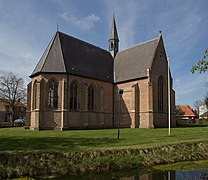 Chaam, Ledevaert kerk
 -
 Voormalig raadhuis, Nieuw Ginneken


References
[edit]- ^ "Gemeentelijke indeling op 1 januari 1997" [Municipal divisions on 1 January 1997]. cbs.nl (in Dutch). CBS. Retrieved 25 April 2014.
- ^ "College van B&W" [Board of mayor and aldermen] (in Dutch). Gemeente Alphen-Chaam. Archived from the original on 26 April 2014. Retrieved 25 April 2014.
- ^ "Kerncijfers wijken en buurten 2020" [Key figures for neighbourhoods 2020]. StatLine (in Dutch). CBS. 24 July 2020. Retrieved 19 September 2020.
- ^ "Postcodetool for 5131AV". Actueel Hoogtebestand Nederland (in Dutch). Het Waterschapshuis. Archived from the original on 21 September 2013. Retrieved 25 April 2014.
- ^ "Bevolkingsontwikkeling; regio per maand" [Population growth; regions per month]. CBS Statline (in Dutch). CBS. 1 January 2021. Retrieved 2 January 2022.
External links
[edit] Media related to Alphen-Chaam at Wikimedia Commons
- Official website
Places adjacent to Alphen-Chaam | ||||||||||||||||
|---|---|---|---|---|---|---|---|---|---|---|---|---|---|---|---|---|
| ||||||||||||||||

| Authority control databases: Geographic |
|---|
This North Brabant location article is a stub. You can help Wikipedia by expanding it. |