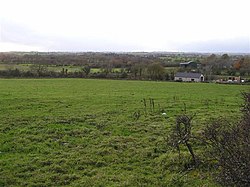
Derrytresk

Derrytresk is a townland outside Coalisland, County Tyrone, Northern Ireland and is close to the shores of Lough Neagh. It is situated in the historic barony of Dungannon Middle and the civil parish of Clonoe and covers an area of 1020 acres.[1] Derrytresk consists of sub-townlands: Derryvarne, Derrykiltena and Derrynahaskila.
The name derives from the Irish: Doire Triosca (Oak wood of the malt grains or grove of the brewer's grains).[2]
Population
The population of the townland declined during the 19th century:[3][4]
| Year | 1841 | 1851 | 1861 | 1871 | 1881 | 1891 |
|---|---|---|---|---|---|---|
| Population | 523 | 493 | 451 | 445 | 383 | 342 |
| Houses | 81 | 76 | 79 | 83 | 76 | 74 |
Sport
Derrytresk Fir An Chnoic (English: Men of the Hill) is the local Gaelic Athletic Association club, and the local camogie team Doiretreasc Cailini an Chonic (English: Girls of the Hill).[citation needed].
See also
Wikimedia Commons has media related to Derrytresk.
References
- ^ "Townlands of County Tyrone". IreAtlas Townland Database. Retrieved 27 December 2012.
- ^ "Derrytresk". Place Names NI. Retrieved 19 March 2013.
- ^ "Census of Ireland 1851". Enhanced Parliamentary Papers on Ireland. Retrieved 27 December 2012.
- ^ "Census of Ireland 1891". Enhanced Parliamentary Papers on Ireland. Retrieved 26 December 2012.
