
Gera
Gera | |
|---|---|
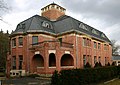
 A view of Gera. | |
 Coat of arms | |
Location of Gera within Thuringia  | |
| Country | Germany |
| State | Thuringia |
| District | Urban district |
| Founded | 995 |
| Government | |
| • Lord mayor | Viola Hahn |
| Area | |
| • Total | 151.93 km2 (58.66 sq mi) |
| Elevation | 205 m (673 ft) |
| Population (2022-12-31)[1] | |
| • Total | 93,634 |
| • Density | 620/km2 (1,600/sq mi) |
| Time zone | UTC+01:00 (CET) |
| • Summer (DST) | UTC+02:00 (CEST) |
| Postal codes | 07545–07557 |
| Dialling codes | 0365, 0336695 |
| Vehicle registration | G |
| Website | www.gera.de |
Gera, the third-largest city in the German state of Thuringia (after Erfurt, the Thuringian capital, and Jena), lies in east Thuringia on the river Weiße Elster, approximately 60 kilometres to the south of the city of Leipzig and 80 kilometres to the east of Erfurt. As of 2010[update] Gera had a population of approximately 99,000.
Geography
Gera lies at a height of between 180 metres (the level of the White Elster river) and 354 m (1,161.42 ft) (when measured at Gera-Falka at the furthest southeastern point). Usually the height above sea level for the city appears as 205 m (672.57 ft) when measured at the market place.
The largest city forest of all the towns of Thuringia, called the City Forest of Gera (Geraer Stadtwald), stands on the western edge of the city. Another forested tract borders on the northwest city boundary. The Zeitzer Forest in Saxony-Anhalt is situated just northeast of the city.
History
The place name Gera originally referred to the area of the Elster river valley where the city now stands. The name most likely[original research?] originated before the European migration period – the Slavic people who first settled the area during the 8th century adopted the name. The first known documentary mention of Gera dates from 995.
In 999 Emperor Otto III assigned the "province" of Gera to the Quedlinburg Abbey. In turn, the church assigned the protectorship of this area in 1209 to the Vogts of Weida (in German: Vögte von Weida) who served as its administrators. The settlement of Gera acquired the rights of a city later in the 13th century. At first, the city grew only slowly. In 1450, it was almost totally destroyed during the Saxon Fratricidal War. Through inheritance over the following centuries, Gera eventually became part of the Reuss principalities.
In 1806 Napoleon set up his Imperial Headquarters at Gera during the War of the Fourth Coalition. From here, on October 12, 1806, the French Emperor sent an arrogant and threatening letter to King Frederick William III of Prussia – a letter that led directily to war and to the crushing defeat of Prussia at the Battle of Jena a few days later.[3]
From 1848 to 1918 Gera served as the capital of the Reuss Junior Line principality. With the industrial revolution in the middle of the 19th century, Gera enjoyed rapid growth through its textile industry. The many city villas built in that era still testify to the former wealth of the city. The Schulenburg mansion designed by the Belgian artist Henry van de Velde is an example. The city became a railway centre where many rail lines converged — highlighting its importance.
-
 Schulenburg villa in Gera, designed by Henry van de Velde

In 1920 the city became part of the newly founded state of Thuringia.
Aerial bombing destroyed some parts of the city in 1945.
The city became a part of the newly created District of Gera (Bezirk Gera) in 1952 within the German Democratic Republic (East Germany). After the German reunification in 1990, Gera became part of the restored state of Thuringia — one of three metropolitan centres (Oberzentren) along with Jena and Erfurt. Since 1998, the Vocational Academy of Gera has found its home here, as well as a private school for allied health sciences. The city hosted the biennial federal horticultural show (Bundesgartenschau) in 2007.
Economy and labour
As of 2009[update] the city economy features the private health sector (SRH Waldklinikum), industrial machinery (Dagro Gera GmbH), communications (DTKS GmbH, Deutsche Telekom AG), security locks (Schloßsicherungen Gera GmbH), optics (POG Präzisionsoptik Gera GmbH), electrical equipment (Electronicon Kondensatoren GmbH), and margarine manufacturing (Othüna). Other companies include a compressor manufacturer (Kompressorenwerk Kaeser), a precision-tool maker (SMK-Präzisionsmechanik), and a subsidiary of the construction company Max Bögl. The e-commerce service provider D+S Europe has a service centre in Gera with several hundred workers, and Rittal, a manufacturer of information technology enclosures, recently[update] moved from Bad Köstritz to Gera.
Some industrial branches operating before 1990 no longer have major importance. Sectors that either no longer exist or have been sharply reduced include those in toolmaking (VEB Wema Union), textiles (VEB Modedruck), textile machinery (VEB Textima), electronic equipment (VEB Elektronik Gera). Other industries that had a presence included VEB Carl Zeiss Jena and a brewery. One important industrial branch had been uranium-ore mining in nearby Ronneburg (SDAG Wismut).
The East Thuringia/Gera metropolitan area as a whole has[when?] a population of 450,000. This makes Gera a regional commercial centre for retail. By 2003, the town had three major retail centres: Gera-Arcaden, Amthor-Passage, and Elster-Forum.
Though the third-largest city in Thuringia, Gera ranks in 7th place in terms of unemployment. The unemployment rate decreased from 15.4% in June 2007 to 14.9% in March 2009.
City organization


The city has 40 different communities, distributed among 12 municipal districts as follows:[4]
Main sights
Sights in Gera include:
- Town Hall (1576, Renaissance)
- Market Square with Simson-fountain
- Osterstein Castle, Gera (largely destroyed 1945)
- City Pharmacy
- Theater (1902)
- Villa Schulenburg, designed by Henry van de Velde
- St. Johannis church (Neo-Gothic)
- St. Salvator church (Baroque with Art Nouveau interior decoration)
- St. Marien church (Late Gothic)
- St. Trinitatis church (Late Gothic)
- Old beer cellars called "Geraer Höhler"
- Zoo Gera (since 1973)
Museums in Gera include:
- City Museum
- Otto Dix House
- Art Galley "Orangerie"
- Museum of Natural History ("Schreiber House", the oldest building in the city), with its adjacent botanical garden, the Botanischer Garten Gera
- Museum for Applied Arts ("Ferber House"), displays collections of Bauhaus ceramics by the artists Otto Lindig und Theodor Bogler; architectural works of Thilo Schoder; and photographs by Aenne Biermann.[5]
In 2007 Gera, together with Ronneburg, is venue of the Bundesgartenschau (the federal horticultural show).
Transport
In the eastern part of Gera lies the airfield Gera-Leumnitz. The nearest airport is Leipzig-Altenburg (approx. 40 km). The Leipzig-Halle airport, with its with many international destinations, is about 90 km north of Gera.
There is a city tram/bus system run by the GVB (Geraer Verkehrsbetrieb).
International relations
Gera is twinned with:
|
|
|
Notable natives
- Johann Heinrich Gottfried Koch, (1705–1775)
- Heinrich Reinhold, (1788-1825), painter and engraver
- Heinrich Gustav Beck, (1857–1933), Minister-president of Saxony 1914–1918
- Otto Lummer (1860–1925), physicist
- Otto Dix (1891–1969), artist
- Rudolf Paul, (1893–1978), President of Thuringia 1945–1947
- Dietrich Peltz (born 1914), Luftwaffe legend
- Nahum Golan (1915–1991), Israeli officer, commander of the Golani Brigade
- Karl Weschke, (1925–2005), painter
- Georg Buschner, (1925–2007), head coach East Germany national football team
- Max Frankel, (born 1930), executive editor, New York Times 1986–1994
- Helga Königsdorf, (born 1938), mathematician and author
- Thilo Sarrazin, (born 1945), German politician
- Wolfgang Tiefensee, (born 1955), politician
- Marlies Göhr, (born 1958), athlete
- Olaf Ludwig, (born 1960), racing cyclist
- Heike Drechsler, (born 1964), Olympic gold medallist long jumper
- Jens Heppner, (born 1964), racing cyclist
References
- Notes
- ^ "Bevölkerung der Gemeinden, erfüllenden Gemeinden und Verwaltungsgemeinschaften in Thüringen Gebietsstand: 31.12.2022" (in German). Thüringer Landesamt für Statistik. June 2023.
- ^ Thüringer Landesamt für Statistik. "Population of Thuringia by district". Retrieved 2007-08-10.
- ^ Christopher Clark, "The Iron Kingdom" (London, 2006), p. 305
- ^ German Wikipedia entry:Liste der Stadtteile von Gera
- ^ Museum for Applied Arts German website, last accessed January 13, 2010. Gera.de (2009-12-23). Retrieved on 2011-06-19.
External links
| Urban districts | |
|---|---|
| Rural districts | |