
Lexington, Tennessee
Lexington, Tennessee | |
|---|---|
 Former post office in Lexington | |
 Flag | |
 Location in Henderson County, Tennessee | |
| Coordinates: 35°39′26″N 88°23′33″W / 35.65722°N 88.39250°W | |
| Country | United States |
| State | Tennessee |
| County | Henderson |
| Government | |
| • Mayor | Jeff Griggs |
| Area | |
• Total | 11.88 sq mi (30.78 km2) |
| • Land | 11.71 sq mi (30.32 km2) |
| • Water | 0.18 sq mi (0.46 km2) |
| Elevation | 522 ft (159.1 m) |
| Population | |
• Total | 7,956 |
| • Density | 679.59/sq mi (262.40/km2) |
| Time zone | UTC-6 (CST) |
| • Summer (DST) | UTC-5 (CDT) |
| ZIP code | 38351 |
| Area code | 731 |
| FIPS code | 47-41980[3] |
| GNIS feature ID | 1291101[4] |
| Website | www |
Lexington is a city in Henderson County, Tennessee, United States. Lexington is midway between Memphis and Nashville, lying 10 miles (16 km) south of Interstate 40, which connects the two cities. The population was 7,956 at the 2020 census.[5] It is the county seat of Henderson County.[6]
History
[edit]Shortly after the 1821 creation of Henderson County, a site near its center was chosen as a county seat, and was named in honor of Lexington, Massachusetts, site of the first battle of the American Revolution.[7] Land Grant holder Samuel Wilson gave the land for the town, retaining a lot on the square where his house was already situated. The square is oriented so the corners point to the cardinal points on the compass.[citation needed] The first county courthouse was built in 1823; Lexington was incorporated in 1824 and by 1830 had a population of 260.
As the lead-up to the Civil War began, Henderson County voted against secession. As the war progressed, both Union and Confederate regiments were recruited in the county. The area in and around Lexington was the site of a skirmish on December 18, 1862. Union Colonel Robert Ingersoll sent his troops to destroy a bridge over Beech Creek to disallow the Confederate army moving into the area. However, Ingersoll's troops did not destroy the bridge, and General Nathan Bedford Forrest's troops headed into Lexington. Forrest's troops overtook the Union soldiers, taking over 140 men, including Colonel Ingersoll, and collected artillery and supplies left behind by Union soldiers who escaped.[8]
In 1918, an African-American man called Berry Noyse who was accused of killing the sheriff was lynched by a mob in the courthouse square and burned in the street.[9]
Geography
[edit]Lexington is in central Henderson County. U.S. Route 412 (Church Street) is the main road through the city, leading east 85 miles (137 km) to Columbia and west 27 miles (43 km) to Jackson. Tennessee State Route 22 (Broad Street) crosses US 412 in the center of Lexington, leading north 9 miles (14 km) to Interstate 40 at Parkers Crossroads and south 20 miles (32 km) to Milledgeville.
According to the United States Census Bureau, Lexington has a total area of 12.4 square miles (32.2 km2), of which 12.2 square miles (31.7 km2) are land and 0.2 square miles (0.4 km2), or 1.34%, are water.[10] The Beech River, an east-flowing tributary of the Tennessee River, runs through the southwestern part of the city.
Lexington is 7 miles (11 km) southwest of Natchez Trace State Park.
Climate
[edit]| Climate data for Lexington, Tennessee, 1991–2020 normals, extremes 1962–present | |||||||||||||
|---|---|---|---|---|---|---|---|---|---|---|---|---|---|
| Month | Jan | Feb | Mar | Apr | May | Jun | Jul | Aug | Sep | Oct | Nov | Dec | Year |
| Record high °F (°C) | 78 (26) |
83 (28) |
87 (31) |
91 (33) |
94 (34) |
104 (40) |
105 (41) |
106 (41) |
101 (38) |
97 (36) |
86 (30) |
78 (26) |
106 (41) |
| Mean maximum °F (°C) | 68.4 (20.2) |
72.6 (22.6) |
79.9 (26.6) |
85.3 (29.6) |
88.9 (31.6) |
93.9 (34.4) |
96.3 (35.7) |
96.7 (35.9) |
93.7 (34.3) |
87.0 (30.6) |
77.9 (25.5) |
69.0 (20.6) |
98.4 (36.9) |
| Mean daily maximum °F (°C) | 47.9 (8.8) |
52.7 (11.5) |
61.7 (16.5) |
71.5 (21.9) |
79.1 (26.2) |
86.4 (30.2) |
89.4 (31.9) |
89.3 (31.8) |
83.8 (28.8) |
73.2 (22.9) |
60.8 (16.0) |
51.1 (10.6) |
70.6 (21.4) |
| Daily mean °F (°C) | 37.6 (3.1) |
42.0 (5.6) |
49.8 (9.9) |
59.0 (15.0) |
67.7 (19.8) |
75.5 (24.2) |
78.8 (26.0) |
78.1 (25.6) |
71.8 (22.1) |
60.2 (15.7) |
48.9 (9.4) |
41.0 (5.0) |
59.2 (15.1) |
| Mean daily minimum °F (°C) | 27.3 (−2.6) |
31.2 (−0.4) |
37.8 (3.2) |
46.4 (8.0) |
56.2 (13.4) |
64.6 (18.1) |
68.2 (20.1) |
67.0 (19.4) |
59.7 (15.4) |
47.2 (8.4) |
37.0 (2.8) |
30.9 (−0.6) |
47.8 (8.8) |
| Mean minimum °F (°C) | 10.5 (−11.9) |
16.7 (−8.5) |
22.4 (−5.3) |
31.7 (−0.2) |
43.0 (6.1) |
54.2 (12.3) |
60.0 (15.6) |
58.3 (14.6) |
45.9 (7.7) |
32.8 (0.4) |
22.6 (−5.2) |
17.2 (−8.2) |
8.8 (−12.9) |
| Record low °F (°C) | −17 (−27) |
1 (−17) |
4 (−16) |
22 (−6) |
32 (0) |
43 (6) |
50 (10) |
47 (8) |
36 (2) |
23 (−5) |
9 (−13) |
−8 (−22) |
−17 (−27) |
| Average precipitation inches (mm) | 4.51 (115) |
4.73 (120) |
4.65 (118) |
5.24 (133) |
6.07 (154) |
4.28 (109) |
4.25 (108) |
3.36 (85) |
3.86 (98) |
4.23 (107) |
4.21 (107) |
5.36 (136) |
54.75 (1,390) |
| Average snowfall inches (cm) | 0.6 (1.5) |
0.3 (0.76) |
0.3 (0.76) |
0.1 (0.25) |
0.0 (0.0) |
0.0 (0.0) |
0.0 (0.0) |
0.0 (0.0) |
0.0 (0.0) |
0.0 (0.0) |
0.1 (0.25) |
0.1 (0.25) |
1.5 (3.77) |
| Average precipitation days (≥ 0.01 in) | 10.1 | 10.3 | 10.5 | 9.3 | 9.8 | 8.1 | 8.1 | 6.4 | 5.9 | 7.6 | 8.5 | 10.5 | 105.1 |
| Average snowy days (≥ 0.1 in) | 0.3 | 0.5 | 0.1 | 0.0 | 0.0 | 0.0 | 0.0 | 0.0 | 0.0 | 0.0 | 0.1 | 0.0 | 1.0 |
| Source 1: NOAA[11] | |||||||||||||
| Source 2: National Weather Service[12] | |||||||||||||
Demographics
[edit]| Census | Pop. | Note | %± |
|---|---|---|---|
| 1880 | 329 | — | |
| 1890 | 715 | 117.3% | |
| 1900 | 1,332 | 86.3% | |
| 1910 | 1,497 | 12.4% | |
| 1920 | 1,792 | 19.7% | |
| 1930 | 1,823 | 1.7% | |
| 1940 | 2,526 | 38.6% | |
| 1950 | 3,566 | 41.2% | |
| 1960 | 3,943 | 10.6% | |
| 1970 | 5,024 | 27.4% | |
| 1980 | 5,934 | 18.1% | |
| 1990 | 5,810 | −2.1% | |
| 2000 | 7,393 | 27.2% | |
| 2010 | 7,652 | 3.5% | |
| 2020 | 7,956 | 4.0% | |
| Sources:[13][14][2] | |||
2020 census
[edit]| Race | Num. | Perc. |
|---|---|---|
| White (non-Hispanic) | 6,085 | 76.48% |
| Black or African American (non-Hispanic) | 1,037 | 13.03% |
| Native American | 12 | 0.15% |
| Asian | 64 | 0.8% |
| Other/Mixed | 450 | 5.66% |
| Hispanic or Latino | 308 | 3.87% |
As of the 2020 United States census, there were 7,956 people, 3,150 households, and 1,915 families residing in the city.
2000 census
[edit]As of the census[3] of 2000, the population density was 640.4 inhabitants per square mile (247.3/km2). There were 3,371 housing units at an average density of 292.0 per square mile (112.7/km2). The racial makeup of the city was 84.50% White, 13.07% African American, 0.14% Native American, 0.26% Asian, 0.03% Pacific Islander, 0.42% from other races, and 1.60% from two or more races. Hispanic or Latino of any race were 1.18% of the population.
There were 3,039 households, out of which 31.2% had children under the age of 18 living with them, 48.8% were married couples living together, 14.5% had a female householder with no husband present, and 33.0% were non-families. 30.4% of all households were made up of individuals, and 12.9% had someone living alone who was 65 years of age or older. The average household size was 2.32 and the average family size was 2.88.
In the city, the population was spread out, with 24.0% under the age of 18, 8.4% from 18 to 24, 28.3% from 25 to 44, 22.3% from 45 to 64, and 17.0% who were 65 years of age or older. The median age was 38 years. For every 100 females, there were 85.7 males. For every 100 females age 18 and over, there were 80.7 males.
The median income for a household in the city was $29,725, and the median income for a family was $41,429. Males had a median income of $31,558 versus $23,212 for females. The per capita income for the city was $18,368. About 10.2% of families and 13.2% of the population were below the poverty line, including 14.9% of those under age 18 and 12.8% of those age 65 or over.
Education
[edit]Public schools in Lexington are operated by the Henderson County School System and the Lexington City School System. There are three schools: Paul G. Caywood Elementary School, Lexington Middle School and Lexington High School. Lexington High School is in the Henderson County School System, while Paul G. Caywood Elementary School, often shortened to "Caywood," and Lexington Middle School, or LMS, are both in the Lexington City School System.
Lexington is home to the Lexington-Henderson County Center of Jackson State Community College, which opened in 1999.[16] The center offers all courses required to earn an associate degree in General Studies, and offers other courses that may be credited towards additional degrees from the main campus in Jackson, Tennessee, or may be transferred to other universities.[16] It has become a popular choice of graduates from Lexington High School, Scotts Hill High School, and other area high schools as a means of continuing their education. The center has become more popular since the introduction of the Tennessee Promise, a state program that provides two years of tuition-free attendance at community colleges and technical colleges in Tennessee.[17]
Newspapers
[edit]- The Lexington Progress, since 1884[18]
- Tennessee Magnet Publications
Arts and culture
[edit]The Lexington-Henderson County Everett Horn Public Library serves the city.[19]
Lexington is home to the very popular Beech Lake. Lexington has one museum, Beech River Heritage Museum, that holds a variety of historical artifacts of Lexington and Henderson County.
Lexington was the setting of a 1994 episode of The X-Files called "E.B.E."[20]
Lexington claims to be the barbecue capital of the country; it supposedly has more barbecue restaurants per capita than any other city in the United States.[21]
Infrastructure
[edit]Henderson County Community Hospital is located in and serves the Lexington area.[22]
Sports
[edit]From 1935 to 1938, Lexington was home to a Minor League Baseball team that played in the Kentucky–Illinois–Tennessee League. Known as the Lexington Giants from 1935 to 1938, the team was renamed the Lexington Bees when it became a farm club of the National League's Boston Bees in 1938.[23]
Notable people
[edit]This article's list of residents may not follow Wikipedia's verifiability policy. (August 2017) |
- Dick Barry (1926–2013) – lawyer and politician
- Buddy Cannon (born 1947) – singer-songwriter and record producer
- Mills Darden (1799–1857) – alleged largest man in history, retired, died, and was buried here[24]
- Doug Gilbert (born 1969) – professional wrestler
- Eddie Gilbert (1961–1995) – professional wrestler
- Loyd Jowers (1926–2000) – restaurateur and alleged conspirator in the assassination of Martin Luther King Jr.
- John McAfee (1945–2021) – founder of McAfee Associates and politician, former resident
- Sam Taylor (1916–1990) – saxophonist
References
[edit]- ^ "ArcGIS REST Services Directory". United States Census Bureau. Retrieved October 15, 2022.
- ^ a b "Census Population API". United States Census Bureau. Retrieved October 15, 2022.
- ^ a b "U.S. Census website". United States Census Bureau. Retrieved January 31, 2008.
- ^ "US Board on Geographic Names". United States Geological Survey. October 25, 2007. Retrieved January 31, 2008.
- ^ "Geographic Identifiers: 2020 Census Summary File 1 (G001): Lexington city, Tennessee". U.S. Census Bureau. Retrieved September 22, 2021.
- ^ "Find a County". National Association of Counties. Archived from the original on May 31, 2011. Retrieved June 7, 2011.
- ^ History of Tennessee from the Earliest Time to the Present. Southern Historical Press. 1886. p. 804. ISBN 978-0-89308-097-6.
- ^ "Rebles rout Yankees in western Tennessee". This Day in History. History.com. Retrieved March 19, 2012.
- ^ Lynching in America: Confronting the Legacy of Racial Terror: Second Edition: Report Summary (PDF). Montgomery, Alabama: Equal Justice Initiative. 2015. p. 13. Archived from the original (PDF) on April 29, 2017. Retrieved October 3, 2018.
When Berry Noyse was accused of killing the sheriff in Lexington, Tennessee, in 1918, an angry mob lynched him in the courthouse square, dragged his body through the town, shot it dozens of times, and burned the body in the middle of the street below hung banners that read, "This is the way we do our bit."
- ^ "Geographic Identifiers: 2010 Census Summary File 1 (G001): Lexington city, Tennessee". American Factfinder. U.S. Census Bureau. Archived from the original on February 13, 2020. Retrieved February 1, 2018.
- ^ "U.S. Climate Normals Quick Access – Station: Lexington, TN". National Oceanic and Atmospheric Administration. Retrieved May 22, 2023.
- ^ "NOAA Online Weather Data – NWS Memphis". National Weather Service. Retrieved May 22, 2023.
- ^ "Census of Population and Housing: Decennial Censuses". United States Census Bureau. Retrieved March 4, 2012.
- ^ "Incorporated Places and Minor Civil Divisions Datasets: Subcounty Resident Population Estimates: April 1, 2010 to July 1, 2012". Population Estimates. U.S. Census Bureau. Archived from the original on June 11, 2013. Retrieved December 11, 2013.
- ^ "Explore Census Data". data.census.gov. Retrieved December 8, 2021.
- ^ a b Jackson, Jackson State Community College is a Tennessee Board of Regents institution All rights reserved 2046 North Parkway |; Tn 38301 |424-3520 |355-Jscc 35.645405 -88.780925. "Jackson State Community College". www.jscc.edu. Retrieved August 2, 2019.
{{cite web}}: CS1 maint: numeric names: authors list (link) - ^ "About". www.tn.gov. Retrieved August 2, 2019.
- ^ "Home". Lexington Progress. Retrieved August 2, 2019.
- ^ "Lexington-Henderson County Everett Horn Public Library". Lexington-Henderson County Everett Horn Public Library. Retrieved March 19, 2012.
- ^ "The X-Files Lexicon: Season 1 - 1x16 E.B.E". www.x-fileslexicon.com.
- ^ Mancour, Terry. "Lexington City Website". Archived from the original on December 26, 2013. Retrieved June 17, 2013.
- ^ "Henderson County Community Hospital". Henderson County Community Hospital. Archived from the original on February 23, 2012. Retrieved March 19, 2012.
- ^ "Lexington, Tennessee Encyclopedia". Baseball-Reference. Sports Reference. Retrieved May 23, 2020.
- ^ Judd, Cameron (February 11, 2021). "Mills Darden Was One Amazingly Big Dude". The Greeneville Sun. Retrieved October 24, 2023.
External links
[edit]Municipalities and communities of Henderson County, Tennessee, United States | ||
|---|---|---|
| Cities | 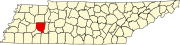 | |
| Towns | ||
| CDPs | ||
| Other communities | ||
| Footnotes | ‡This populated place also has portions in an adjacent county or counties | |
| International | |
|---|---|
| National | |
| Geographic | |