Reusel-De Mierden
Appearance
Reusel-De Mierden | |
|---|---|
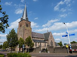
 Church in Lage Mierde | |
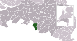
 Location in North Brabant | |
| Coordinates: 51°22′N 5°10′E / 51.367°N 5.167°E | |
| Country | Netherlands |
| Province | North Brabant |
| Established | 1 January 1997[1] |
| Government | |
| • Body | Municipal council |
| • Mayor | Jetty Eugster-van Bergeijk (acting) (CDA) |
| Area | |
| • Total | 78.66 km2 (30.37 sq mi) |
| • Land | 77.88 km2 (30.07 sq mi) |
| • Water | 0.78 km2 (0.30 sq mi) |
| Elevation | 32 m (105 ft) |
| Population (January 2021)[5] | |
| • Total | 13,127 |
| • Density | 169/km2 (440/sq mi) |
| Time zone | UTC+1 (CET) |
| • Summer (DST) | UTC+2 (CEST) |
| Postcode | 5094–5096, 5540–5541 |
| Area code | 013, 0497 |
| Website | www |
Reusel-De Mierden (Dutch pronunciation: [ˈrøːzəl də ˈmiːrdə(n)] ) is a municipality in the southern Netherlands. It is located in the North Brabant province, and has an area of 78.66 km2 (30.37 sq mi). It had a population of 13,127 in 2021.
Population centres
- Hooge Mierde
- Hulsel
- Lage Mierde
- Reusel
Topography
Dutch Topographic map of the municipality of Reusel-De Mierden, June 2015
Genealogy
Reusel-De Mierden erroneously appears in more than a million family trees as a place of origin or residence. This is due to a software error that changed "Holland" to "Reusel-De Mierden, Noord-Brabant, Netherlands."[6]

Notable people
- Steven Mierdman (ca.1510 in Hooge Mierde – 1559) a Dutch printer of Reformation books
- Harry van Gestel (born 1953 in Reusel) a Dutch artist and painter
- Geert van der Weijst (born 1990 in Reusel) a former Dutch cyclist
See also
Gallery
-
Town hall of Reusel, De Mierden
-
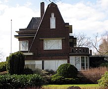
Lage Mierde De Mispelbocht
-
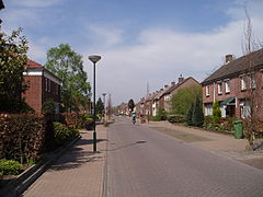
Reusel-Beukenlaan
-
near Moergestel, brook: de Reusel
References
- ^ "Gemeentelijke indeling op 1 januari 1997" [Municipal divisions on 1 January 1997]. cbs.nl (in Dutch). CBS. Retrieved 2 June 2014.
- ^ "College van B&W" [Board of mayor and aldermen] (in Dutch). Gemeente Reusel-De Mierden. Archived from the original on 5 June 2014. Retrieved 2 June 2014.
- ^ "Kerncijfers wijken en buurten 2020" [Key figures for neighbourhoods 2020]. StatLine (in Dutch). CBS. 24 July 2020. Retrieved 19 September 2020.
- ^ "Postcodetool for 5541KB". Actueel Hoogtebestand Nederland (in Dutch). Het Waterschapshuis. Retrieved 2 June 2014.
- ^ "Bevolkingsontwikkeling; regio per maand" [Population growth; regions per month]. CBS Statline (in Dutch). CBS. 1 January 2021. Retrieved 2 January 2022.
- ^ "Was your ancestor born in Reusel-De Mierden? Guess again!". Dutch Genealogy. Retrieved 17 March 2017.
External links
 Media related to Reusel-De Mierden at Wikimedia Commons
- Official website


