
Roselle Park, New Jersey: Difference between revisions
m Replacing Census_Bureau_map_of_Roselle_Park,_New_Jersey.gif with File:Census_Bureau_map_of_Roselle_Park,_New_Jersey.png (by GifTagger because: Replacing GIF by exact PNG duplicate.). |
m add details re borough form of government, with refs; other cleanup using AWB |
||
| Line 17: | Line 17: | ||
|mapsize = 250x200px |
|mapsize = 250x200px |
||
|map_caption = Map of Roselle Park in Union County. Inset: Location of Union County in New Jersey. |
|map_caption = Map of Roselle Park in Union County. Inset: Location of Union County in New Jersey. |
||
|image_map1 =Census_Bureau_map_of_Roselle_Park,_New_Jersey.png |
|image_map1 = Census_Bureau_map_of_Roselle_Park,_New_Jersey.png |
||
|mapsize1 = 250x200px |
|mapsize1 = 250x200px |
||
|map_caption1 = Census Bureau map of Roselle Park, New Jersey |
|map_caption1 = Census Bureau map of Roselle Park, New Jersey |
||
| Line 141: | Line 141: | ||
[[Image:Roselle Park PostOffice.JPG|thumb|Post Office]] |
[[Image:Roselle Park PostOffice.JPG|thumb|Post Office]] |
||
[[Image:Roselle Park MunicipalComplex.JPG|thumb|Municipal Complex]] |
[[Image:Roselle Park MunicipalComplex.JPG|thumb|Municipal Complex]] |
||
The Borough of Roselle Park is governed under the [[Borough (New Jersey)|Borough]] form of New Jersey municipal government. The governing body consists of a Mayor and a Borough Council comprising six council members, with all positions elected on a partisan basis as part of the November general election.<ref name=DataBook>''2012 New Jersey Legislative District Data Book'', [[Rutgers University]] [[Edward J. Bloustein School of Planning and Public Policy]], March 2013, p. 90.</ref> The Borough form of government used by Roselle Park, the most common system used in the state, is a "[[weak mayor]] / strong council" government in which council members act as the legislative body with the mayor presiding at meetings and voting only in the event of a tie. The mayor makes committee and liaison assignments for council members, and most appointments are made by the mayor with the advice and consent of the council.<ref>Cerra, Michael F. [http://www.njslom.org/magart0307_p14.html "Forms of Government: Everything You've Always Wanted to Know, But Were Afraid to Ask"], [[New Jersey State League of Municipalities]]. Accessed |
The Borough of Roselle Park is governed under the [[Borough (New Jersey)|Borough]] form of New Jersey municipal government. The governing body consists of a Mayor and a Borough Council comprising six council members, with all positions elected on a partisan basis as part of the November general election.<ref name=DataBook>''2012 New Jersey Legislative District Data Book'', [[Rutgers University]] [[Edward J. Bloustein School of Planning and Public Policy]], March 2013, p. 90.</ref> The Borough form of government used by Roselle Park, the most common system used in the state, is a "[[weak mayor]] / strong council" government in which council members act as the legislative body with the mayor presiding at meetings and voting only in the event of a tie. The mayor can [[veto]] ordinances subject to an [[veto override|override]] by a two-thirds majority vote of the council. The mayor makes committee and liaison assignments for council members, and most appointments are made by the mayor with the advice and consent of the council.<ref>Cerra, Michael F. [http://www.njslom.org/magart0307_p14.html "Forms of Government: Everything You've Always Wanted to Know, But Were Afraid to Ask"], [[New Jersey State League of Municipalities]]. Accessed November 30, 2014.</ref><ref>[http://cgs.rutgers.edu/sites/ce-drupal02.rutgers.edu.cgs/files/documents/resource_center/rc_munichart_formsgovt_2011.pdf#page=6 "Forms of Municipal Government in New Jersey"], p. 6. [[Rutgers University]] Center for Government Studies. Accessed December 1, 2014.</ref> Roselle Park is divided into five election districts, referred to as [[Ward (country subdivision)|wards]], with one Councilperson elected from each ward, and one Councilperson elected [[at-large]], with two council seats up for election each year, and is one of only two boroughs statewide that use wards (the other is [[Roselle, New Jersey|Roselle]]. The Mayor is elected to a four-year term and Councilpersons are elected to three-year terms.<ref name=Council/><ref>[http://clerkshq.com/Content/RosellePark-nj/books/code/roselleparkc02.htm Borough Code: CHAPTER II ADMINISTRATION], Borough of Roselle Park. Accessed October 24, 2014. "The Governing Body shall consist of the Mayor and six (6) Council members, one (1) member elected at large, five (5) members elected by ward in the Borough, all of whom shall be elected and take office in the manner provided by law. The term of office shall commence January 1 next following their election. ... Roselle Park is governed under the Borough form of government outlined in Chapter 60 of Title 40A of the New Jersey Statutes with the exception of the election of Council members."</ref> |
||
{{As of|2013}}, the [[Mayor]] |
{{As of|2013}}, the [[Mayor]] of Roselle Park is Joseph Accardi ([[Republican Party (United States)|R]], term ends December 31, 2014).<ref>[http://www.rosellepark.net/content/3041/3137/3211.aspx Mayor Joseph Accardi], Borough of Roselle Park. Accessed October 28, 2014.</ref> Members of the Borough Council are Andrew Casais (Ward 1; R, 2014), Carl A. Hokanson (At Large; [[Democratic Party (United States)|D]], 2014), M. Gino Elmarassy (Ward 4; D, 2016), Ryan Kelly (Ward 3; R, 2016), Charlene Komar Storey (Ward 2; D, 2015) and Michael Yakubov (Ward 5; R, 2015).<ref name=Council>[http://www.rosellepark.net/content/3041/3137/default.aspx Mayor & Council], Borough of Roselle Park. Accessed October 28, 2014.</ref><ref>[http://ucnj.org/government/county-clerk/elected-officials-roselle-park-winfield County Clerk Elections: Roselle Park - Winfield], [[Union County, New Jersey]]. Accessed October 28, 2014.</ref><ref name=Union2010>[http://ucnj.org/nov2result/Election%20Result_dtl.htm#cont43 Union County General Election November 2, 2010], [[Union County, New Jersey]] Clerk. Accessed May 22, 2013.</ref><ref name=Union2011>[http://ucnj.org/OfficialGeneralElectionResults2011/Official%20General%202011_dtl.htm#cont32 Union County 2011 General, November 8, 2011], [[Union County, New Jersey]] Clerk. Accessed May 22, 2013.</ref><ref name=Union2012>[http://ucnj.org/general-election/Election%20Result_dtl.htm#cont33 Union Co 2012 General/School Election November 6, 2012], [[Union County, New Jersey]] Clerk. Accessed May 22, 2013.</ref> |
||
===Federal, state and county representation=== |
===Federal, state and county representation=== |
||
| Line 219: | Line 219: | ||
* [http://www.rpsd.org/ Roselle Park School District] |
* [http://www.rpsd.org/ Roselle Park School District] |
||
* {{NJReportCard|39|4550|0|Roselle Park School District}} |
* {{NJReportCard|39|4550|0|Roselle Park School District}} |
||
* [http://nces.ed.gov/ccd/schoolsearch/school_list.asp?Search=1&DistrictID=3414310 Data for the Roselle Park School District], [[National Center for Education Statistics]] |
* [http://nces.ed.gov/ccd/schoolsearch/school_list.asp?Search=1&DistrictID=3414310 School Data for the Roselle Park School District], [[National Center for Education Statistics]] |
||
* [http://www.colfaxmanor.org/ Colfax Manor] |
* [http://www.colfaxmanor.org/ Colfax Manor] |
||
* [http://www.roselleparkumc.org/ Community United Methodist Church] |
* [http://www.roselleparkumc.org/ Community United Methodist Church] |
||
Revision as of 19:57, 1 December 2014
Roselle Park, New Jersey | |
|---|---|
| Borough of Roselle Park | |
 Roselle Park Welcome Sign | |
 Map of Roselle Park in Union County. Inset: Location of Union County in New Jersey. | |
 Census Bureau map of Roselle Park, New Jersey | |
| Country | United States |
| State | New Jersey |
| County | Union |
| Incorporated | March 22, 1901 |
| Government | |
| • Type | Borough |
| • Mayor | Joseph Accardi (term ends December 31, 2014)[1] |
| • Clerk | Doreen Cali[2] |
| Area | |
| • Total | 1.232 sq mi (3.191 km2) |
| • Land | 1.232 sq mi (3.191 km2) |
| • Water | 0.000 sq mi (0.000 km2) 0.00% |
| • Rank | 481st of 566 in state 19th of 21 in county[4] |
| Elevation | 79 ft (24 m) |
| Population | |
| • Total | 13,297 |
| • Estimate (2013)[10] | 13,525 |
| • Rank | 188th of 566 in state 14th of 21 in county[11] |
| • Density | 10,792.7/sq mi (4,167.1/km2) |
| • Rank | 30th of 566 in state 1st of 21 in county[11] |
| Time zone | UTC-5 (Eastern (EST)) |
| • Summer (DST) | UTC-4 (Eastern (EDT)) |
| ZIP code | |
| Area code(s) | 908 Exchanges: 241, 245, 259, 298, 620[14] |
| FIPS code | 3403964650[4][15][16] |
| GNIS feature ID | 0885380[4][17] |
| Website | www |

Roselle Park is a borough in Union County, New Jersey, United States. As of the 2010 United States Census, the borough's population was 13,297,[7][8][9] reflecting an increase of 16 (+0.1%) from the 13,281 counted in the 2000 Census, which had in turn increased by 476 (+3.7%) from the 12,805 counted in the 1990 Census.[19]
Roselle Park was incorporated as a borough by an Act of the New Jersey Legislature on March 22, 1901, from portions of Union Township.[20][21] The separation occurred due to a number of grievances based on a lack of sufficient public services, including; lack of a modern sewage system, poor schools, neglected roads, and minimal public safety measures.[22]
Geography
Roselle Park is located at 40°39′55″N 74°16′00″W / 40.665265°N 74.266706°W (40.665265,-74.266706). According to the United States Census Bureau, the borough had a total area of 1.232 square miles (3.191 km2), all of which was land.[4][18]
The borough is bordered to the northeast by Union Township, to the northwest by Kenilworth, to the east by Elizabeth, to the south by Roselle and to the west by Cranford.
Demographics
| Census | Pop. | Note | %± |
|---|---|---|---|
| 1910 | 3,138 | — | |
| 1920 | 5,438 | 73.3% | |
| 1930 | 8,969 | 64.9% | |
| 1940 | 9,661 | 7.7% | |
| 1950 | 11,537 | 19.4% | |
| 1960 | 12,546 | 8.7% | |
| 1970 | 14,277 | 13.8% | |
| 1980 | 13,377 | −6.3% | |
| 1990 | 12,805 | −4.3% | |
| 2000 | 13,281 | 3.7% | |
| 2010 | 13,297 | 0.1% | |
| 2013 (est.) | 13,525 | [10][23] | 1.7% |
| Population sources: 1910-1920[24] 1910-1930[25] 1930-1990[26] 2000[27][28] 2010[6][7][8][9] | |||
Census 2010
The Census Bureau's 2006-2010 American Community Survey showed that (in 2010 inflation-adjusted dollars) median household income was $61,923 (with a margin of error of +/- $5,415) and the median family income was $75,017 (+/- $8,553). Males had a median income of $50,502 (+/- $5,243) versus $41,193 (+/- $5,261) for females. The per capita income for the borough was $30,566 (+/- $2,011). About 3.6% of families and 5.1% of the population were below the poverty line, including 9.0% of those under age 18 and 1.9% of those age 65 or over.[29]
Census 2000
As of the 2000 United States Census[15] there were 13,281 people, 5,137 households, and 3,416 families residing in the borough. The population density was 10,855.7 people per square mile (4,203.1/km2). There were 5,258 housing units at an average density of 4,297.8 per square mile (1,664.0/km2). The racial makeup of the borough was 80.87% White, 2.42% African American, 0.11% Native American, 9.14% Asian, 0.02% Pacific Islander, 4.89% from other races, and 2.55% from two or more races. Hispanic or Latino of any race were 16.34% of the population.[27][28]
There were 5,137 households out of which 30.1% had children under the age of 18 living with them, 50.8% were married couples living together, 11.2% had a female householder with no husband present, and 33.5% were non-families. 28.2% of all households were made up of individuals and 8.5% had someone living alone who was 65 years of age or older. The average household size was 2.58 and the average family size was 3.22.[27][28]
In the borough the population was spread out with 22.2% under the age of 18, 8.8% from 18 to 24, 33.5% from 25 to 44, 22.8% from 45 to 64, and 12.6% who were 65 years of age or older. The median age was 37 years. For every 100 females there were 95.0 males. For every 100 females age 18 and over, there were 91.4 males.[27][28]
The median income for a household in the borough was $53,717, and the median income for a family was $63,403. Males had a median income of $42,623 versus $33,105 for females. The per capita income for the borough was $24,101. About 3.4% of families and 4.3% of the population were below the poverty line, including 6.3% of those under age 18 and 1.6% of those age 65 or over.[27][28]
History
The first known settlement within what is now the Borough was built by Samuel Williams in 1700. Galloping Hill Road was continually used by revolutionary war scouts, delivering messages to and from General George Washington and Governor Livingston. Galloping Hill Road also believed to be the route traveled by the British columns en route to the Battle of Connecticut Farms, battling the New Jersey militia the entire way. Son of American general William Crane, was bayoneted and killed by the British near what is now Galloping Hill Road and Colonial Road.[30]
Elizabethtown & Somerville Railroad passed through in 1839, as the first railroad in Northern New Jersey. The first store in the world to be lit by electric light was Stone's Store on Westfield Avenue, lit by Thomas Edison's carbon filament prototype. In 1907, the first poured concrete building in the world, now the Robert Gordon School, was built in Roselle Park using Edison's revolutionary process. Roselle Park was home to the factory and lab of Marconi Wireless Telegraph, and became the site of the first regularly broadcast radio station, "WDY".[30]
Government
Local government


The Borough of Roselle Park is governed under the Borough form of New Jersey municipal government. The governing body consists of a Mayor and a Borough Council comprising six council members, with all positions elected on a partisan basis as part of the November general election.[3] The Borough form of government used by Roselle Park, the most common system used in the state, is a "weak mayor / strong council" government in which council members act as the legislative body with the mayor presiding at meetings and voting only in the event of a tie. The mayor can veto ordinances subject to an override by a two-thirds majority vote of the council. The mayor makes committee and liaison assignments for council members, and most appointments are made by the mayor with the advice and consent of the council.[31][32] Roselle Park is divided into five election districts, referred to as wards, with one Councilperson elected from each ward, and one Councilperson elected at-large, with two council seats up for election each year, and is one of only two boroughs statewide that use wards (the other is Roselle. The Mayor is elected to a four-year term and Councilpersons are elected to three-year terms.[33][34]
As of 2013[update], the Mayor of Roselle Park is Joseph Accardi (R, term ends December 31, 2014).[35] Members of the Borough Council are Andrew Casais (Ward 1; R, 2014), Carl A. Hokanson (At Large; D, 2014), M. Gino Elmarassy (Ward 4; D, 2016), Ryan Kelly (Ward 3; R, 2016), Charlene Komar Storey (Ward 2; D, 2015) and Michael Yakubov (Ward 5; R, 2015).[33][36][37][38][39]
Federal, state and county representation
Roselle Park is located in the 10th Congressional District[40] and is part of New Jersey's 21st state legislative district.[8][41][42] Prior to the 2010 Census, Roselle Park had been part of the 7th Congressional District, a change made by the New Jersey Redistricting Commission that took effect in January 2013, based on the results of the November 2012 general elections.[43]
For the 118th United States Congress, New Jersey's 10th congressional district is represented by Donald Payne Jr. (D, Newark).[44][45] New Jersey is represented in the United States Senate by Democrats Cory Booker (Newark, term ends 2027)[46] and Bob Menendez (Englewood Cliffs, term ends 2025).[47][48]
For the 2024-2025 session, the 21st legislative district of the New Jersey Legislature is represented in the State Senate by Jon Bramnick (R, Westfield) and in the General Assembly by Michele Matsikoudis (R, New Providence) and Nancy Munoz (R, Summit).[49] Template:NJ Governor
Template:NJ Union County Freeholders
Politics
As of March 23, 2011, there were a total of 7,525 registered voters in Roselle Park, of which 2,325 (30.9% vs. 41.8% countywide) were registered as Democrats, 1,279 (17.0% vs. 15.3%) were registered as Republicans and 3,918 (52.1% vs. 42.9%) were registered as Unaffiliated. There were 3 voters registered to other parties.[50] Among the borough's 2010 Census population, 56.6% (vs. 53.3% in Union County) were registered to vote, including 72.9% of those ages 18 and over (vs. 70.6% countywide).[50][51]
In the 2012 presidential election, Democrat Barack Obama received 3,064 votes here (59.9% vs. 66.0% countywide), ahead of Republican Mitt Romney with 1,931 votes (37.7% vs. 32.3%) and other candidates with 75 votes (1.5% vs. 0.8%), among the 5,117 ballots cast by the borough's 7,841 registered voters, for a turnout of 65.3% (vs. 68.8% in Union County).[52][53] In the 2008 presidential election, Democrat Barack Obama received 3,083 votes here (53.5% vs. 63.1% countywide), ahead of Republican John McCain with 2,530 votes (43.9% vs. 35.2%) and other candidates with 96 votes (1.7% vs. 0.9%), among the 5,759 ballots cast by the borough's 7,953 registered voters, for a turnout of 72.4% (vs. 74.7% in Union County).[54] In the 2004 presidential election, Democrat John Kerry received 2,753 votes here (50.6% vs. 58.3% countywide), ahead of Republican George W. Bush with 2,619 votes (48.1% vs. 40.3%) and other candidates with 43 votes (0.8% vs. 0.7%), among the 5,443 ballots cast by the borough's 7,773 registered voters, for a turnout of 70.0% (vs. 72.3% in the whole county).[55]
In the 2009 gubernatorial election, Republican Chris Christie received 1,700 votes here (49.2% vs. 41.7% countywide), ahead of Democrat Jon Corzine with 1,404 votes (40.6% vs. 50.6%), Independent Chris Daggett with 249 votes (7.2% vs. 5.9%) and other candidates with 41 votes (1.2% vs. 0.8%), among the 3,455 ballots cast by the borough's 7,711 registered voters, yielding a 44.8% turnout (vs. 46.5% in the county).[56]
Education
The Roselle Park School District serves public school students in pre-Kindergarten through twelfth grade. As of the 2011-12 school year, the district's five schools had an enrollment of 1,995 students and 173.5 classroom teachers (on an FTE basis), for a student–teacher ratio of 11.50:1.[57] Schools in the district (with 2011-12 enrollment data from the National Center for Education Statistics[58]) are Aldene Elementary School[59] (PreK-5; 301 students), Robert Gordon Elementary School[60] (K-5; 269), Sherman Elementary School[61] (K-5; 322), Roselle Park Middle School[62] (6-8; 489) and Roselle Park High School[63] (9-12; 614).[64][65]
Library
The Roselle Park Veterans Memorial Library was renamed in the early 1980s in honor of the veterans of Roselle Park who made the building possible. The library currently has more than 10,000 square feet (930 m2) of space used to store traditional books in addition to computers, books on tape, videos, CD's, Meeting Room, information center, pictures, and music tapes. The library offers a photocopier and fax service and allows its patrons to reserve and renew materials over the phone and online. The library offers free Wi-Fi access.[66]
The Veterans Memorial Library offers an array of events for an older audience such as charity projects, book discussions, and a Book of the Month Club.[67] The Veterans Memorial Library also caters to children and young teens with many different events. Events such as Homework Help, No Bullying Resources, and Crazy For Crafts, among other things, are offered free of charge and children are encouraged to participate.[68]
Transportation
Roads and highways
As of 2010[update], the borough had a total of 27.48 miles (44.22 km) of roadways, of which 23.20 miles (37.34 km) were maintained by the municipality, 2.32 miles (3.73 km) by Union County and 1.96 miles (3.15 km) by the New Jersey Department of Transportation.[69]
Route 28 passes through Roselle Park, and the Garden State Parkway skirts the western boundary of the borough.
Public transportation
New Jersey Transit Bus Operations provides bus service on the 58 with service from Elizabeth to Kenilworth, on the 94 to Newark and on the 113 to the Port Authority Bus Terminal in New York City.[70]
Newark Liberty International Airport is approximately 10 minutes away. Linden Airport, a general aviation facility, is in nearby Linden.
Railroads
Roselle Park has a rich railroading heritage. A steam locomotive adorns the Borough seal, and the town is very welcoming to railroad enthusiasts.
The Elizabethtown & Somerville railway began laying rails through what would become Roselle Park in 1839. It eventually became the Central Railroad of New Jersey between Jersey City, New Jersey and Scranton, Pennsylvania. Throughout the years as traffic grew, the line would grow to four main tracks, and also offered trains of Reading Company and the Baltimore and Ohio Railroad.[30]
Roselle Park and Roselle formerly shared a rail station on the CNJ mainline. Passenger service east of Bayonne ended on April 30, 1967. Shuttle service between Bayonne and Cranford continued on until August 1978 but eventually ended, resulting in the closure of the old station on Chestnut Street.[71] The line continued to see operation as an access route to the NJTransit/NJDOT railroad shops at Elizabethport until the mid-1980s. It is currently out of service and unused, as the Conrail Elizabeth Industrial Track.
Competition would come as the Lehigh Coal and Navigation Company realized that railroading was a more efficient mode of transportation for their coal than a canal system. They formed the Lehigh Valley Railroad, and began building Eastward in 1853. By 1872, they had reached Roselle, and formed the subsidiary Newark and Roselle Railway in order to continue building East to the Hudson River. April 1, 1976 the Lehigh Valley Railroad became part of the Consolidated Rail Corporation, also known as Conrail and became known as their "Lehigh Line". On June 1, 2001, Conrail was purchased and split between Norfolk Southern (60%) and CSX (40%), and became "shared assets". Conrail continues to operate the Lehigh Line. In addition to New Jersey Transit the line sees anywhere from 35-45 freights per day from four railroads; Conrail, Norfolk Southern, CSX, and tri-weekly Canadian Pacific (formerly Delaware and Hudson Railway). The track is Norfolk Southern's primary access route into and out of the New York City metropolitan area, and is also part of CSX's primary North-South corridor.
The Roselle Park train station offers New Jersey Transit commuter rail service as part of their Raritan Valley Line service. This was a result of the Aldene Connection in Roselle Park between tracks of the Central Railroad and Lehigh Valley Railroad, which opened April 30, 1967, allowing passengers to travel directly to Newark Penn Station and New York Penn Station, rarther than traveling to the Central Railroad of New Jersey Terminal in Jersey City and taking ferries into Manhattan.[72] Currently the station is located at milepost 16.0 on the Conrail Lehigh Line, on the corner of Chestnut Street and West Lincoln Avenue; the same location of the original Lehigh Valley station. In addition to local travel, from here, one take the train to Newark, New Jersey or New York City and connect to various modes of travel to nearly anywhere in the U.S. and Canada on Amtrak.
The borough was once served by the Rahway Valley Railroad. The line was exempted in 1991 by then Rahway Valley Railroad controller Delaware Otsego Corporation, and was given to the County of Union.[73] It has remained dormant since. However, beginning in 2004, the Union County Board of Chosen Freeholders began taking steps to reactivate the routes. They named the Morristown and Erie Railway as designated operator and funded the beginning of right-of-way renewal, though the project has faced opposition from residents who believe that the line would be used to transport trash.[74] Currently the Morristown and Erie Railway is awaiting further funding to complete the work. As of 2011, the project has halted and no further steps are being taken to reactivate the railway.[citation needed]
Notable people
People who were born in, residents of, or otherwise closely associated with Roselle Park include:
- Michael Ausiello (born 1972), TV Guide writer.[75]
- Rick Barry (born 1944), NBA All-Pro Forward. Ranked #2 on the Sports Illustrated list of The 50 Greatest New Jersey Sports Figures.[76]
- Mike Daly, producer / songwriter / multi-instrumentalist.[77]
- Gregory Gillespie (1936–2000), artist.[78]
- Keith Loneker (born 1971), former professional football player and actor.[79]
- Alan Pasqua (born 1952), pianist, composer and jazz musician.[80]
References
- ^ 2013 New Jersey Mayors Directory, New Jersey Department of Community Affairs. Accessed May 13, 2013.
- ^ Borough Clerk, Borough of Roselle Park. Accessed March 13, 2011.
- ^ a b 2012 New Jersey Legislative District Data Book, Rutgers University Edward J. Bloustein School of Planning and Public Policy, March 2013, p. 90.
- ^ a b c d e f Gazetteer of New Jersey Places, United States Census Bureau. Accessed June 14, 2013.
- ^ U.S. Geological Survey Geographic Names Information System: Borough of Roselle Park, Geographic Names Information System. Accessed March 11, 2013.
- ^ a b 2010 Census Populations: Union County, Asbury Park Press. Accessed December 10, 2011.
- ^ a b c DP-1 - Profile of General Population and Housing Characteristics: 2010 for Roselle Park borough, Union County, New Jersey, United States Census Bureau. Accessed May 22, 2013.
- ^ a b c d Municipalities Grouped by 2011-2020 Legislative Districts, New Jersey Department of State, p. 9. Accessed January 6, 2013.
- ^ a b c Profile of General Demographic Characteristics: 2010 for Roselle Park borough, New Jersey Department of Labor and Workforce Development. Accessed May 22, 2013.
- ^ a b PEPANNRES - Annual Estimates of the Resident Population: April 1, 2010 to July 1, 2013 - 2013 Population Estimates for New Jersey municipalities, United States Census Bureau. Accessed June 16, 2014.
- ^ a b GCT-PH1 Population, Housing Units, Area, and Density: 2010 - State -- County Subdivision from the 2010 Census Summary File 1 for New Jersey, United States Census Bureau. Accessed May 22, 2013.
- ^ Look Up a ZIP Code for Roselle Park, NJ, United States Postal Service. Accessed December 10, 2011.
- ^ Zip Codes, State of New Jersey. Accessed August 29, 2013.
- ^ Area Code Lookup - NPA NXX for Roselle Park, NJ, Area-Codes.com. Accessed August 29, 2013.
- ^ a b American FactFinder, United States Census Bureau. Accessed September 4, 2014.
- ^ A Cure for the Common Codes: New Jersey, Missouri Census Data Center. Accessed October 29, 2012.
- ^ US Board on Geographic Names, United States Geological Survey. Accessed September 4, 2014.
- ^ a b US Gazetteer files: 2010, 2000, and 1990, United States Census Bureau. Accessed September 4, 2014.
- ^ Table 7. Population for the Counties and Municipalities in New Jersey: 1990, 2000 and 2010, New Jersey Department of Labor and Workforce Development, February 2011. Accessed May 20, 2013.
- ^ Snyder, John P. The Story of New Jersey's Civil Boundaries: 1606-1968, Bureau of Geology and Topography; Trenton, New Jersey; 1969. p. 240. Accessed October 23, 2012.
- ^ Borough of Roselle Park, Union County, New Jersey. Accessed January 2, 2008.
- ^ The History of Roselle Park, New Jersey, Borough of Roselle Park. Accessed January 2, 2008.
- ^ Census Estimates for New Jersey April 1, 2010 to July 1, 2013, United States Census Bureau. Accessed September 23, 2014.
- ^ Compendium of censuses 1726-1905: together with the tabulated returns of 1905, New Jersey Department of State, 1906. Accessed May 21, 2013.
- ^ Fifteenth Census of the United States : 1930 - Population Volume I, United States Census Bureau, p. 719. Accessed December 10, 2011.
- ^ New Jersey Resident Population by Municipality: 1930 - 1990, Workforce New Jersey Public Information Network, backed up by the Internet Archive as of May 2, 2009. Accessed December 10, 2011.
- ^ a b c d e Census 2000 Profiles of Demographic / Social / Economic / Housing Characteristics for Roselle Park borough, New Jersey, United States Census Bureau. Accessed May 22, 2013.
- ^ a b c d e DP-1: Profile of General Demographic Characteristics: 2000 - Census 2000 Summary File 1 (SF 1) 100-Percent Data for Roselle Park borough, Union County, New Jersey, United States Census Bureau. Accessed May 22, 2013.
- ^ DP03: Selected Economic Characteristics from the 2006-2010 American Community Survey 5-Year Estimates for Roselle Park borough, Union County, New Jersey, United States Census Bureau. Accessed May 22, 2013.
- ^ a b c Roselle Park - History. Accessed December 10, 2011.
- ^ Cerra, Michael F. "Forms of Government: Everything You've Always Wanted to Know, But Were Afraid to Ask", New Jersey State League of Municipalities. Accessed November 30, 2014.
- ^ "Forms of Municipal Government in New Jersey", p. 6. Rutgers University Center for Government Studies. Accessed December 1, 2014.
- ^ a b Mayor & Council, Borough of Roselle Park. Accessed October 28, 2014.
- ^ Borough Code: CHAPTER II ADMINISTRATION, Borough of Roselle Park. Accessed October 24, 2014. "The Governing Body shall consist of the Mayor and six (6) Council members, one (1) member elected at large, five (5) members elected by ward in the Borough, all of whom shall be elected and take office in the manner provided by law. The term of office shall commence January 1 next following their election. ... Roselle Park is governed under the Borough form of government outlined in Chapter 60 of Title 40A of the New Jersey Statutes with the exception of the election of Council members."
- ^ Mayor Joseph Accardi, Borough of Roselle Park. Accessed October 28, 2014.
- ^ County Clerk Elections: Roselle Park - Winfield, Union County, New Jersey. Accessed October 28, 2014.
- ^ Union County General Election November 2, 2010, Union County, New Jersey Clerk. Accessed May 22, 2013.
- ^ Union County 2011 General, November 8, 2011, Union County, New Jersey Clerk. Accessed May 22, 2013.
- ^ Union Co 2012 General/School Election November 6, 2012, Union County, New Jersey Clerk. Accessed May 22, 2013.
- ^ Plan Components Report, New Jersey Redistricting Commission, December 23, 2011. Accessed January 6, 2013.
- ^ 2012 New Jersey Citizen's Guide to Government, p. 64, New Jersey League of Women Voters. Accessed January 6, 2013.
- ^ Districts by Number for 2011-2020, New Jersey Legislature. Accessed January 6, 2013.
- ^ 2011 New Jersey Citizen's Guide to Government, p. 64, New Jersey League of Women Voters. Accessed January 6, 2013.
- ^ Directory of Representatives: New Jersey, United States House of Representatives. Accessed January 3, 2019.
- ^ Biography, Congressman Donald M. Payne Jr. Accessed January 3, 2019. "U.S. Representative Donald M. Payne, Jr. is a lifelong resident of Newark, New Jersey."
- ^ U.S. Sen. Cory Booker cruises past Republican challenger Rik Mehta in New Jersey, PhillyVoice. Accessed April 30, 2021. "He now owns a home and lives in Newark's Central Ward community."
- ^ Biography of Bob Menendez, United States Senate, January 26, 2015. "Menendez, who started his political career in Union City, moved in September from Paramus to one of Harrison's new apartment buildings near the town's PATH station.."
- ^ Home, sweet home: Bob Menendez back in Hudson County. nj.com. Accessed April 30, 2021. "Booker, Cory A. - (D - NJ) Class II; Menendez, Robert - (D - NJ) Class I"
- ^ Legislative Roster for District 21, New Jersey Legislature. Accessed January 18, 2024.
- ^ a b Voter Registration Summary - Union, New Jersey Department of State Division of Elections, March 23, 2011. Accessed May 22, 2013.
- ^ GCT-P7: Selected Age Groups: 2010 - State -- County Subdivision; 2010 Census Summary File 1 for New Jersey, United States Census Bureau. Accessed May 22, 2013.
- ^ Presidential November 6, 2012 General Election Results - Union County, New Jersey Department of State Division of Elections, March 15, 2013. Accessed May 22, 2013.
- ^ Number of Registered Voters and Ballots Cast November 6, 2012 General Election Results - Union County, New Jersey Department of State Division of Elections, March 15, 2013. Accessed May 22, 2013.
- ^ 2008 Presidential General Election Results: Union County, New Jersey Department of State Division of Elections, December 23, 2008. Accessed May 22, 2013.
- ^ 2004 Presidential Election: Union County, New Jersey Department of State Division of Elections, December 13, 2004. Accessed May 22, 2013.
- ^ 2009 Governor: Union County, New Jersey Department of State Division of Elections, December 31, 2009. Accessed May 22, 2013.
- ^ District information for Roselle Park School District, National Center for Education Statistics. Accessed October 28, 2014.
- ^ School Data for the Roselle Park School District, National Center for Education Statistics. Accessed October 28, 2014.
- ^ Aldene Elementary School, Roselle Park School District. Accessed September 3, 2013.
- ^ Robert Gordon Elementary School, Roselle Park School District. Accessed September 3, 2013.
- ^ Sherman Elementary School, Roselle Park School District. Accessed September 3, 2013.
- ^ Roselle Park Middle School, Roselle Park School District. Accessed September 3, 2013.
- ^ Roselle Park High School, Roselle Park School District. Accessed May 22, 2013.
- ^ Schools, Roselle Park School District. Accessed September 3, 2013.
- ^ New Jersey School Directory for the Roselle Park School District, New Jersey Department of Education. Accessed May 22, 2013.
- ^ Veterans Memorial Library, Union County, New Jersey. Accessed March 18, 2012.
- ^ Current Events & Programs, Roselle Park Veterans Memorial Library. Accessed September 3, 2013.
- ^ Children & Teens, Roselle Park Veterans Memorial Library. Accessed September 3, 2013.
- ^ Union County Mileage by Municipality and Jurisdiction, New Jersey Department of Transportation, May 2010. Accessed July 18, 2014.
- ^ Union County Bus / Rail Connections, New Jersey Transit, backed up by the Internet Archive as of May 22, 2009. Accessed December 10, 2011.
- ^ Frassinelli, Mike. "NJ Transit opens Bayonne 8th Street Station, extending Hudson-Bergen Light Rail service", The Star-Ledger, January 31, 2011. Accessed September 3, 2013. "Bayonne Mayor Mark Smith was in high school when that part of downtown Bayonne waved goodbye to train service nearly 33 years ago. 'The last time a train rolled out of here was in August of 1978, headed for Cranford and points west,' he said. For 113 years previously, Smith said, Bayonne had been part of the reliable Jersey Central railroad system that linked the state."
- ^ Burks, Edward C. "HIGHER FARES SET FOR ALDENE LINK; Rail Connection in Jersey Will Benefit 12,000", The New York Times, April 30, 1967. Accessed September 3, 2013. "The long-delayed $25-million Aldene plan for the 12,000 daily commuters on the Central Railroad of New Jersey goes into effect today with increases in most monthly commutation fares."
- ^ Maxton, Donald A. The Rahway Valley Railroad, p. 7. Arcadia Publishing, 2002. ISBN 9780738510088. Accessed September 3, 2013.
- ^ Staff. "Garbage Trains", Daily Record (Morristown), May 16, 2005. Accessed September 3, 2013. "But the chief executive officer of the Morristown & Erie Railway Co., the Morristown company contracted by Union County to rebuild the Rahway Valley Railroad and the Staten Island Railroad lines, and a representative of a group that supports the Lackawanna Cutoff, said the opponent group's assertion was wrong."
- ^ Gillette, Felix. "The Doctor Is In: TV addicts cut off by the W.G.A. turn to 'TV Guide' guy", The New York Observer, November 15, 2007. Accessed November 28, 2007. "Indeed, it was TV that helped make life bearable for the young Mr. Ausiello. He grew up in the small town of Roselle Park, New Jersey, a half hour outside of Elizabeth."
- ^ The 50 Greatest New Jersey Sports Figures, Sports Illustrated, December 27, 1999
- ^ Louie, Tim. "North Jersey Notes Updates", The Aquarian Weekly, November 5, 2008. Accessed October 28, 2014. "And finally, my bud and legendary photographer, Mark Weiss, handled all of the photography in a new book that was recently released called Time Flies When You’re In A Coma: The Wisdom Of The Metal Gods by author and Roselle Park, NJ, native Mike Daly."
- ^ "GREGORY GILLESPIE, 64, UNFLINCHING PAINTER", The Plain Dealer, April 30, 2000. Accessed August 18, 2007. "Gillespie was born in 1936 in Roselle Park, N.J., and raised in a strict Roman Catholic household."
- ^ Keith Loneker, database Football. Accessed August 18, 2007.
- ^ Stewart, Zan. "VALLEY WEEKEND; He's Taking His Grand Piano and Going Out on a Limb; In a break from soundtracks, synthesizers and written music, Alan Pasqua will play a spontaneous, acoustic solo show Sunday in Glendale.", Los Angeles Times, April 18, 1996. Accessed February 25, 2008. "Pasqua's been fond of acoustic pianos since he started playing at age 7 in Roselle Park, N.J."
External links
- Borough website
- Roselle Park School District
- School Performance Reports for the Roselle Park School District, New Jersey Department of Education
- School Data for the Roselle Park School District, National Center for Education Statistics
- Colfax Manor
- Community United Methodist Church
Municipalities and communities of Union County, New Jersey, United States | ||
|---|---|---|
| Cities | 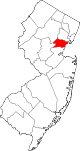 | |
| Boroughs | ||
| Town | ||
| Townships | ||
| CDPs | ||
| Other communities | ||