
Kearney County, Nebraska: Difference between revisions
No edit summary |
|||
| Line 1: | Line 1: | ||
{{Infobox U.S. County| |
{{Infobox U.S. County| |
||
county = |
county = Kearney County| |
||
state = Nebraska | |
state = Nebraska | |
||
founded = ''Information needed''| |
founded = ''Information needed''| |
||
| Line 11: | Line 11: | ||
pop = 6882 | |
pop = 6882 | |
||
density_km2 =5| |
density_km2 =5| |
||
web = www. |
web = www.kearneycounty.ne.gov/ | |
||
|}} |
|}} |
||
''' |
'''Kearney County''' is a [[county]] located in the [[U.S. state]] of [[Nebraska]]. As of [[2000]], the population is 6,882. Its [[county seat]] is [[Minden, Nebraska|Minden]][[Geographic references|<sup>6</sup>]]. |
||
In the Nebraska [[license plate]] system, |
In the Nebraska [[license plate]] system, Kearney County is represented by the prefix 52 (it had the fifty-second-largest number of vehicles registered in the county when the license plate system was established in [[1922]]). |
||
==Geography== |
==Geography== |
||
| Line 37: | Line 37: | ||
==Demographics== |
==Demographics== |
||
{| border="1" cellspacing="0" cellpadding="5" style="float:right; margin-left:10px;" |
{| border="1" cellspacing="0" cellpadding="5" style="float:right; margin-left:10px;" |
||
|align=center colspan=2| ''' |
|align=center colspan=2| '''Kearney County<br>Population by decade''' |
||
|- |
|- |
||
| align=center | |
| align=center | |
||
| Line 76: | Line 76: | ||
*[[Wilcox, Nebraska|Wilcox]] |
*[[Wilcox, Nebraska|Wilcox]] |
||
{{ |
{{Kearney County, Nebraska}} |
||
{{Nebraska}} |
{{Nebraska}} |
||
{{coord|40.51|-98.95|display=title|type:adm2_region:US-NE_source:UScensus1990}} |
{{coord|40.51|-98.95|display=title|type:adm2_region:US-NE_source:UScensus1990}} |
||
[[Category: |
[[Category:Kearney County, Nebraska| ]] |
||
[[Category:Nebraska counties]] |
[[Category:Nebraska counties]] |
||
[[ar:مقاطعة كيارني، نبراسكا]] |
[[ar:مقاطعة كيارني، نبراسكا]] |
||
[[de: |
[[de:Kearney County]] |
||
[[bpy:কেরনেয় কাউন্টি, নেব্রাস্কা]] |
[[bpy:কেরনেয় কাউন্টি, নেব্রাস্কা]] |
||
[[lmo: |
[[lmo:Kearney County, Nebraska]] |
||
[[nl: |
[[nl:Kearney County]] |
||
[[no: |
[[no:Kearney County]] |
||
[[nds: |
[[nds:Kearney County]] |
||
[[zh:卡尼縣 (內布拉斯加州)]] |
[[zh:卡尼縣 (內布拉斯加州)]] |
||
Revision as of 20:37, 24 December 2007
Kearney County | |
|---|---|
 Location within the U.S. state of Nebraska | |
 Nebraska's location within the U.S. | |
| Coordinates: 40°31′N 98°57′W / 40.51°N 98.95°W | |
| Country | |
| State | |
| Founded | Information needed |
| Seat | Minden |
| Area | |
| • Total | 516 sq mi (1,340 km2) |
| • Land | 516 sq mi (1,340 km2) |
| • Water | 0 sq mi (0 km2) 0.02% |
| Population (2000) | |
| • Total | 6,882 |
| • Density | 10/sq mi (5/km2) |
| Website | www |
Kearney County is a county located in the U.S. state of Nebraska. As of 2000, the population is 6,882. Its county seat is Minden6.
In the Nebraska license plate system, Kearney County is represented by the prefix 52 (it had the fifty-second-largest number of vehicles registered in the county when the license plate system was established in 1922).
Geography
According to the U.S. Census Bureau, the county has a total area of 1,337 km² (516 sq mi). 1,337 km² (516 sq mi) of it is land and 0 km² (0 sq mi) of it (0.02%) is water.
Adjacent Counties
- Buffalo County, Nebraska - north
- Adams County, Nebraska - east
- Webster County, Nebraska - southeast
- Franklin County, Nebraska - south
- Harlan County, Nebraska - southwest corner
- Phelps County, Nebraska - west
Demographics
| Kearney County Population by decade | |
|
1860 - 474 | |
As of the census2 of 2000, there were 6,882 people, 2,643 households, and 1,902 families residing in the county. The population density was 5/km² (13/sq mi). There were 2,846 housing units at an average density of 2/km² (6/sq mi). The racial makeup of the county was 97.82% White, 0.16% Black or African American, 0.20% Native American, 0.23% Asian, 0.01% Pacific Islander, 0.99% from other races, and 0.58% from two or more races. 2.34% of the population were Hispanic or Latino of any race.
There were 2,643 households out of which 34.40% had children under the age of 18 living with them, 62.90% were married couples living together, 6.40% had a female householder with no husband present, and 28.00% were non-families. 24.30% of all households were made up of individuals and 10.90% had someone living alone who was 65 years of age or older. The average household size was 2.50 and the average family size was 2.98.
In the county the population was spread out with 26.80% under the age of 18, 6.40% from 18 to 24, 27.50% from 25 to 44, 22.70% from 45 to 64, and 16.70% who were 65 years of age or older. The median age was 39 years. For every 100 females there were 98.40 males. For every 100 females age 18 and over, there were 94.60 males.
The median income for a household in the county was $39,247, and the median income for a family was $44,877. Males had a median income of $29,987 versus $20,081 for females. The per capita income for the county was $18,118. About 5.50% of families and 8.50% of the population were below the poverty line, including 10.00% of those under age 18 and 6.80% of those age 65 or over.
City and villages
Municipalities and communities of Kearney County, Nebraska, United States | ||
|---|---|---|
| City | 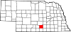 | |
| Villages | ||
| Townships | ||
| Unincorporated communities | ||
| Ghost town | ||