Bloom Township, Fairfield County, Ohio: Difference between revisions
Ken Gallager (talk | contribs) simpler |
Rescuing 1 sources and tagging 0 as dead. #IABot (v1.2.6) |
||
| Line 74: | Line 74: | ||
|area_code = |
|area_code = |
||
|blank_name = [[Federal Information Processing Standard|FIPS code]] |
|blank_name = [[Federal Information Processing Standard|FIPS code]] |
||
|blank_info = 39-06950<ref name="GR2">{{cite web|url=http://factfinder2.census.gov|publisher=[[United States Census Bureau]]|accessdate=2008-01-31|title=American FactFinder}}</ref> |
|blank_info = 39-06950<ref name="GR2">{{cite web|url=http://factfinder2.census.gov |publisher=[[United States Census Bureau]] |accessdate=2008-01-31 |title=American FactFinder |deadurl=yes |archiveurl=https://web.archive.org/web/20130911234518/http://factfinder2.census.gov |archivedate=2013-09-11 |df= }}</ref> |
||
|blank1_name = [[Geographic Names Information System|GNIS]] feature ID |
|blank1_name = [[Geographic Names Information System|GNIS]] feature ID |
||
|blank1_info = 1086074<ref name="GR3" /> |
|blank1_info = 1086074<ref name="GR3" /> |
||
Revision as of 09:53, 4 November 2016
Bloom Township, Fairfield County, Ohio | |
|---|---|
 Rock Mill Covered Bridge | |
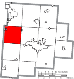
 Location of Bloom Township in Fairfield County | |
| Country | United States |
| State | Ohio |
| County | Fairfield |
| Area | |
| • Total | 37.2 sq mi (96.4 km2) |
| • Land | 37.1 sq mi (96.2 km2) |
| • Water | 0.08 sq mi (0.2 km2) |
| Elevation | 1,096 ft (334 m) |
| Population (2010) | |
| • Total | 8,466 |
| • Density | 228/sq mi (88.0/km2) |
| Time zone | UTC-5 (Eastern (EST)) |
| • Summer (DST) | UTC-4 (EDT) |
| FIPS code | 39-06950[2] |
| GNIS feature ID | 1086074[1] |
| Website | www |
Bloom Township is one of the thirteen townships of Fairfield County, Ohio, United States. As of the 2010 census the population was 8,466,[3] up from 6,374 at the 2000 census. 7,028 people lived in the unincorporated portions of the township in 2010.[4]
Geography
Located in the western part of the county, it borders the following townships:
- Violet Township - north
- Liberty Township - northeast corner
- Greenfield Township - east
- Hocking Township - southeast corner
- Amanda Township - south
- Walnut Township, Pickaway County - southwest corner
- Madison Township, Pickaway County - west
- Madison Township, Franklin County - northwest
Portions of three villages are located in Bloom Township: a part of Carroll in the northeast, and most of Lithopolis plus a small portion of Canal Winchester in the northwest.
Name and history
Statewide, other Bloom Townships are located in Morgan, Scioto, Seneca, and Wood counties.
Bloom Township was established in 1805.[5] It is the location of the Old Maid's Orchard Mound, a burial mound constructed by the Adena culture; it lies within Chestnut Ridge Metro Park,[6] in the northern part of the township.[7]
Government
The township is governed by a three-member board of trustees, who are elected in November of odd-numbered years to a four-year term beginning on the following January 1. Two are elected in the year after the presidential election and one is elected in the year before it. There is also an elected township fiscal officer,[8] who serves a four-year term beginning on April 1 of the year after the election, which is held in November of the year before the presidential election. Vacancies in the fiscal officership or on the board of trustees are filled by the remaining trustees.
References
- ^ a b "US Board on Geographic Names". United States Geological Survey. 2007-10-25. Retrieved 2008-01-31.
- ^ "American FactFinder". United States Census Bureau. Archived from the original on 2013-09-11. Retrieved 2008-01-31.
{{cite web}}: Unknown parameter|deadurl=ignored (|url-status=suggested) (help) - ^ "Geographic Identifiers: 2010 Census Summary File 1 (G001), Bloom township, Fairfield County, Ohio". American FactFinder. U.S. Census Bureau. Retrieved June 28, 2016.
- ^ "Geographic Identifiers: 2010 Census Summary File 1 (G001), Remainder of Bloom township, Bloom township, Fairfield County, Ohio". American FactFinder. U.S. Census Bureau. Retrieved June 27, 2016.
- ^ Miller, Charles Christian (1912). History of Fairfield County, Ohio, and representative citizens. Chicago, Richmond-Arnold Pub. Co. p. 132.
- ^ Metro Parks Fact Sheets: The Adena Way of Life, Metro Parks, 2004. Accessed 2010-10-30.
- ^ DeLorme. Ohio Atlas & Gazetteer. 7th ed. Yarmouth: DeLorme, 2004, 68. ISBN 978-0-89933-281-9.
- ^ §503.24, §505.01, and §507.01 of the Ohio Revised Code. Accessed 4/30/2009.

