Sophie-Charlotte-Platz (Berlin U-Bahn)
Appearance
 Station platform | |||||||||||
| General information | |||||||||||
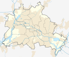
| Location | Kaiserdamm/Suarezstraße Charlottenburg, Berlin Germany | ||||||||||
| Coordinates | 52°30′39″N 13°17′48″E / 52.51083°N 13.29667°E | ||||||||||
| Owned by | Berliner Verkehrsbetriebe | ||||||||||
| Operated by | Berliner Verkehrsbetriebe | ||||||||||
| Platforms | 2 side platforms | ||||||||||
| Tracks | 2 | ||||||||||
| Connections | |||||||||||
| Construction | |||||||||||
| Structure type | Underground | ||||||||||
| Bicycle facilities | No | ||||||||||
| Accessible | Yes (westbound only) | ||||||||||
| Other information | |||||||||||
| Fare zone | |||||||||||
| Services | |||||||||||
| |||||||||||
 | |||||||||||

Sophie-Charlotte-Platz is a Berlin U-Bahn station on line U2.
History
The station was built by A. Grenander and opened in 1908. In 1935, the windows on top were removed. In 1938, the entrances of the station had to be moved. In 1988, twenty-six large paintings were attached to the walls showing the history of the subway before the First World War.[2]
It was heavily damaged by air raids on 15 February 1944.
References
- ^ "Alle Zielorte". Verkehrsverbund Berlin-Brandenburg. 1 January 2021. p. 64. Retrieved 5 May 2021.
- ^ J. Meyer-Kronthaler: Berlins U-Bahnhöfe. be.bra Verlag (1996)


