Mathilakam
Mathilakam | |
|---|---|
Village | |
| Coordinates: 10°17′32″N 76°09′55″E / 10.2922744°N 76.1653315°E | |
| Country | |
| State | Kerala |
| District | Thrissur |
| Languages | |
| • Official | Malayalam, English |
| Time zone | UTC+5:30 (IST) |
| PIN | 680685 |
| Vehicle registration | 47 |
| Coastline | 0 kilometres (0 mi) |
| Nearest city | Kodungallur, Irinjalakkuda |
| Avg. summer temperature | 35 °C (95 °F) |
| Avg. winter temperature | 20 °C (68 °F) |
| Part of a series on |
| Jainism |
|---|
 |

Mathilakam is a village in Kodungallur taluk, Thrissur district in Kerala, south India. It is located around 5 miles north of Kodungallur on National Highway 66.
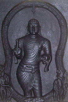
Mathilakam is generally identified by historians as the location of the medieval Jain vihara, the Thirukkunavay Temple.[1] The shrine was also known as the Kunavayir Kottam, the monastery of Ilamko Atikal (the author of the Tamil epic Chilappathikaram).[1] It seems that by 15th century, the Thirukkunavay Temple was transformed into a Shiva temple. The temple was probably destroyed completely in late medieval period.[1]
At Madilakam...the excavation revealed a 1.7 metres thick occupation overlying the natural sand. Several massive walls of laterite were exposed, one of which measuring 1.12 metres in breadth was traced to a length of 12 metres. The structure-complex seems to belong to the temple. The occurrence in the lower-half of the deposit of the sturdy red ware, the Chinese Celadon Ware and Chola coins would date the site to the 10th-11th centuries AD. The coins bear the familiar Chola characteristics, viz., the standing king on one side and the seated goddess on the other. Besides, hundreds of small earthen lamps were picked up from this site which might indicate that the venue was probably that of the temple, though this needs further confirmation. Another important find in this area was the outer wall of Madilakam, on the south extremity of the village. The wall was found to be running in the east-west direction and probably extended up to the backwaters on the east.
Indian Archaeology 1969-70: A Review (Archaeological Survey of India)
Excavations were conducted by Archaeological Survey of India at Mathilakam in 1967.[2] In the excavations conducted in 1970, an 8th-9th century AD foundation, structurally different from the standard Hindu temple foundations in shape, was revealed.[1]
Kerala State Archaeological Department conducted a field survey at Mathilakam in 2014.[2] In 2020, the Archaeological Survey of India granted licence to a non-profit trust to undertake excavations in Mathilakam.[3][4] The first phase of the excavations was started with the opening of six trial trenches.[3][4] The trust completed the trial excavations at Mathilakam in 2020.[4]
References
- ^ a b c d Narayanan, M. G. S. (2013) [1972]. Perumals of Kerala: Brahmin Oligarchy and Ritual Monarchy. Thrissur (Kerala): CosmoBooks. pp. 340–42.
- ^ a b "Archaeological Team Begins Field Survey at Mathilakam". The Hindu. 2014. ISSN 0971-751X.
{{cite news}}: CS1 maint: url-status (link) - ^ a b Saju, M. T. (2020). "Rediscovering Ancient Tamilakam: Pattanam and Mathilakam Excavations to Begin Soon". The Times of India.
{{cite web}}: CS1 maint: url-status (link) - ^ a b c Harigovind, Abhinaya (2020). "Ancient Ring Well Unearthed at Thevarkadu". The Hindu. ISSN 0971-751X.
{{cite news}}: CS1 maint: url-status (link)


