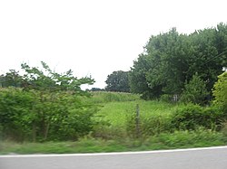
Aberdeen Mound
Appearance
Aberdeen Mound | |
 Seen from a distance to the east | |
| Location | Western side of State Route 41, north of Aberdeen[2] |
|---|---|
| Nearest city | Aberdeen, Ohio |
| Coordinates | 38°40′4″N 83°45′47″W / 38.66778°N 83.76306°W |
| NRHP reference No. | 74001401[1] |
| Added to NRHP | July 15, 1974 |
The Aberdeen Mound is a historic site in Aberdeen, Ohio, United States. Located north of the village off State Route 41,[2] it was listed on the National Register of Historic Places in 1974.
Historic uses
- Graves/Burials
References
- ^ "National Register Information System". National Register of Historic Places. National Park Service. March 13, 2009.
- ^ a b Koleszar, Stephen C. An Archaeological Survey of Southwestern Ohio. Columbus: Ohio Historical Society, 1970, 20.
See also


