Choo-Ha
Tools
Actions
General
Print/export
Print/export
In other projects
Appearance
From Wikipedia, the free encyclopedia
This is an old revision of this page, as edited by Wasquewhat (talk | contribs) at 07:26, 1 October 2017 (+ref). The present address (URL) is a permanent link to this revision, which may differ significantly from the current revision.
| Choo-Ha | |
|---|---|
 | |
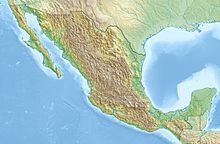
| Location | Quintana Roo, Mexico |
| Coordinates | 20°26′8″N 87°46′6″W / 20.43556°N 87.76833°W / 20.43556; -87.76833 |
| Geology | Limestone |
| Entrances | 1 cenotes |
Choo-Ha, Tamcach-Ha and Multun-Ha are a series of small cenotes close to the Mayan site of Cobá in central Yucatán Peninsula. All of them are accessible to the public for swimming.[1][2] Choo-Ha has a small entrance of only about 3 by 4 meters.
Fauna
Small fish and turtles live in this cenote. Visitors must take a shower to clean from sun oil before swimming.
References

Chetumal (capital) | |||||||||||
| Municipalities (seats) |
| ||||||||||
| Places of interest |
| ||||||||||
Retrieved from "https://en.wikipedia.org/w/index.php?title=Choo-Ha&oldid=803227453"


