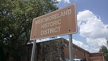
Westmoreland, Houston
Appearance


The Westmoreland Historic District is a neighborhood in Neartown Houston, Texas. It is west of Spur 527, between Westheimer Road and West Alabama Street.[1][2]
The community was created in 1902 and was home to many prominent families in Greater Houston.[1] The historic district's boundaries were established on July 23, 1997.[3] As of 2009 many of the original houses are still standing.[1]
Notable residents
- Governor of Texas James V. Allred - He lived in the James V. Allred House, 400 Emerson[4]
Education
Residents are zoned to the Houston Independent School District.[3] Residents are zoned to Macgregor Elementary School,[5] Gregory-Lincoln Education Center (for middle school),[6] and Lamar High School.[7]
References
- ^ a b c Gonzales, J. R. "When a celebrity dies: Looking at a few front pages." Houston Chronicle. July 10, 2009. Retrieved on May 26, 2010.
- ^ Map of Neartown. Neartown Association. Retrieved October 20, 2008.
- ^ a b "Westmoreland Historic District." City of Houston. Retrieved on May 26, 2010.
- ^ Martin, Betty L. and Martha Peterson. "Westmoreland to host home tour." Houston Chronicle. Thursday October 31, 2002. ThisWeek 2. Retrieved on May 26, 2010.
- ^ "Macgregor Elementary Attendance Zone." Houston Independent School District. Retrieved on May 26, 2010.
- ^ "Gregory-Lincoln Middle Attendance Zone." Houston Independent School District. Retrieved on May 26, 2010.
- ^ "Lamar High School Attendance Zone." Houston Independent School District. Retrieved on May 26, 2010.
External links
Wikimedia Commons has media related to Westmoreland, Houston.
- Westmoreland Historic District Collection: An Inventory of Records at the Houston Metropolitan Research Center, Houston Public Library
- Westmoreland Preservation Alliance, a 501(c)(3) organization dedicated to the history and preservation of the Westmoreland neighborhood.

