R368 road (Ireland)

Coordinates: 53°43′40″N 8°09′56″W / 53.727889°N 8.165616°W / 53.727889; -8.165616
From Wikipedia, the free encyclopedia

This is an old revision of this page, as edited by Dl2000 (talk | contribs) at 00:41, 27 January 2020 (image->file; en-IE). The present address (URL) is a permanent link to this revision, which may differ significantly from the current revision.

R368 road shield}}
R368 road
Bóthar R368
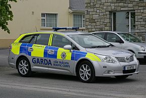
Garda Traffic Corps Silver Toyota Avenis D4D Estate 11D8750 - Flickr - D464-Darren Hall.jpg
Garda car on the R368
Route information
Length34.6 km (21.5 mi)
Major junctions
From N4 Carrick-on-Shannon
Major intersections R370 Cortober
Crosses Killukin River
R369 Elphin
Crosses Owneur River
N5 Strokestown
To N61 Four Mile House
Location
CountryIreland
Highway system

The R368 road is a regional road in Ireland, located in County Roscommon.[1][2][3]

References

53°43′40″N 8°09′56″W / 53.727889°N 8.165616°W / 53.727889; -8.165616