R571 road (Ireland)
| R571 road | |
|---|---|
| Bóthar R571 | |
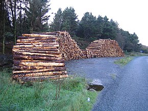
 Cut timber by the R571 at Foildarrig. | |
| Route information | |
| Length | 35.4 km (22.0 mi) |
| Major junctions | |
| From | |
| Crosses Kealincha River Passes through Ardgroom Enters County Kerry Crosses Drumminboy River and Glantrasna River Crosses Cloonnee River | |
| To | |
| Location | |
| Country | Ireland |
| Highway system | |
The R571 road is a regional road in Ireland, located in County Cork and County Kerry.[1][2][3][4]
References
- ^ http://www.sabre-roads.org.uk/wiki/index.php?title=R204
- ^ http://www.irishstatutebook.ie/eli/2012/si/54/made/en/print
- ^ http://www.leitrimobserver.ie/news/local-news/194499/A-milestone-in-history-.html
- ^ https://www.irishtimes.com/life-and-style/travel/go-walk-rabhach-s-glen-beara-peninsula-co-kerry-1.2111484

