Dande
Appearance
Dande | |
|---|---|
Municipality, commune and town | |
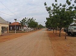
 Road through Barra do Dande | |
| Coordinates: 8°28′22″S 13°22′23″E / 8.47278°S 13.37306°E | |
| Country | |
| Province | Bengo Province |
| Area | |
| • Total | 2,786 sq mi (7,216 km2) |
| Population (2014 Census)[1] | |
| • Total | 222,528 |
| • Density | 80/sq mi (31/km2) |
| Time zone | UTC+1 (WAT) |
Dande, with its capital at Barra do Dande, is a municipality in Bengo Province in Angola.[2]
Subdivisions
Dande comprises seven communes as follows.
References
- ^ "Resultados Definitivos Recenseamento Geral da População e Habitação – 2014 Província do Bengo" (PDF). Instituto Nacional de Estatística, República de Angola. Retrieved 3 May 2020.
- ^ "City councils of Angola". Statoids. Retrieved April 6, 2009.

