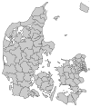
Langeland Municipality

Langeland municipality is a municipality (Danish, kommune) in Region of Southern Denmark in Denmark consisting of the islands of Langeland, Strynø, and Siø which has several inhabitants. It covers an area of 291.07 km² and has a total population of 12,491 (1 January 2020). It is connected to Funen via a bridge, Langelandsbroen. There is a ferry route, Spodsbjerg-Tårs, with regular traffic between Spodsbjerg, population 215 (2014), and Tårs in Lolland Municipality. As of 1 January 2018, Tonni Hansen is the mayor of Langeland Municipality. He is the only member of the Socialist People's Party to hold the top political post in a municipality in 2018. Previously, Lejre Municipality had a mayor, Mette Touborg, from this party, but she left her position 28 September 2016 for a new job.
The municipality was created as a result of the municipal reform of 2007, through a merger of the municipalities of Rudkøbing, Sydlangeland and Tranekær. However, the new municipality nonetheless agreed to enter into a "municipal cooperation agreement" with Svendborg Municipality.[1]
Locations
| Rudkøbing | 4,500 |
| Tullebølle | 780 |
| Humble | 640 |
| Bagenkop | 460 |
| Lohals | 440 |
| Lindelse | 310 |
| Snøde | 290 |
| Spodsbjerg | 200 |
Politics
Langeland's municipal council consists of 15 members, elected every four years. The municipal council has six political committees.[2]
Municipal council
Below are the municipal councils elected since the Municipal Reform of 2007.
| Election | Party | Total seats |
Turnout | Elected mayor | |||||||||
|---|---|---|---|---|---|---|---|---|---|---|---|---|---|
| A | B | C | F | O | Borgerlisten Langeland | V | Ø | ||||||
| 2005 | 5 | 2 | 1 | 12 | 5 | 25 | 76.0% | Knud Gether (T) | |||||
| 2009 | 3 | 1 | 1 | 1 | 1 | 5 | 3 | 15 | 72.4% | Bjarne Nielsen (V) | |||
| 2013 | 2 | 2 | 4 | 5 | 2 | 77.3% | |||||||
| 2017 | 3 | 1 | 6 | 1 | 4 | 75.2% | Tonni Hansen (F) | ||||||
| Data from Kmdvalg.dk 2005, 2009, 2013 and 2017 | |||||||||||||
External links
- Official website (in Danish)
References
- Municipal statistics: NetBorger Kommunefakta, delivered from KMD aka Kommunedata (Municipal Data)
- Municipal mergers and neighbors: Eniro new municipalities map
- Specific
55°00′00″N 10°50′00″E / 55°N 10.8333°E

