R608 road (Ireland)
| R608 road | |
|---|---|
| Bóthar R608 | |
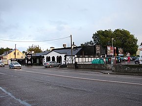
 R608 passing the White Horse, Ballincollig | |
| Route information | |
| Length | 12.2 km (7.6 mi) |
| Major junctions | |
| From | |
Crosses Curraheen River | |
| To | |
| Location | |
| Country | Ireland |
| Highway system | |
The R608 road is a regional road in Ireland, located in County Cork and Cork City. It passed through the N22 3 times and goes from Cork City Centre to the large town of Ballincollig via Wilton and Bishopstown. [1][2][3]
References
- ^ "R608". Roader's Digest: The SABRE Wiki. SABRE. Retrieved 2016-03-09.
- ^ "S.I. No. 54/2012 - Roads Act 1993 (Classification of Regional Roads) Order 2012". irishstatutebook.ie. Retrieved 2016-03-09.
- ^ http://www.opticalexpress.ie/store/cork-model-farm-road.html
51°53′21″N 8°29′56″W / 51.889097°N 8.498772°W

