R187 road (Ireland)
| R187 road | |
|---|---|
| Bóthar R187 | |
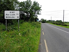
 R187 at Annaghervy | |
| Route information | |
| Length | 7.0 km (4.3 mi) |
| Major junctions | |
| From | Inishammon (Border) |
| To | |
| Location | |
| Country | Ireland |
| Highway system | |

The R187 road is a regional road in Ireland, located in County Monaghan. It runs from the N54 to the border, where it continues as the B36 road to Rosslea, County Fermanagh.[1][2]
References
- ^ "R187". Roader's Digest: The SABRE Wiki. SABRE. Retrieved 9 March 2016.[self-published source]
- ^ "S.I. No. 54/2012 - Roads Act 1993 (Classification of Regional Roads) Order 2012". irishstatutebook.ie. Retrieved 9 March 2016.

