Balingoan
Balingoan | |
|---|---|
| Municipality of Balingoan | |
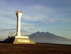
 Balingoan pier with Camiguin in the background | |
 Map of Misamis Oriental with Balingoan highlighted | |
Location within the Philippines | |
| Coordinates: 9°00′N 124°51′E / 9°N 124.85°E | |
| Country | |
| Region | Northern Mindanao |
| Province | Misamis Oriental |
| District | 1st District |
| Founded | March 1, 1952 |
| Barangays | 9 (see Barangays) |
| Government | |
| • Type | Sangguniang Bayan |
| • mayor of Balingoan[*] | Pedro Panulaya |
| • Electorate | 8,819 voters (2022) |
| Area | |
| • Total | 57.80 km2 (22.32 sq mi) |
| Population (2020 census)[3] | |
| • Total | 11,020 |
| • Density | 190/km2 (490/sq mi) |
| Time zone | UTC+8 (PST) |
| ZIP code | 9011 |
| PSGC | |
| IDD : area code | +63 (0)88 |
| Income class | 5th municipal income class |
| Revenue (₱) | ₱ 87.08 million (2020) |
| Native languages | Cebuano Binukid Subanon Tagalog |
| Website | www |
Balingoan, officially the Municipality of Balingoan, is a 5th class municipality in the province of Misamis Oriental, Philippines. According to the 2020 census, it has a population of 11,020 people.[3]
Barangays
Balingoan is politically subdivided into 9 barangays.
- Baukbauk (Poblacion)
- Dahilig
- Kabangasan
- Kabulakan
- Kauswagan
- Lapinig (Poblacion)
- Mantangale
- Mapua
- San Alonzo
History
Formerly part of Talisayan, it gained independence on March 1, 1952. According to the local legend,it derived its name from the word "baling ni juan" (John's Fishing Net), which later on became simply as "Balingoan".
Demographics
|
| ||||||||||||||||||||||||||||||||||||
| Source: Philippine Statistics Authority[4][5][6][7] | |||||||||||||||||||||||||||||||||||||
In the 2020 census, the population of Balingoan, Misamis Oriental, was 11,020 people,[3] with a density of 190 inhabitants per square kilometre or 490 inhabitants per square mile.
Economy
Produce: Copra, fish, sea shells, fruits, vegetables, animal meat, and dairy products.
Culture
Feast day: May 29. Patron Saint: San Alonzo de Rodriguez
Transportation
Port of Balingoan is the main port for travellers going to the provincial island of Camiguin. From Cagayan de Oro to Balingoan is about 86 kilometres (53 mi) and would take around 1.5 hours bus ride as well as from Butuan.
Education
There are 9 Public Elementary Schools situated in Barangays San Alonzo, Bauk-bauk, Lapinig, Mantangale, Mapua, Kauswagan, Kabulakan, Dahilig and Kabangasan.
References
- ^ Municipality of Balingoan | (DILG)
- ^ "Province: Misamis Oriental". PSGC Interactive. Quezon City, Philippines: Philippine Statistics Authority. Retrieved 12 November 2016.
- ^ a b c Census of Population (2020). "Region X (Northern Mindanao)". Total Population by Province, City, Municipality and Barangay. Philippine Statistics Authority. Retrieved 8 July 2021.
- ^ Census of Population (2015). "Region X (Northern Mindanao)". Total Population by Province, City, Municipality and Barangay. Philippine Statistics Authority. Retrieved 20 June 2016.
- ^ Census of Population and Housing (2010). "Region X (Northern Mindanao)" (PDF). Total Population by Province, City, Municipality and Barangay. National Statistics Office. Retrieved 29 June 2016.
- ^ Censuses of Population (1903–2007). "Region X (Northern Mindanao)". Table 1. Population Enumerated in Various Censuses by Province/Highly Urbanized City: 1903 to 2007. National Statistics Office.
- ^ "Province of Misamis Oriental". Municipality Population Data. Local Water Utilities Administration Research Division. Retrieved 17 December 2016.
External links
- Municipality of Balingoan
- Philippine Standard Geographic Code listing for Balingoan - National Statistical Coordination Board
- Local Governance Performance Management System

