Dverberg (municipality)
Dverberg Municipality
Dverberg herred | |
|---|---|
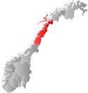
 Nordland within Norway | |
 Dverberg within Nordland | |
| Coordinates: 69°06′23″N 15°57′50″E / 69.1064°N 15.9640°E | |
| Country | Norway |
| County | Nordland |
| District | Vesterålen |
| Established | 1 Jan 1838 |
| • Created as | Formannskapsdistrikt |
| Disestablished | 1 Jan 1964 |
| • Succeeded by | Andøy in 1964 |
| Administrative centre | Dverberg |
| Area (upon dissolution) | |
| • Total | 279 km2 (108 sq mi) |
| Population (1964) | |
| • Total | 1,719 |
| • Density | 6.2/km2 (16/sq mi) |
| Time zone | UTC+01:00 (CET) |
| • Summer (DST) | UTC+02:00 (CEST) |
| ISO 3166 code | NO-1872[1] |
Dverberg is a former municipality in Nordland county, Norway. The municipality existed from 1838 until its dissolution in 1964. The municipality encompassed areas on the island of Andøya in what is now Andøy Municipality. Starting out at about 616 square kilometres (238 sq mi) in 1838, it was reduced in size in 1924. Upon its dissolution in 1964, the municipality was only 279 square kilometres (108 sq mi). The administrative centre was the village of Dverberg where Dverberg Church is located.[2][3]
History

The prestegjeld of Dverberg was established as a municipality on 1 January 1838 (see formannskapsdistrikt). It originally covered the whole island of Andøya as well as about 100 square kilometres (39 sq mi) on the northeastern tip of the large island of Hinnøya, plus a number of very small surrounding islets.[3]
On 1 January 1924, Dverberg municipality was divided into three. The northern part of Dverberg became the new municipality of Andenes (population: 2,213) and the southern part of Dverberg was separated to become the new municipality of Bjørnskinn (population: 1,410). This left 1,477 residents in Dverberg which now only covered the central part of the island of Andøya.
During the 1960s, there were many municipal mergers across Norway due to the work of the Schei Committee. On 1 January 1964, the neighboring municipalities of Bjørnskinn (population: 1,835), Andenes (population: 3,812), and Dverberg (population: 1,719) were all merged back together again to create the new Andøy Municipality.[2][4]
Notable residents
- Torstein Raaby (1918-1964), Norwegian resistance fighter and explorer
See also
References
- ^ Bolstad, Erik; Thorsnæs, Geir, eds. (2023-01-26). "Kommunenummer". Store norske leksikon (in Norwegian). Kunnskapsforlaget.
- ^ a b Thorsnæs, Geir, ed. (2016-09-10). "Dverberg – tidligere kommune". Store norske leksikon (in Norwegian). Kunnskapsforlaget. Retrieved 2018-09-08.
- ^ a b Helland, Amund (1908). "Dverberg herred". Norges land og folk: Nordlands amt (in Norwegian). Vol. XVIII. Kristiania, Norway: H. Aschehoug & Company. p. 820. Retrieved 2018-09-08.
- ^ Jukvam, Dag (1999). "Historisk oversikt over endringer i kommune- og fylkesinndelingen" (PDF) (in Norwegian). Statistisk sentralbyrå.

