
Ellis County, Oklahoma
Ellis County | |
|---|---|
| Ellis County Courthouse in Arnett, Oklahoma Ellis County Courthouse in Arnett, Oklahoma | |
 Location within the U.S. state of Oklahoma | |
 Oklahoma's location within the U.S. | |
| Coordinates: 36°13′N 99°45′W / 36.21°N 99.75°W | |
| Country | |
| State | |
| Seat | Arnett |
| Area | |
| • Total | 1,232 sq mi (3,190 km2) |
| • Land | 1,229 sq mi (3,183 km2) |
| • Water | 3 sq mi (7 km2) 0.22% |
| Population (2000) | |
| • Total | 4,075 |
| • Density | 2/sq mi (1/km2) |
| Time zone | UTC−6 (Central) |
| • Summer (DST) | UTC−5 (CDT) |
| Congressional district | 3rd |
Ellis County is a county located in the U.S. state of Oklahoma. As of 2000, the population was 4,075. Its county seat is ArnettTemplate:GR.
Geography
According to the U.S. Census Bureau, the county has a total area of 1,232 square miles (3,190 km²), of which, 1,229 square miles (3,183 km²) of it is land and 3 square miles (7 km²) of it (0.22%) is water. Gage Public Schools are located in Ellis County. The Gage Public School website is http://www.gage.k12.ok.us
Major highways
Adjacent counties
- Harper County (north)
- Woodward County (east)
- Dewey County (southeast)
- Roger Mills County (south)
- Hemphill County, Texas (southwest)
- Lipscomb County, Texas (west)
- Beaver County (northwest)
Demographics
As of the censusTemplate:GR of 2000, there were 4,075 people, 1,769 households, and 1,218 families residing in the county. The population density was 3 people per square mile (1/km²). There were 2,146 housing units at an average density of 2 per square mile (1/km²). The racial makeup of the county was 96.29% White, 0.05% Black or African American, 1.20% Native American, 0.10% Asian, 0.74% from other races, and 1.62% from two or more races. 2.60% of the population were Hispanic or Latino of any race. 96.6% spoke English, 2.0% Spanish and 1.4% German as their first language.
There were 1,769 households out of which 25.30% had children under the age of 18 living with them, 59.90% were married couples living together, 6.00% had a female householder with no husband present, and 31.10% were non-families. 29.20% of all households were made up of individuals and 15.70% had someone living alone who was 65 years of age or older. The average household size was 2.27 and the average family size was 2.79.
In the county, the population was spread out with 21.80% under the age of 18, 6.00% from 18 to 24, 21.60% from 25 to 44, 28.60% from 45 to 64, and 22.00% who were 65 years of age or older. The median age was 45 years. For every 100 females there were 97.70 males. For every 100 females age 18 and over, there were 95.10 males.
The median income for a household in the county was $27,951, and the median income for a family was $33,750. Males had a median income of $27,237 versus $17,772 for females. The per capita income for the county was $16,472. About 9.20% of families and 12.50% of the population were below the poverty line, including 19.50% of those under age 18 and 10.00% of those age 65 or over.
Cities and towns
References
External links
Municipalities and communities of Ellis County, Oklahoma, United States | ||
|---|---|---|
| Towns | 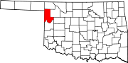 | |
| Unincorporated communities | ||
| Ghost town | ||