Fangcun District
Appearance
| Fangcun 芳村区 | |||||||
|---|---|---|---|---|---|---|---|
| District of the China | |||||||
| 1949–2005 | |||||||
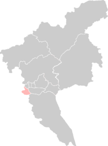
 Location of Fangcun on Guangzhou. | |||||||
| History | |||||||
• Established | 1949 | ||||||
• Disestablished | 2005 | ||||||
| |||||||
| Today part of | Part of the Liwan District | ||||||
Fangcun District (Chinese: 芳村区) was a former district in Guangzhou, Guangdong, China. It lay to the southwest of Guangzhou's modern downtown area and south of the Pearl River.[1] It was established in 1949 after the Chinese Communist Party took over Guangzhou from the Kuomintang.[2] In 2005, it merged with the Liwan District.[3][4]


