
Hitchcock County, Nebraska
Hitchcock County | |
|---|---|
_courthouse_from_SW.JPG) Hitchcock County courthouse in Trenton | |
 Location within the U.S. state of Nebraska | |
 Nebraska's location within the U.S. | |
| Coordinates: 40°11′N 101°02′W / 40.18°N 101.04°W | |
| Country | |
| State | |
| Founded | 1873 |
| Seat | Trenton |
| Largest city | Culbertson |
| Area | |
| • Total | 719 sq mi (1,860 km2) |
| • Land | 710 sq mi (1,800 km2) |
| • Water | 9 sq mi (20 km2) 1.19% |
| Population (2000) | |
| • Total | 3,111 |
| • Density | 5/sq mi (2/km2) |
| Website | www |
Hitchcock County is a county located in the U.S. state of Nebraska. As of 2000, the population was 3,111. Its county seat is Trenton Template:GR.
In the Nebraska license plate system, Hitchcock County is represented by the prefix 67 (it had the sixty-seventh-largest number of vehicles registered in the county when the license plate system was established in 1922).
Geography
According to the U.S. Census Bureau, the county has a total area of 719 square miles (1,861 km²), of which, 710 square miles (1,839 km²) of it is land and 9 square miles (22 km²) of it (1.19%) is water.
Adjacent counties
- Red Willow County, Nebraska - (East)
- Rawlins County, Kansas - (South)
- Dundy County, Nebraska - (West)
- Hayes County, Nebraska - (North)
- Frontier County, Nebraska - (Northeast)
Places adjacent to Hitchcock County, Nebraska | ||||||||||||||||
|---|---|---|---|---|---|---|---|---|---|---|---|---|---|---|---|---|
| ||||||||||||||||
History
Hitchcock County was formed in 1873. It was named after the US Senator Phineas Warren Hitchcock.[1]
Demographics
| Hitchcock County Population by decade | |
|
1880 - 1,012 | |
As of the census Template:GR of 2000, there were 3,111 people, 1,287 households, and 899 families residing in the county. The population density was 4 people per square mile (2/km²). There were 1,675 housing units at an average density of 2 per square mile (1/km²). The racial makeup of the county was 98.36% White, 0.10% Black or African American, 0.29% Native American, 0.13% Asian, 0.29% from other races, and 0.84% from two or more races. 1.41% of the population were Hispanic or Latino of any race.
There were 1,287 households out of which 28.00% had children under the age of 18 living with them, 61.10% were married couples living together, 6.40% had a female householder with no husband present, and 30.10% were non-families. 27.40% of all households were made up of individuals and 15.50% had someone living alone who was 65 years of age or older. The average household size was 2.37 and the average family size was 2.89.
In the county the population was spread out with 23.80% under the age of 18, 5.90% from 18 to 24, 22.60% from 25 to 44, 25.40% from 45 to 64, and 22.30% who were 65 years of age or older. The median age was 44 years. For every 100 females there were 95.00 males. For every 100 females age 18 and over, there were 92.60 males.
The median income for a household in the county was $28,287, and the median income for a family was $34,490. Males had a median income of $25,833 versus $18,879 for females. The per capita income for the county was $14,804. About 10.90% of families and 14.90% of the population were below the poverty line, including 22.90% of those under age 18 and 8.40% of those age 65 or over.
Villages
- Culbertson
- Palisade (partial)
- Stratton
- Trenton
References
Municipalities and communities of Hitchcock County, Nebraska, United States | ||
|---|---|---|
| Villages | 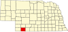 | |
| Unincorporated community | ||
| Footnotes | ‡This populated place also has portions in an adjacent county or counties | |