
Interstate 476
Template:Infobox Interstate/Intrastate Interstate 476 is a 132.10 mi (212.59 km)-long[1][2][3] auxiliary Interstate Highway, designated between Interstate 95 near Chester, Pennsylvania and Interstate 81 near Scranton, Pennsylvania, serves as the primary north-south Interstate corridor through eastern Pennsylvania. It consists of both the 21.5 mile[2] Mid-County Expressway, locally referred to as the "Blue Route", through the suburban Philadelphia counties of Delaware and Montgomery, and the 110.6 mile[3] Northeast Extension of the Pennsylvania Turnpike connecting the Philadelphia metropolitan area with the Lehigh Valley, the Poconos, and the Scranton-Wilkes-Barre metropolitan area.
While proposed as early as 1929, the construction of the Mid-County Expressway through Delaware County, Pennsylvania was not completed until 1991 due to massive community and environmental opposition during the freeway revolts of the 1960s and 1970s, leading The Philadelphia Inquirer to dub it "the most costly, most bitterly opposed highway in Pennsylvania history."[4]
Following the completion of the Mid-County Expressway, in 1996 the Interstate 476 designation was extended to include the entire length of the existing Northeast Extension. Since the extension, I-476 has been the longest auxiliary Interstate highway in the United States.
Route description

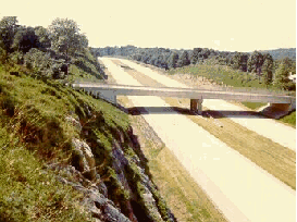
Blue Route
| Major cities Bolded cities are officially-designated control cities for signs[5][6][7] |
|---|
The portion of Interstate 476 between Interstate 95 and Interstate 276, running north-south through Delaware County, Pennsylvania, is officially known as the Mid-County Expressway and the Veterans Memorial Highway, as well as by its ubiquitous nickname, the Blue Route. The road begins at Interstate 95 near the southwest Philadelphia suburb of Chester, near Philadelphia International Airport.[8]
Heading north, the road immediately narrows to a four-lane parkway north of Exit 1, a reduced design built due to local environmental concerns.[9] The route winds through the western Philadelphia suburbs of Wallingford, Swarthmore, and Springfield, meeting U.S. Route 1 at a massive three-level diamond interchange.[10]
At Pennsylvania Route 3, the route widens to six lanes,[11] bisecting the famous Main Line at U.S. Route 30, and interchanging with the Interstate 76, the Schuylkill Expressway, at Conshohocken. After crossing the Schuylkill River, the freeway interchanges with a few more roads and then comes to an end at the Mid-County toll barrier with the Pennsylvania Turnpike in Plymouth Meeting.[12][13]
Northeast Extension

Beyond the toll barrier, Interstate 476 enters the Pennsylvania Turnpike system, interchanging with Interstate 276 and continuing north as the Northeast Extension of the Pennsylvania Turnpike. The route continues through the Philadelphia suburbs, past Lansdale and Quakertown, and into the Lehigh Valley metropolitan area. It interchanges with U.S. Route 22 near Allentown, which also offers an indirect connection to Pennsylvania Route 309 and Interstate 78.[14]
North of Allentown, the route enters the Poconos, tunneling underneath Blue Mountain, and meeting U.S. Route 209 near Lehighton. Continuing through the mountains, it cuts through Hickory Run State Park, interchanging with Interstate 80 on the perimeter on its way to the end of the toll ticket system at Bear Creek, Pennsylvania.
North of the toll barrier, the route meets Pennsylvania Route 115, which provides access to nearby Wilkes-Barre. Near Pittston, an interchange provides an indirect connection to Interstate 81 through Scranton. The route then crosses the Wyoming Valley and skirts around Scranton, with an exit to local Keyser Avenue.[15] North of Scranton, the route comes to an abrupt end at a hairpin curve in Clarks Summit, with connections to Interstate 81, U.S. Route 6 and U.S. Route 11.[13]
History
Mid-County Expressway
Originally planned as far back as 1929, the Mid-County Expressway was later proposed by the Pennsylvania Turnpike Commission as the "Chester Extension" of the Pennsylvania Turnpike in 1954. After the advent of the Interstate Highway System, the project was transferred to the Pennsylvania Department of Highways to be built as part of the system, designating it first as Interstate 495, and later as Interstate 480, as I-76 was designated as I-80S at the time. The present-day I-476 designation was assigned on February 6, 1964 when I-80S was renumbered as I-76.[16]

The road received its ubiquitous nickname from a 1958 location report indicating various proposed geographic configurations of an expressway through Delaware County with lines of various colors on a map. The "blue route" through the Crum Creek valley won out over other contenders, which included a more easterly "red route" and "yellow route" and a more westerly "green route".[17]
As one of the most controversial Interstate Highways in Pennsylvania, construction of I-476 began in 1967, but was not completed until 1991 between MacDade Blvd.(Exit 1) and Interstate 76(Exit 16), and until 1992 between Germantown Pike east/Chemical Rd.(Exit 19) and Interstate 276 (PA Turnpike), due to litigation between the Pennsylvania Department of Transportation and several communities in the road's path over environmental concerns. However, the section of Interstate 476(south end of I-476) between I-95 and MacDade Blvd.(Exit 1) was opened in 1987, but the signs refer to as "To MacDade Blvd" until 1991 when I-476/The Blue Route was opened between Exits 1 and 16. An agreement in 1985 led to many environmental compromises in the road's design, including a downsized four-lane design south of Pennsylvania Route 3, ramp meters, and federal scenic route status, prohibiting the erection of advertisement billboards along the entire freeway portion. While the redesigned highway was largely well-received, the constriction to four lanes has led to bottleneck conditions in the area, and many communities that originally opposed the road have now called for its widening.[18]
The road is currently undergoing a complete rehabilitation project, including paving, bridge repair, and ramp maintenance of the entire length of the freeway between Interstate 95 and the Pennsylvania Turnpike.[19]
Northeast Extension

The Northeast Extension of the Pennsylvania Turnpike system opened in stages from November 23, 1955 to November 7, 1957, and was originally designated Pennsylvania Route 9.[20]
The hairpin curve at the highway's northern terminus was designed to allow for expansion northward to the New York state line. However, as with the Chester Extension to the south, it was decided to incorporate this segment as part of Interstate 81 following the advent of the Interstate system.[21]
The highway includes a major, 4,461-foot tunnel through Blue Mountain known as the Lehigh Tunnel. The tunnel was named as such so as not to cause confusion with the existing Blue Mountain Tunnel on the mainline. The tunnel was originally to be named for Turnpike Commission chairman Thomas J. Evans, but this was changed due to his July 25, 1967 conviction for conspiracy to defraud the Turnpike Commission of $19 million. The Lehigh Tunnel was originally a two-lane tunnel in the manner of the mainline turnpike's original seven tunnels, until it was "twinned" in 1991.[22]
In 1996, after the expansion of the Lehigh Tunnel and the completion of the I-276/I-476/PA 9 interchange, the I-476 designation was extended up the entire length of the Northeast Extension, replacing the PA 9 designation. This extension resulted in I-476 surpassing the 120 mile Interstate 495 in Massachusetts as the longest auxiliary Interstate highway.[23]
PennDOT is in the preliminary stages of planning the widening of the Northeast Extension from Mid-County to Lansdale from 4 lanes to 6.[24]
Exit list
| County | Location | Mile[25] | # | Destinations | Notes |
|---|---|---|---|---|---|
| Delaware | Chester Township | 0.00 | Access to Philadelphia International Airport. | ||
| 0.00 | Access to Widener University, and Commodore Barry Bridge. | ||||
| Ridley Township | 0.48 | 1 | MacDade Boulevard | Becomes East 22nd Street in Chester. Also is a connector to US 13.[8] | |
| Springfield Township | 3.39 | 3 | Media (Baltimore Pike) - Swarthmore | To Swarthmore College and Pennsylvania Institute of Technology. to Longwood Gardens use Baltimore Pike South. | |
| Marple Township | 5.07 | 5 | To Penn State University's Delaware County campus, Granite Run Mall, and Strayer University. Longwood Gardens - use US 1 south. | ||
| Haverford Township | 8.77 | 9 | West Chester University, 69th Street Terminal | ||
| Villanova | 13.24 | 13 | Villanova University, Saint Joseph's University, Cabrini College, Eastern University, Valley Forge Military Academy and Haverford College | ||
| Montgomery | West Conshohocken | 15.84 | 16A | Exit 16 southbound. | |
| 16.18 | 16B | ||||
| Plymouth Meeting | 18.81 | 18A-B | Conshohocken/Norristown | Exit 18 Southbound (Norristown Only) | |
| 19.40 | 19 | Germantown Pike east - Plymouth Meeting | Northbound exit, southbound entrance. | ||
| 19.69 | 20 | Northbound exit, southbound entrance. Norristown exit on PA Turnpike mainline. Access to Plymouth Meeting Mall. | |||
| 19.97 | Southern terminus of Northeast Extension of the Pennsylvania Turnpike. Mid-County toll barrier. Southern terminus of closed ticket system. | ||||
| 20.33 | Mid-County Interchange on PA Turnpike mainline. | ||||
| 20.67 | Southbound exit. Mid-County Interchange on PA Turnpike mainline. | ||||
| Towamencin Township | 30.78 | 31 | |||
| Bucks | Milford Township | 44.39 | 44 | ||
| Lehigh | Lower Macungie Twp. | 56.37 | Allentown service plaza. | ||
| South Whitehall Twp. | 57.71 | 56 | to LVI Airport and Dorney Park. | ||
| Lehigh-Carbon county line | 71.68 | Lehigh Tunnel | |||
| Carbon | Franklin Twp. | 76.23 | 74 | To western Pocono towns including Jim Thorpe and Palmerton. | |
| Penn Forest Twp. | 86.62 | Hickory Run service plaza. | |||
| Kidder Twp. | 95.25 | 95 | Access to the Delaware Water Gap. | ||
| Luzerne | Bear Creek | 105.85 | 105 | ||
| Pittston Twp. | 113.42 | Wyoming Valley toll barrier. Northern terminus of closed ticket system. | |||
| 115.17 | 115 | ||||
| Lackawanna | Taylor | 121.61 | Keyser Avenue toll barrier. | ||
| 122.36 | 123 | Keyser Avenue | |||
| Clarks Summit | 131.20 | Clarks Summit toll barrier. | |||
| 131.37 | 131 | Exit known as Scranton before opening of Keyser Avenue. | |||
See also
References
- ^ Cite error: The named reference
Blue Routewas invoked but never defined (see the help page). - ^ a b Cite error: The named reference
congestionwas invoked but never defined (see the help page). - ^ a b Cite error: The named reference
tollmileagewas invoked but never defined (see the help page). - ^ "FHWA By Day - December 19". Retrieved 2007-03-07.
- ^ Signage referencing control city of Plymouth Meeting. Created by O (on Commons, 2007-06-30). Retrieved on 2007-07-11.
- ^ Signage referencing control city of Chester. Created by O (on Commons, 2007-06-30). Retrieved on 2007-07-11.
- ^ Onramp to I-476 from PA 663. AARoads.com (2004-04-24). Retrieved on 2007-07-11.
- ^ a b "Exit 1". Google. Retrieved 2007-06-11.
- ^ "Reducing Impacts Through Improved Highway Section". Overview of Departmental Recommendations on the Blue Route (I-476). Pennsylvania Department of Transportation. 1984. Retrieved 2007-06-11.
- ^ "Map/Satellite image of Exit 5". Google. Retrieved 2007-06-11.
- ^ "Satellite image of Exit 9". Google. Retrieved 2007-06-11.
- ^ "I-476 between US 30 and I-276". Google. Retrieved 2007-06-11.
- ^ a b Official Tourism and Transportation (PDF) (Map). Pennsylvania Department of Transportation. 2006. Retrieved 2007-03-07.
- ^ "I-476 at the Lehigh Valley interchange". Google. Retrieved 2007-06-11.
- ^ "I-476 around Scranton". Google. Retrieved 2007-06-11.
- ^ "Was I-76 Numbered to Honor Philadelphia for Independence Day, 1776?". Ask the Rambler. Federal Highway Administration. 2005-01-18. Retrieved 2007-06-06.
{{cite web}}: Check date values in:|date=(help) - ^ "History of the Blue Route". I-476 Improvement Project. Pennsylvania Department of Transportation. Retrieved 2007-06-11.
- ^ "Asphalt: the Magazine of the Asphalt Institute, Summer 1997" (PDF). Retrieved 2007-03-07.
- ^ "I-476 Improvement Project". Retrieved 2007-03-07.
- ^ State Transportation, front (PDF) (Map). Pennyslvania Department of Transportation. 1989. Retrieved 2007-06-11.
- ^ Lackawanna County (PDF) (Map). Pennsylvania Department of Transportation. 1966. Retrieved 2007-06-11.
- ^ "Turnpike History". About the PTC. Pennsylvania Turnpike Commission. Retrieved 2007-03-07.
- ^ "Route Log and Finder List, table 2". Federal Highway Administration. 2002-10-31. Retrieved 2007-03-07.
{{cite web}}: Check date values in:|date=(help) - ^ "Northeast Extension Plans Open To Public Monday Night". NBC 10. Retrieved 2007-04-19.
- ^ DeLorme Street Atlas USA 2007, Toggle Measure Tool. Retrieved on 2007-02-27.
External links
| ||
Template:Metro Philadelphia expressways Template:Lehigh Valley Travel