Interstate 93
Template:Infobox Interstate Interstate 93 (abbreviated I-93) is an interstate highway in the New England section of the United States. Its southern terminus is in Canton, Massachusetts, in the Boston metropolitan area, at Interstate 95 (map); its northern terminus is near St. Johnsbury, Vermont at Interstate 91.
Length
| Miles | km | ||
| 46.19[1] | 74.33 | Massachusetts | |
| 131.39[2] | 211.45 | New Hampshire | |
| 11.10[3] | 17.86 | Vermont | |
| 188.68 | 303.65 | Total | |
Major cities
Bolded cities are officially-designated control cities for signs.
- Quincy, Massachusetts
- Boston, Massachusetts
- Salem, New Hampshire
- Manchester, New Hampshire
- Concord, New Hampshire
- Plymouth, New Hampshire
- Littleton, New Hampshire
- St. Johnsbury, Vermont
Intersections with other interstates
- Interstate 95 in Canton, Massachusetts (map)
- Interstate 90 in Boston, Massachusetts (map)
- Interstate 95 in Woburn, Massachusetts (map)
- Interstate 495 in Andover, Massachusetts (map)
- Interstate 293 in Manchester, New Hampshire (map)
- Interstate 89 in Bow, New Hampshire
- Interstate 393 in Concord, New Hampshire
- Interstate 91 in St. Johnsbury, Vermont
Spur routes
- Manchester, New Hampshire - I-293 - The southernmost portion of this highway, between I-93 and the Everett Turnpike, was once known as Interstate 193.
- Concord, New Hampshire - I-393
Big Dig

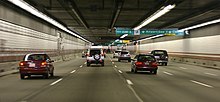
Interstate 93 is famous for being reconstructed by the Central Artery/Tunnel Project, more commonly known as the Big Dig. The Big Dig is the most massive urban construction project in American history[4]. The project replaced the elevated central arterty highway that ran through downtown Boston, cutting the city in two. As of October, 2006, the underground construction of the tunnel system is complete, however repairs continue to many parts of the tunnel due to water leakage because of improper construction of the slurry walls.
See Big Dig and Masspike for other details of the project.
Tolls
No tolls are collected on any part of the highway in Massachusetts, however there are tolls ($3.00 for passenger vehicles as of October, 2006) for vehicles accessing Route 93 from Logan International Airport via the Sumner Tunnel (Route 1A). In New Hampshire, there is one toll in Hooksett, New Hampshire.
Notes
- An 8 mile (13 km) section of I-93 through Franconia Notch State Park, called the Franconia Notch Parkway in New Hampshire, was constructed as a two-lane freeway with a median divider. This was built as a compromise between the state's park department and highway officials. The speed limit on the Parkway is 45 mph (70 km/h). Originally, this section had its own exit number sequence, but they are now called Exit 34A, 34B, and 34C. This section is technically not part of I-93 and is not recognized by FHWA. I-93 is actually in two segments connected by the Franconia Notch Parkway. Signage formerly read "U.S. 3 TO I-93" in this area, but has been replaced by U.S. 3 and I-93 signage along the entire length of the Parkway. Indeed, an older brown overhead sign that read "TO I-93" has been overlaid with an I-93 shield.
- In New Hampshire, between the northern end of I-293 in Hooksett and the beginning of I-89 in Bow, I-93 also carries the northern end of the Everett Turnpike. There is one toll booth along this section, at Exit 11 in Hooksett; toll for passenger cars is 75 cents (50 cents at the ramp toll booth).
- A section of the highway south of Boston, beginning south of the Savin Hill overpass and ending just before the junction with Route 3, utilizes a "zipper lane", in which a movable barrier carves out a high occupancy vehicle lane in the non-peak side of the highway during rush hour.
- Hazardous cargoes are now prohibited from I-93 tunnels in Boston.
- I-93's original southern terminus was in Cambridge (just north of Boston) where it was to meet Interstate 695. However, when that route was cancelled, and I-95 was cancelled and rerouted along Route 128 in the mid-1970s, I-93's route was extended an additional 18 miles down the Central Artery (which had been signed as a multiplex I-95/MA-3 before I-95 was rerouted) and the Southeast Expressway (what was then just Route 3) from Boston to Braintree and then west along former Route 128 to its intersection with I-95 in Canton.
- I-93's route from Boston to Canton has also carried the U.S. Route 1 designation since 1989. The US route's path was changed to assist truck traffic which was banned along much of the route's original path between Boston and I-95/Route 128 in Dedham.
- There are two major park and ride facilities off I-93, the Anderson Regional Transportation Center in Woburn, Massachusetts, at Exit 37C, and the Quincy Adams Red Line (MBTA) subway station, at Exit 7 in Quincy.
- The Big Dig tunnel through Boston has been officially named the Thomas "Tip" O'Neill Tunnel in honor of late Speaker of the House Tip O'Neill who helped pass the legislation that funded the Big Dig.
- In an attempt to alleviate rush-hour traffic jams, travel in the breakdown lane of I-93 is permitted on a small stretch between Exit 38 and Exit 47/48. This extra travel is permitted on the southbound side on weekdays between 6AM and 10AM, and on the northbound side between 3PM and 7PM. However, on most busy days this fails to prevent traffic delays.
See also
References
- ^ Executive Office of Transportation, Office of Transportation Planning - 2005 Road Inventory
- ^ New Hampshire DOT Route Logs
- ^ VTrans Traffic Log
- ^ "Review Begins After Big Dig Tunnel Collapse". CNN.com. 2006-07-12. Retrieved 2006-07-25.
{{cite news}}: Check date values in:|date=(help)
External links
| Browse numbered routes | ||||
|---|---|---|---|---|
| ← Error: Invalid type: Interstate | MA | |||
| ← Error: Invalid type: Interstate | NH | → Error: Invalid type: Interstate | ||
| ← Error: Invalid type: Interstate | VT | → | ||
