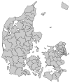
Jammerbugt Municipality
Appearance

Jammerbugt is a municipality (Danish, kommune) in North Denmark Region in Denmark. It covers an area of 863 km² and a total population of 38,957 (2008).
On January 1, 2007 Jammerbugt municipality was created as the result of Kommunalreformen ("The Municipal Reform" of 2007), consisting of the former municipalities of Brovst, Fjerritslev, Pandrup, and Aabybro.
The name of the region, the Jammerbugt, or Bay of Woe, was originally given due to the numerous shipwrecks laid there.[1]


External links
- Jammerbugt municipality's official website Template:Da icon
- VisitJammerbugten official tourism website
References
- Municipal statistics: NetBorger Kommunefakta, delivered from KMD aka Kommunedata (Municipal Data)
- Municipal mergers and neighbors: Eniro new municipalities map
- ^ Murray, John (1871). A Handbook for Travellers in Denmark, Norway, and Sweden. London: John Murray. p. 96.

