
Ketchikan, Alaska: Difference between revisions
No edit summary |
|||
| Line 1: | Line 1: | ||
Ketchikan is full of water. It rains all day every day. Expect to get wet. You will get wet. If you don't like rain, please don't come here and then complain that it is raining in a National Rainforest. I hate that shit. |
|||
{{Infobox settlement |
{{Infobox settlement |
||
|official_name = Ketchikan, Alaska |
|official_name = Ketchikan, Alaska |
||
Revision as of 20:43, 17 November 2010
Ketchikan is full of water. It rains all day every day. Expect to get wet. You will get wet. If you don't like rain, please don't come here and then complain that it is raining in a National Rainforest. I hate that shit.
Ketchikan, Alaska | |
|---|---|
 Ketchikan Skyline | |
| Nickname(s): Salmon Capital of the World, Rain Capital of Alaska, Alaska's First City | |
 Location in Alaska | |
| Country | United States |
| State | Alaska |
| Borough | Ketchikan Gateway |
| Government | |
| • Mayor | Lew Williams III |
| • Governing Body | City Council |
| Area | |
| • Total | 4.1 sq mi (10.7 km2) |
| • Land | 3.4 sq mi (8.7 km2) |
| • Water | 0.8 sq mi (2.0 km2) |
| Elevation | 0 ft (0 m) |
| Population | |
| • Total | 7,368 |
| • Density | 2,245.5/sq mi (851.7/km2) |
| Time zone | UTC-9 (AKST) |
| • Summer (DST) | UTC-8 (AKDT) |
| ZIP codes | 99901, 99903, 99918, 99919, 99950[3] |
| Area code | 907 |
| FIPS code | 02-38970 |
| GNIS feature ID | 1423039 |
| Website | www.city.ketchikan.ak.us |
Ketchikan (Template:Pron-en) is a city in Ketchikan Gateway Borough, Alaska, United States, the southeasternmost sizable city in that state. With an estimated population of 7,368 in 2010, it is the fifth most populous city in the state.[2]
Ketchikan's economy is based upon tourism and fishing, and the city is known as the "Salmon Capital of the World." The Misty Fjords National Monument is one of the area's major attractions.
Ketchikan is named after Ketchikan Creek, which flows through the town. Ketchikan comes from the Tlingit name for the creek, Kitschk-hin, the meaning of which is unclear. It may mean "the river belonging to Kitschk"; other accounts claim it means "Thundering Wings of an Eagle."[4]
Ketchikan's secondary post office box ZIP code, 99950, is the highest ZIP code ever assigned in the United States. Most residents use the ZIP code 99901.[3][5][6] Ketchikan also has the world's largest collection of standing totem poles, located at three major locations: City of Saxman, Totem Bight, and the Totem Heritage Center. The totem poles are replicas made during the Roosevelt Administration. The CCC put the natives to work replicating their hertitage in the totems they carved.
Geography

Ketchikan is located on Revillagigedo Island, 90 miles (145 km) north of Prince Rupert, British Columbia and 235 miles (378 km) south of Juneau, Alaska.
According to the United States Census Bureau, the city has a total area of 4.1 sq mi (10.7 km²). 3.4 sq mi (8.7 km²) of it is land and 0.8 sq mi (2.0 km²) of it (18.60%) is water.
The average annual rainfall is 152 inches (3,900 mm); average annual snowfall is 37 inches (94 cm). The average high temperature in July is 65 °F (18 °C), and the average high temperature in January is 39 °F (4 °C).
The ½-mile-wide channel called the Tongass Narrows separates Ketchikan from Gravina Island, where Ketchikan International Airport is located. In August 2005 the 2005 Highway Bill provided for $223m to build the Gravina Island Bridge (nicknamed "the Bridge to Nowhere" by its critics) between Ketchikan and Gravina Island. The bridge would have connected the island of Ketchikan to Gravina island where the airport is located so one can drive to the airport rather than taking the ferry across the waters. After years of national and international ridicule over the expense of this project, the Alaska government ultimately chose not to build the bridge, and will spend the appropriated funds elsewhere.
Demographics


As of 2004, there were 8,044 people, 3,300 households, and 1,997 families residing in the City. The population density was 2,348.6/sq mi (907.6/km²). It is the most densely populated city in Alaska. There were 3,645 housing units at an average density of 1,080.6/sq mi (417.6/km²). The racial makeup of the city was 65.31% White, 0.84% Black or African American, 19.80% Native American, 6.85% Asian, 0.20% Pacific Islander, 0.52% from other races, and 6.68% from two or more races. 3.38% of the population were Hispanic or Latino of any race.
There were 3,300 households out of which 52% had children under the age of 18 living with them, 48.6% were married couples living together, 13.0% had a female householder with no husband present, and 38.4% were non-families. 31.7% of all households were made up of individuals and 7.9% had someone living alone who was 65 years of age or older. The average household size was 2.44 and the average family size was 3.09.
The population is spread out with 22.7% under the age of 18, 8.6% from 18 to 24, 32.95% from 25 to 44, 22.35% from 45 to 64, and 9.3% who were 65 years of age or older. The median age was 42 years. For every 100 females there were 101.93 males. For every 100 females age 18 and over, there were 102.0 males.
The median income for a household in the city was $44,807, and the median income for a family was $52,529. Males had a median income of $41,926 versus $30,411 for females. The per capita income for the city was $22,484. About 4.9% of families and 7.6% of the population were below the poverty line, including 8.3% of those under age 18 and 4.8% of those age 65 or over.
In 2007, the population of the city of Ketchikan was reported at 7,685.[7]
| Year | Population |
|---|---|
| 1900 | 1,000 |
| 1910 | 1,613 |
| 1920 | 2,500 |
| 1930 | 3,800 |
| 1940 | 4,700 |
| 1950 | 5,300 |
| 1960 | 6,500 |
| 1970 | 7,000 |
| 1980 | 7,200 |
| 1990 | 8,300 |
| 2000 | 7,900 |
Media

Ketchikan is home to the radio stations KTKN, KGTW, KFMJ, and KRBD.
Ketchikan also houses the publishing offices of the Ketchikan Daily News. The region has local television programming provided by Ketchikan Public Utilities CommVision, which boasts 12 local channels of constantly updating entertainment, borough assembly, city council, school board, and planning commission meetings, Southeast Alaska programming, Ketchikan High School sports and events, local history, gardening and scenes, and a calendar of upcoming local events; local television signals are also translations of Seattle and Anchorage stations.
Several movies have been shot in Ketchikan including The Silver Horde, Spawn of the North, Timber Tramps and Cry Vengeance plus episodes of the television programs The Love Boat and Baywatch.[9]
Government and infrastructure
The City of Ketchikan operates under a council-manager form of government.
The Alaska Marine Highway System has its headquarters in Ketchikan.[10]
Transportation
Ketchikan serves as both an air and marine transportation hub for southern Southeast Alaska.
The Ketchikan International Airport serves as both a gateway for Alaska Airlines jet service from Seattle and a bush carrier and charter aircraft hub for destinations like Hyder, Metlakatla, Alaska, and Prince of Wales Island.

Ketchikan receives service to two separate ferry lines. Ketchikan sits on the Alaska Marine Highway's Inside Passage route and sees a large number of ships northbound (to the rest of Alaska) and southbound (to Prince Rupert, British Columbia — where a six hour connection can be made to the BC Ferries system — and Bellingham, Washington). Ketchikan also sees regular day service from the Alaska Marine Highway vessel M/V Lituya, a day boat that shuttles between Ketchikan and Metlakatla, its homeport.
The Inter-Island Ferry Authority serves Ketchikan daily (and, in the summer, twice daily) with the dayboat M/V Prince of Wales from its homeport in Hollis on Prince of Wales Island. Ketchikan often serves as a connection between the Prince of Wales and mainline Alaska Marine Highway vessels that run to the rest of Southeast Alaska.
Education
Colleges and universities
Public education
Sister cities
Ketchikan's former sister city of Kanayama along with four other cities were incorporated into the larger city of Gero on March 1, 2004.[11]
Residents
- Sean M. Burke, a computer programmer and linguist.
- Ray Troll, an artist who blends art and science in his fish-laden drawings.[12][13]
See also
References
- ^ "Annual Estimates of the Population for All Incorporated Places in Alaska" (CSV). 2005 Population Estimates. U.S. Census Bureau, Population Division. June 21, 2006. Retrieved November 9, 2006.
- ^ a b "Annual Estimates of the Population for Incorporated Places in Alaska". United States Census Bureau. 2008-07-10. Retrieved 2008-07-14.
- ^ a b "ZIP Codes by City". United States Postal Service. Retrieved 2008-07-27.
- ^ Ketchikan in the Encyclopædia Britannica
- ^ "United States Postal Service Facts". United States Postal Service. Retrieved 2008-07-27.
- ^ "Find All Cities in a ZIP Code". United States Postal Service. Retrieved 2008-07-27.
- ^ 2007 Community Legislative Priority List
- ^ Lahmeyer, Jan (2003-02-11). "ALASKA historical demographical data of the urban centers". Population Statistics. Retrieved 2008-09-09.
- ^ Totem Land Tinsel Town
- ^ "Contact Us." Alaska Marine Highway. Retrieved on October 25, 2009.
- ^ Alaska sister cities index
- ^ "Artist Ray Troll's creations are filled to the gills". Seattle Post-Intelligencer. 1991-10-22. Retrieved 2009-01-17.
- ^ Sudermann, Hannelore (Spring 2007). "Ray Troll-A Story of Fish, Fossils and Funky Art". Washington State Magazine. Washington State University. Retrieved 2009-01-17.
External links
Municipalities and communities of Ketchikan Gateway Borough, Alaska, United States | ||
|---|---|---|
| Cities | 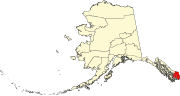 | |
| CDPs | ||
| Unincorporated community | ||
| Ghost towns | ||
Hyder is an exclave of the Ketchikan Gateway Borough and is located in the Prince of Wales–Hyder Census Area. | ||
