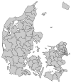
Lejre Municipality
Lejre Municipality
Lejre Kommune | |
|---|---|
 | |
| Country | Denmark |
| Region | Region Zealand |
| Seat | Kirke Hvalsø |
| Government | |
| • Mayor | Carsten Rasmussen (Social Democrats) |
| Area | |
| • Total | 240.07 km2 (92.69 sq mi) |
| Population (2016) | |
| • Total | 27,333 |
| • Density | 110/km2 (290/sq mi) |
| Time zone | UTC+1 (CET) |
| • Summer (DST) | UTC+2 (CEST) |
| Municipal code | 350 |
| Website | www.lejre.dk |
Lejre Municipality is a municipality in Denmark.
The current municipality was established on 1 January 2007 as a result of Kommunalreformen ("The Municipal Reform" of 2007), merging the former Lejre Municipality with Bramsnæs Municipality and Hvalsø Municipality to form a new Lejre Municipality. 28 September 2016 Carsten Rasmussen took over as mayor from Mette Touborg, who was leaving for a new job. She had been the mayor since 1 January 2010. She was the only one from the left wing Socialist People's Party to hold the highest political position in a municipality, whereas he is from the Social Democrats.

The municipality consists of the following settlements (populations as of 2011): Kirke Hvalsø (3,941), Lejre (2,343), Osted (2,073), Kirke Hyllinge (1,984), Ejby (1,876), Gevninge (1,711) Kirke Såby (1,676) Kirke Sonnerup (965), Gershøj (688), Lyndby (561).
Local companies include the chocolate manufacturer Friis-Holm.
External links
Notes
References
- Municipal statistics: NetBorger Kommunefakta, delivered from KMD aka Kommunedata (Municipal Data)
- Municipal mergers and neighbors: Eniro new municipalities map


