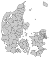
Mariagerfjord Municipality
Appearance
You can help expand this article with text translated from the corresponding article in Danish. (June 2014) Click [show] for important translation instructions.
|

Mariagerfjord is a municipality (Danish, kommune) in North Jutland Region in Denmark. It covers an area of 723.63 km² (2011) and a has a population of 42,093 (2014).

On January 1, 2007 Mariagerfjord municipality was created as the result of Kommunalreformen ("The Municipal Reform" of 2007), consisting of the former municipalities of Arden, Hadsund and Hobro, and the major part of Mariager, and a very small part of Aalestrup and a very small part of Nørager municipality.
The municipality consists of the land around Mariager Fjord, its namesake.
References
- Municipal statistics: NetBorger Kommunefakta, delivered from KMD aka Kommunedata (Municipal Data)
- Municipal mergers and neighbors: Eniro new municipalities map

