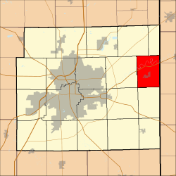
Maumee Township, Allen County, Indiana
Appearance
(Redirected from Maumee Township, Indiana)
Maumee Township | |
|---|---|
 Location in Allen County, Indiana | |
| Coordinates: 41°08′14″N 84°50′22″W / 41.13722°N 84.83944°W | |
| Country | |
| State | |
| County | Allen |
| Government | |
| • Type | Indiana township |
| Area | |
| • Total | 26.69 sq mi (69.13 km2) |
| • Land | 26.37 sq mi (68.30 km2) |
| • Water | 0.32 sq mi (0.83 km2) 1.19% |
| Elevation | 745 ft (227 m) |
| Population | |
| • Total | 2,647 |
| • Density | 99/sq mi (38.4/km2) |
| ZIP code | 46797 |
| GNIS feature ID | 0453616 |
Maumee Township is one of twenty townships in Allen County, Indiana, United States. As of the 2010 census, its population was 2,620.[2]
Geography
[edit]According to the United States Census Bureau, Maumee Township covers an area of 26.69 square miles (69.13 km2); of this, 26.37 square miles (68.30 km2) is land and 0.32 square miles (0.83 km2), or 1.19 percent, is water.[2]
Cities, towns, villages
[edit]Unincorporated towns
[edit](This list is based on USGS data and may include former settlements.)
Adjacent townships
[edit]- Scipio Township (north)
- Carryall Township, Paulding County, Ohio (northeast)
- Harrison Township, Paulding County, Ohio (east)
- Jackson Township (south)
- Jefferson Township (southwest)
- Milan Township (west)
- Springfield Township (northwest)
Cemeteries
[edit]The township contains Diehl Cemetery.
Major highways
[edit]School districts
[edit]- East Allen County Schools
Political districts
[edit]- Indiana's 3rd congressional district
- State House District 79
- State Senate District 14
References
[edit]Citations
[edit]- ^ "Census Bureau profile: Maumee Township, Allen County, Indiana". United States Census Bureau. May 2023. Retrieved March 19, 2024.
- ^ a b "Geographic Identifiers: 2010 Demographic Profile Data (DP-1): Maumee township, Allen County, Indiana". U.S. Census Bureau, American Factfinder. Archived from the original on February 10, 2020. Retrieved March 26, 2013.
Sources
[edit]- United States Census Bureau 2008 TIGER/Line Shapefiles
- United States Board on Geographic Names (GNIS)
- IndianaMap
Wikimedia Commons has media related to Maumee Township, Allen County, Indiana.

