Milbourne Lodge School
This article needs additional citations for verification. (June 2011) |
| Milbourne Lodge School | |
|---|---|
| Address | |
 | |
Arbrook Lane , , KT10 9EG | |
| Information | |
| Type | Pre-prep & prep school |
| Established | 1912 |
| Headmaster | Stephen Ilett |
| Gender | Coeducational |
| Age | 4 to 13 |
| Website | http://www.milbournelodge.co.uk/ |
Milbourne Lodge School is a co-educational pre-prep and preparatory school for children aged four to thirteen.
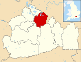
Located in Esher, Surrey, the school is housed in a Victorian mansion situated on 8.5 acres (3.4 ha) of Surrey countryside.
History
Milbourne Lodge was founded in 1912 by Mr. Harvey Wyatt, who established the school in Arbrook Lane, Surrey. The school remains on its original site with the preparatory year groups occupying the original school building and the pre-preparatory year groups taught in what was previously the Headmaster’s house.
In 1948 the school was bought by Norman Hale who was Headmaster for fifty-one years. During Hale’s tenure, Milbourne Lodge built up its reputation for outstanding academic achievements and numerous scholarship awards to top public schools.
According to the school's website, many pupils at Milbourne Lodge subsequently win scholarships and places at major independent schools, such as Eton College, Harrow School, Winchester College, Charterhouse, Wellington College, St Paul's School, The Royal Grammar School and Wycombe Abbey. Over the past twenty-five years, pupils have won more than one hundred academic scholarships to Eton, St. Paul’s and Winchester alone.[1]
In 2007 Milbourne Lodge became part of the Cognita group. The present headmaster, Stephen Ilett, was appointed in 2010.
References
- ^ "Norman Hale: Milbourne Lodge Preparatory School (obituary)". The Times. 22 October 2008.
External links
- Official website
- "Norman Hale (obituary)". The Daily Telegraph. 20 October 2008.

