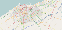
Moulay Rachid (district)
Moulay Rachid
مولاي رشيد | |
|---|---|
District of Casablanca | |
| Coordinates: 33°34′13″N 7°32′31″W / 33.57028°N 7.54194°W | |
| Country | |
| Region | Casablanca-Settat |
| Area | |
| • Total | 13.38 km2 (5.17 sq mi) |
| Population (2004) | |
| • Total | 384,044 |
| Time zone | UTC+0 (WET) |
| • Summer (DST) | UTC+1 (WEST) |
Moulay Rachid (مولاي رشيد) is a district and southeastern suburb of Casablanca, in the Casablanca-Settat region of Morocco. The district, named after Prince Moulay Rachid of Morocco, covers an area of 13.38 square kilometres (5.7 square miles) and as of 2004 had 384,044 inhabitants.[1] It lies to the east of Sbata.
Subdivisions
The district is divided into two arrondissements:
References
- ^ "La Préfecture de Casablanca" (in French). Casablanca.ma. Archived from the original on 26 March 2010. Retrieved 22 April 2012.
{{cite web}}: Unknown parameter|deadurl=ignored (|url-status=suggested) (help)

